shopblog.nl
Categorieën
  Sluiten

Meer Rucksack Readers
Meer Rucksack Readers in Literatuur boeken

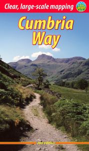
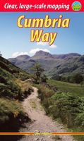
Wandelgids Cumbria Way | Rucksack Readers

Lange afstandswandelgids van de Cumbria Way door het Lake district. Wandelgids met kaarten en beschrijving. op waterbestendig papier, in spiraalbinding. The Cumbria Way begins at Ulverston and heads north through the Lake District for 73 miles (123 km) through unspoiled dales, passing stone-built farms, going around charming lakes and running benea...
19,95

Webshops met dit product

Webshop
Bezorging
Prijs

Anderen bekeken ook

Wandelgids Cumbria Way | Rucksack Readers
Lange afstandswandelgids van de Cumbria Way door het Lake district. Wandelgids met kaarten en beschrijving. op waterbestendig papier, in spiraalbinding. The Cumbria Way begins at Ulverston and heads north through the Lake District for 73 miles (123 km) through unspoiled dales, passing stone-built farms, going around charming lakes and running beneath rugged fells. Busy tourist towns and villages contrast with woodland, wild fellside, high passes and remote moorlands. The Way passes over the summit of High Pike (658 m/2158 ft) with panoramic views, and ends by descending to the historic border city of Carlisle.   This new edition covers various route updates (mostly near Ulverston), has larger scale mapping and includes many fresh photos. It is in our new, narrow format – more pocketable, with perfect binding sewn for extra robustness, lightweight and more rainproof than ever.   detailed description of the route from south to north Foreword by broadcaster Eric Robson geology, history…
19,95
Wandelgids The Cumbria Way | Cicerone
A guidebook to the Cumbria Way, a 73-mile long distance path through the heart of the English Lake District from Ulverston to Carlisle. The route is largely low-level, and accessible to new trekkers, but this guide offers alternative mountain days to climb some of the famous fells en route.   The guide divides the route into 5 stages of between 12 and 16 miles, but there is plenty of opportunity to plan your itinerary for a more easy-going 7 to 8 days. The Lake District is a walkers paradise, and there is no better way to experience the fells, lakes and woodlands of the Lake District than by trekking through their midst.    This guidebook also provides useful information for every stage, from accommodation to available facilities en route, as well as an annotated OS map and details on points of interest. The result is a guidebook that enhances a walk on the Cumbria Way, as well as providing the walker with the tools to complete the trek.   Steden en Dorpen Ulverston, Torver, Coniston, …
20,95
Wandelgids The Dales Way | Rucksack Readers
This charming walk runs for 79 miles (127 km) from Ilkley in the Yorkshire Dales to Bowness in the Lake District. The route heads north through Wharfedale, crisscrossing the river, and rises over high moorland to pick up River Dee through Dentdale. It joins River Lune briefly before heading west to Bowness on Lake Windermere. The LDWA has documented Link Routes for walkers beginning in Leeds, Harrogate and Bradford.   Along the Way, you’ll see impressive railway viaducts and fine stone bridges; Bolton Priory and many small churches; limestone scenery with stone walls, hay meadows and lime kilns; and heritage centres you can visit. Above all, the route is blessed with many small villages with B&Bs and welcoming pubs at strategic intervals. Gradients are modest and most people will complete it comfortably in 6 or 7 days.   This guidebook has all you need to plan and enjoy the Dales Way:   detailed directions for the main Way walked south to north detailed directions for the Bradford…
17,50
Wandelgids The Kerry Way | Rucksack Readers
Beschrijving van de Kerry Way, een bekend lange afstands pad in Ierland. Goede beschrijvingen / Engels. "An eye-catching, colourful publication with clear directions" - Irish Mountain Log   The Kerry Way runs for about 130 miles (210 km) through Ireland’s most spectacular mountain landscapes, starting and finishing in the town of Killarney. Dramatic peaks and glens, wild moorlands, lakes and windswept passes blend magnificently with extensive coastal panoramas. The complete walk takes about nine days, but it can easily be shortened. The third edition of our guidebook was fully revised in 2021 with updates to the route options and the step-by-step directions. It has customised mapping at 1:45,000, a better scale than the OSI Discovery maps, and it contains 100 colour photos, many of them new.   This book is in our lighter, more pocket-friendly format, with perfect binding instead of concealed wiro.   This guidebook contains all you need to plan and enjoy the Kerry Way:   the Way in …
22,50
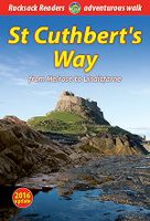
Wandelgids St. Cuthbert's Way | Rucksack Readers
Lange afstandswandelgids van de St. Cuthbert's Way wandeling. Wandelgids met kaarten en beschrijving. op waterbestendig papier, in spiraalbinding. Follow the footsteps of St Cuthbert in this easy-going walk of 63 miles (101 km) from Melrose Abbey in the Scottish Borders to the Holy Island of Lindisfarne in Northumberland. St Cuthbert's Way is one of Scotland's Great Trails, and it is also one of England's great trails. Starting from the ruins of Melrose Abbey, it winds alongside the River Tweed, and after about 31 miles you walk across the border into England on high ground.   The Way includes a section of Roman road and passes castles, hill forts and historic ruins along the way. Most people will complete it comfortably within 5 or 6 days. Its summit is Wideopen Hill (369m/1210ft), and its barefoot finale is the Pilgrim Way to Lindisfarne with its priory and castle.   The route is fully waymarked, the gradients are modest and it has welcoming B&Bs and pubs at strategic intervals.…
22,50
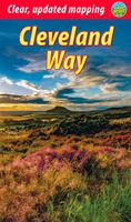
Wandelgids Cleveland Way | Rucksack Readers
“A testament to excellent research, writing and photography” - Malcolm Hodgson, Trail Manager   The Cleveland Way is one of England’s oldest and best-loved National Trails. It runs for 108 miles (174 km) around the North York Moors National Park, starting inland at Helmsley, offering panoramic views over the vales of York and Mowbray and from the Cleveland Hills. After reaching the coast at Saltburn, it heads south along the dramatic sea cliffs, with their tales of shipwrecks and smugglers, to end at Filey.   The route features ancient burial mounds, ruined castles, abbeys and Roman remains, with more recent traces of industrial history. Vast areas of heather moorland are host to a wide range of wildlife. The Cleveland Way is easily accessible by public transport and is divided into easy stages by villages of character with friendly pubs and accommodation. Above all, walkers are welcomed with warm Yorkshire hospitality.   Our new second edition has larger-scale mapping, several route u…
19,95

Klanten-reviews van Wandelgids Cumbria Way | Rucksack Readers

Er zijn nog geen beoordelingen voor dit productBen jij de eerste die een review plaatst?

Meer over Wandelgids Cumbria Way | Rucksack Readers

Productomschrijving

Lange afstandswandelgids van de Cumbria Way door het Lake district. Wandelgids met kaarten en beschrijving. op waterbestendig papier, in spiraalbinding. The Cumbria Way begins at Ulverston and heads north through the Lake District for 73 miles (123 km) through unspoiled dales, passing stone-built farms, going around charming lakes and running beneath rugged fells. Busy tourist towns and villages contrast with woodland, wild fellside, high passes and remote moorlands. The Way passes over the summit of High Pike (658 m/2158 ft) with panoramic views, and ends by descending to the historic border city of Carlisle.   This new edition covers various route updates (mostly near Ulverston), has larger scale mapping and includes many fresh photos. It is in our new, narrow format – more pocketable, with perfect binding sewn for extra robustness, lightweight and more rainproof than ever.   detailed description of the route from south to north Foreword by broadcaster Eric Robson geology, history, farming and wildlife information about public transport and travel lavishly illustrated, with 85 colour photos map of the entire route (1:55,000) in robust format, on rainproof paper.

Productspecificaties

Artikelnummer(s)
Brand
Rucksack Readers

Verken gerelateerde categorieën

Shopblog.nl maakt gebruik van cookies. Ga je verder op onze website, ga dan akkoord met het plaatsen van cookies en de verwerking van deze data door ons en vermelde partners.