shopblog.nl
Categorieën
  Sluiten

Meer Ordnance Survey

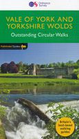
Wandelgids 49 Pathfinder Guides Vale of York and the Yorkshire Wolds |

Wandelgids van een deel van Engeland. Deze gids bevat 28 dagwandelingen, variërend van korte tochten tot pittige dagtochten. De bijbehorende kaarten zijn uitstekend: men heeft de topografische kaarten van Ordnance Survey gebruikt waarop de route is ingetekend. Daarnaast praktische informatie over de wandeling en wat beschrijvingen van het gebied. ...
18,50

Webshops met dit product

Webshop
Bezorging
Prijs

Anderen bekeken ook

Wandelgids 49 Pathfinder Guides Vale of York and the Yorkshire Wolds |
Wandelgids van een deel van Engeland. Deze gids bevat 28 dagwandelingen, variërend van korte tochten tot pittige dagtochten. De bijbehorende kaarten zijn uitstekend: men heeft de topografische kaarten van Ordnance Survey gebruikt waarop de route is ingetekend. Daarnaast praktische informatie over de wandeling en wat beschrijvingen van het gebied. With 28 circular, graded walks all tried and tested by seasoned walkers, this guidebook for the Vale of York and the Yorkshire Wolds will help you to make the most of a holiday or day out. Routes range from 4km (2.5 miles) up to 15.3km (9.5 miles), so there is a route to suit all abilities and available time.   While most visitors to the area go to Yorkshire's two national parks, the flat plains of the Vale of York and the rolling uplands the Wolds are a great alternative, and still provide a huge diversity of scenery and walking opportunities. Highlights of the 28 walks shown include the coast at Flamborough Head, the deserted medieval vil…
18,50
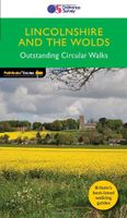
Wandelgids 50 Pathfinder Guides Pathfinder Lincolnshire & the Wolds |
Discover 28 beautiful walks across Lincolnshire & the Wolds with the OS Pathfinder Guidebooks, graded by length and ranging from 3 to 11 miles.   Explore the second largest county in England, Lincolnshire. The county is largely unspoilt and offers a great opportunity for new and unique walking experiences. Routes in this book include Thornton Abbey, Sway Valley, Horncastle, the Vale of Belvoir, and Frampton Marsh.   Each walk includes a detailed description, an OS map, GPS waypoints and notes of key features and things to see.   This is one of a seriess of books with great walking routes covering the most popular and scenic areas of Britain. Printed with weather-resistant covers featuring durable rounded corners, they are the perfect companion for country walking throughout Britain.
18,50
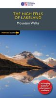
Wandelgids 71 Pathfinder Guides The High Fells of Lakeland | Ordnance
Are you planning a holiday to the Lake District? Do you enjoy a hill-walking challenge with impressive mountain-top views? Inside Pathfinder (R) Guide to the High Fells of Lakeland are 20 majestic and challenging fell walks amid the glorious scenery of the Lake District mountains with clear and easy-to-follow route directions compiled from the author's 40 years' experience of Lakeland walking. For adventurous ramblers and walkers wanting a hill-walking challenge, this brand new Pathfinder (R) walking guide features 20 demanding day-walks in the mountains of the Lake District, from Scafell Pike (highest mountain in the Lake District), to Helvellyn, Skiddaw, Great End and Bowfell - all over 900m (nearly 3000 feet) high. Giving a detailed guide to 20 inspiring expeditions on the high fells of Lakeland, Pathfinder (R) Guide to the High Fells of Lakeland explores some of the best fell walking country in the Lake District. With views over to Buttermere, Derwentwater and Grasmere, the Lakelan…
18,50
Wandelgids 82 Pathfinder Guides Orkney and Shetland | Ordnance Survey
Wandelgids van een deel van Engeland. Deze gids bevat 28 dagwandelingen, variërend van korte tochten tot pittige dagtochten. De bijbehorende kaarten zijn uitstekend: men heeft de topografische kaarten van Ordnance Survey gebruikt waarop de route is ingetekend. Daarnaast praktische informatie over de wandeling en wat beschrijvingen van het gebied. 28 outstanding walks – 23 circular and five there-and-back routes visiting eleven islands across both archipelagos. The size and nature of the islands lend themselves best to short and half-day walks where unhurried and free-range walking is encouraged and the endless distractions of scenery, seabirds, wildflowers and sea watching are best appreciated and enjoyed at a relaxed pace.   In Orkney, the first walk is a short stroll around Hoxa Head with its extensive views across Scapa Flow and subsequent routes go on to explore more widely over Mainland Orkney and take in the islands of Hoy, Rousay and South Ronaldsay, concluding with a ramble alo…
18,50
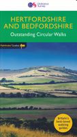
Wandelgids 54 Pathfinder Guides Hertfordshire and Bedfordshire | Ordna
Wandelgids van een deel van Engeland, Schotland of Wales. Deze gids bevat 28 dagwandelingen, variërend van korte tochten tot pittige dagtochten. De bijbehorende kaarten zijn uitstekend: men heeft de topografische kaarten van Ordnance Survey gebruikt waarop de route is ingetekend. Daarnaast praktische informatie over de wandeling en wat beschrijvingen van het gebied. Both counties tend to be underrated by walkers, often overlooked in favour of the delights of the Thames Valley or the hillier Chilterns country of Buckinghamshire. But they do possess much fine walking country, with a diversity of terrain, gentle hilly regions, lots of pleasant woodland, attractive riverside landscapes and an impressive collection of pretty villages.   There are a large number of country parks, especially in Bedfordshire, which make excellent starting points for walks in the surrounding countryside, linked by the public footpath network. Both Hertfordshire and Bedfordshire have an extensive network of well…
18,50
Fietskaart 10 Cycling guides North York Moors | Goldeneye
Scheur- en watervast foetskaart van de North York Moors  met ingetekende fietsroutes.   Our maps are double-sided, printed on an A2 sheet with a concertina fold. This allows for easy folding and folding, and an ease of access to the mapping. The material is rain and tear-resistant. Our early maps were designed at the scale of 2 miles to 1 inch/1:126,720. The later designs along with digitalisation are 1: 100,000. We were encouraged by the Cycle Touring Club to convert our cartography toward the cycle market (to replace the out-of-print Bartholomew series). As time and the series progressed we have added more data: The National Cycle Network routes, Regional Routes, and Traffic-Free Family Routes, as and when they are developed. These routes are in addition to the Circular Routes Goldeneye Commissioned at the outset of our publishing schedule. We are also adding to new editions; bike shops, cycle hire, and tea rooms, along with the tourist attractions already featured. Our plan is to ma…
14,95

Klanten-reviews van Wandelgids 49 Pathfinder Guides Vale of York and the Yorkshire Wolds |

Er zijn nog geen beoordelingen voor dit productBen jij de eerste die een review plaatst?

Meer over Wandelgids 49 Pathfinder Guides Vale of York and the Yorkshire Wolds |

Productomschrijving

Wandelgids van een deel van Engeland. Deze gids bevat 28 dagwandelingen, variërend van korte tochten tot pittige dagtochten. De bijbehorende kaarten zijn uitstekend: men heeft de topografische kaarten van Ordnance Survey gebruikt waarop de route is ingetekend. Daarnaast praktische informatie over de wandeling en wat beschrijvingen van het gebied. With 28 circular, graded walks all tried and tested by seasoned walkers, this guidebook for the Vale of York and the Yorkshire Wolds will help you to make the most of a holiday or day out. Routes range from 4km (2.5 miles) up to 15.3km (9.5 miles), so there is a route to suit all abilities and available time.   While most visitors to the area go to Yorkshire's two national parks, the flat plains of the Vale of York and the rolling uplands the Wolds are a great alternative, and still provide a huge diversity of scenery and walking opportunities. Highlights of the 28 walks shown include the coast at Flamborough Head, the deserted medieval village of Wharram Percy and the Pocklington Canal.   Each walk includes a full description and an extract of the OS map for the route as well as notes and photos of key features not to miss. This is one of a series of Pathfinder Guides, which are Britain’s best-loved walking guides. Printed with weather-resistant covers featuring durable rounded corners, they are the perfect companion for country walking throughout Britain.

Productspecificaties

Artikelnummer(s)
Brand
Ordnance Survey
Shopblog.nl maakt gebruik van cookies. Ga je verder op onze website, ga dan akkoord met het plaatsen van cookies en de verwerking van deze data door ons en vermelde partners.