shopblog.nl
Categorieën
  Sluiten

Stadsplattegrond Pocket Street Map Folkestone | A-Z Map Company

Navigate your way around Folkestone with detailed street maps from A-Z This up-to-date, folded A-Z street map includes all of the 1,500 streets in and around Folkestone. Detailed coverage of an area extending from Hawkinge to Sandgate in the south, and from East Wear Bay in the east to Newington in the west.   Postcode districts, one-way streets an...
7,95

Webshops met dit product

Webshop
Bezorging
Prijs

Anderen bekeken ook

Stadsplattegrond Pocket Street Map Dover | A-Z Map Company
Navigate your way around Dover with detailed street maps from A-Z This up-to-date, folded A-Z street map includes all of the 1,500 streets in and around Dover as well as:   Postcode districts, one-way streets and car parks Places of interest On the reverse side there is a handy index to streets, places of interest, place and area names, park and ride sites, national rail stations, hospitals and hospices Detailed coverage of an area extending from Napchester in the north to the harbour in the south, and from beyond Jubilee Way to the east and Kearsney in the west.   With its clear mapping at a scale of 5.5 inches to 1 mile, this is the perfect reference map for finding your way around Dover.
7,95
Stadsplattegrond Pocket Street Map Peterborough | A-Z Map Company
Navigate your way around Peterborough with detailed street maps from A-Z This up-to-date, folded A-Z street map includes all of the 1,500 streets in and around Peterborough. Detailed coverage of an area extending from Walton in the north to Hampton Gardens in the south, and from Fengate in the east to Thorpe Wood Golf Course in the west.   This street map includes the following:   Postcode districts, one-way streets and car parks Places of interest On the reverse there is a handy index to streets, places of interest, place and area names, park and ride sites, national rail stations, hospitals and hospices With clear mapping at a scale of 5.5 inches to 1 mile, this is the perfect reference map for finding your way around Peterborough.
7,95
Stadsplattegrond Pocket Street Map Windsor | A-Z Map Company
Navigate your way around Windsor with detailed street maps from A-Z This up-to-date, folded A-Z street map includes all of the 1,500 streets in and around Windsor.   Postcode districts, one-way streets and car parks Places of interest On the reverse there is a handy index to streets, places of interest, place and area names, park and ride sites, national rail stations, hospitals and hospices Detailed coverage of an area extending from Chalvey and the M4 motorway in the north to Old Windsor in the south, and from Sunnymeads in the east to Oakley Green in the west.   The perfect reference map for finding your way around Windsor.
7,95
Stadsplattegrond Pocket Street Map Bristol | A-Z Map Company
Navigate your way around Bristol with detailed street maps from A-Z This up-to-date, folded A-Z street map includes all of the 1,500 streets in and around Bristol. Detailed coverage of an area extending from Bishopston in the north to Knowle Golf Course in the south, and from Crew’s Hole in the east to Leigh Woods in the west.   The large scale 1 mile to 5.5 inch (1 km to 8.68 cm) street map includes the following:   Places of interest One-way streets and car parks Index to streets, places of interest, place and area names, park and ride sites, national rail stations, hospitals and hospices The perfect reference map for finding your way around Bristol.
7,95
Stadsplattegrond Pocket Street Map Salisbury | A-Z Map Company
Navigate your way around Salisbury with detailed street maps from A-Z This up-to-date, folded A-Z street map includes all of the 1,500 streets in and around Salisbury as well as:   Postcode districts, one-way streets and car parks Places of interest On the reverse side there is a handy index to streets, places of interest, place and area names, park and ride sites, national rail stations, hospitals and hospices Detailed coverage of an area extending from Stratford sub Castle in the north to Salisbury District Hospital in the south, and from Laverstock in the east to Wilton Park in the west.
7,95
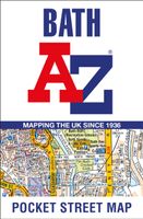
Stadsplattegrond Pocket Street Map Bath | A-Z Map Company
This up-to-date detailed A-Z street map includes more than 1,700 streets in and around Bath. This street map includes the following: Postcode districts, one-way streets and car parks Tourist attractions and places of interest marked On the reverse side of the map there is a handy index to streets, places of interest, place and area names, park and ride sites, national rail stations, hospitals and hospicesIdeal companion to a sat-nav - it enables route planning and route sense-checking Extensive mapping covers an area from Charlcombe in the north to Combe Down in the south, and from Bathampton Down in the east to Whiteway in the west. With clear mapping at a scale of 5.5 inches to 1 mile, this is the perfect reference map for finding your way around Bath.
7,95
Stadsplattegrond Pocket Street Map Portsmouth | A-Z Map Company
Navigate your way around Portsmouth with detailed street maps from A-Z This up-to-date detailed, folded A-Z street map includes more than 2000 streets in and around Portsmouth. As well as ferry routes from Portsmouth Harbour, other areas covered include Southsea, Fratton, Milton Common, Hilsea and Cosham.   The large-scale street map includes the following: • Places of interest • Postcode districts, one-way streets and car parks • Index to streets, places of interest, place and area names, park and ride sites, national rail stations, hospitals and hospices   The perfect reference map for finding your way around Portsmouth
7,95
Stadsplattegrond Pocket Street Map Liverpool | A-Z Map Company
Navigate your way around Liverpool with detailed street maps from A-Z This fully updated, folded map covers all of Central London, including: Regent's Park, King's Cross, The Barbican, Spitalfields, Tower Bridge, The South Bank, Waterloo Station, Westminster, South Kensington, Paddington Station and Lord's Cricket Ground.   The large scale 1 mile to 5.5 inch (1 km to 8.68 cm) street map includes the following:   • Places of interest   • One-way streets and car parks   • Index to streets, places of interest, place and area names, park and ride sites, national rail stations, hospitals and hospices   • Separate lists of streets, places of interest, cinemas, theatres and stations (which include London Underground, National Rail and Docklands Light Railway stations)   • A central London Underground Map is printed on the back cover.   The perfect reference map for finding your way around Central London.
7,95
Stadsplattegrond Pocket Street Map Cardiff | A-Z Map Company
Navigate your way around Leeds with detailed street maps from A-Z This up-to-date, folded A-Z street map includes all of the 2,100 streets in and around Blackpool. As well as the Promenade this handy map covers Great Marton Moss, Common Edge, Pleasure Beach, Hawes Side, Staining, Laytoun, North Shore and Warbreck.   The large scale 1 mile to 5.5 inch (1 km to 8.68 cm) street map includes the following:   • Places of interest   • Blackpool tramway stops and route (Cavendish Road to Starr Gate)   • One-way streets and car parks   • Index to streets, places of interest, place and area names, park and ride sites, national rail stations, hospitals and hospices   The perfect reference map for finding your way around Blackpool.
7,95
Stadsplattegrond Pocket Street Map Leeds | A-Z Map Company
Navigate your way around Leeds with detailed street maps from A-Z This up-to-date, folded A-Z street map includes all of the 2,100 streets in and around Blackpool. As well as the Promenade this handy map covers Great Marton Moss, Common Edge, Pleasure Beach, Hawes Side, Staining, Laytoun, North Shore and Warbreck.   The large scale 1 mile to 5.5 inch (1 km to 8.68 cm) street map includes the following:   • Places of interest   • Blackpool tramway stops and route (Cavendish Road to Starr Gate)   • One-way streets and car parks   • Index to streets, places of interest, place and area names, park and ride sites, national rail stations, hospitals and hospices   The perfect reference map for finding your way around Blackpool.
7,95

Klanten-reviews van Stadsplattegrond Pocket Street Map Folkestone | A-Z Map Company

Er zijn nog geen beoordelingen voor dit productBen jij de eerste die een review plaatst?

Meer over Stadsplattegrond Pocket Street Map Folkestone | A-Z Map Company

Productomschrijving

Navigate your way around Folkestone with detailed street maps from A-Z This up-to-date, folded A-Z street map includes all of the 1,500 streets in and around Folkestone. Detailed coverage of an area extending from Hawkinge to Sandgate in the south, and from East Wear Bay in the east to Newington in the west.   Postcode districts, one-way streets and car parks Places of interest On the reverse side there is a handy index to streets, places of interest, place and area names, park and ride sites, national rail stations, hospitals and hospices With clear mapping on a scale of 5.5 inches to 1 mile, this is the perfect reference map for finding your way around Folkestone.

Verken gerelateerde categorieën

Shopblog.nl maakt gebruik van cookies. Ga je verder op onze website, ga dan akkoord met het plaatsen van cookies en de verwerking van deze data door ons en vermelde partners.