shopblog.nl
Categorieën
  Sluiten

Stadsplattegrond Pocket Street Map Cambridge | A-Z Map Company

Stadsplattegrond van Cambridge in 48 pagina´s, inclusief index met straatnamen en belangrijke plaatsen. Bevat tevens een detail weergave van het centrum.   Navigate your way around Cambridge with detailed street maps from A-Z This up-to-date, folded A-Z street map includes more than 2,000 streets in and around Norwich. As well as the Norwich Cathed...
7,95

Webshops met dit product

Webshop
Bezorging
Prijs

Anderen bekeken ook

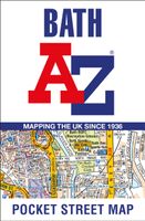
Stadsplattegrond Pocket Street Map Bath | A-Z Map Company
This up-to-date detailed A-Z street map includes more than 1,700 streets in and around Bath. This street map includes the following: Postcode districts, one-way streets and car parks Tourist attractions and places of interest marked On the reverse side of the map there is a handy index to streets, places of interest, place and area names, park and ride sites, national rail stations, hospitals and hospicesIdeal companion to a sat-nav - it enables route planning and route sense-checking Extensive mapping covers an area from Charlcombe in the north to Combe Down in the south, and from Bathampton Down in the east to Whiteway in the west. With clear mapping at a scale of 5.5 inches to 1 mile, this is the perfect reference map for finding your way around Bath.
7,95
Stadsplattegrond Pocket Street Map Birmingham | A-Z Map Company
Handzame stadsplattegrond van het centrum van Birmingham. This up-to-date detailed A-Z street map includes more than 3,000 streets in and around Birmingham. As well as the city centre and St Philip’s Cathedral, the other areas covered include Moseley, Edgbaston, Small Heath, the Jewellery Quarter, Winson Green, Gib heath, Lozells, Saltley and Aston.   The large-scale street map includes the following: • Places of interest • Postcode districts, one-way streets and car parks • Index to streets, places of interest, place and area names, park and ride sites, national rail stations, hospitals and hospices   The perfect reference map for finding your way around Birmingham.
7,95
Stadsplattegrond Pocket Street Map Manchester | A-Z Map Company
Handzame stadsplattegrond van het centrum van Manchester This up-to-date detailed A-Z street map includes more than 2,000 streets in and around Manchester. As well as the Northern Quarter and Spinningfields, the other areas covered include Moss Side, Ordsall, Weaste, Salford, Seedley, Lower Kersal, Strangeways, Miles Platting and West Gorton.The large-scale street map includes the following: - Places of interest- Postcode districts, one-way streets and car parks- Index to streets, places of interest, place and area names, park and ride sites, national rail stations, hospitals and hospices. The perfect reference map for finding your way around Manchester.
7,95
Stadsplattegrond Premier Map London | A-Z Map Company
Grote kaart van Londen, ongeveer 10 kilometer rond Charing Cross - centrum Londen. Uitgebredie kaart met alle straatnamen.  Gedetailleerde stadsplattegrond Londen schaal 1:21.000 met los straatnamenregister. Gebied omvat ca. 10 km rondom Charing Cross, Londen centrum tot aan Acton, Charlton, East Ham, Hendon, Kew Sydenham, Walthamstow, Wembley, Wimbledon   Navigate your way around London with this detailed, easy-to-use, and up-to-date A-Z Premier Map. A full-colour, single sided, fold-out street map, covering a six-mile radius from Charing Cross in Central London. Extending to Muswell Hill to the north, London City Airport to the east, Crystal Palace to the south, and Wembley to the west.   Attached to the cover is a booklet containing a comprehensive index of more than 40,000 streets, along with selected flats, walkways, places of interest, fire stations, hospitals and hospices within this region. Also included on the map are postcode districts, one-way streets, the congestion zone…
14,95
Wegenatlas - Stadsplattegrond London Street Atlas - Londen | A-Z Map Company
Handzame, maar behoorlijk dikke stadsatlas van Londen. Gebonden uitgave, maar toch redelijk makkelijk open ter klappen. Met register achterin. Zeer uitgebried met alle staten en steegjes. Centrumgedeelte met meer details (1:11.000)  dan de kaarten buiten het centrum (1:22.000) This A-Z London Street Atlas includes 155 pages of our famous standard street mapping at a scale of 2.88 inches to 1 mile, extending to:   Barnet Chingford Dagenham Sidcup Chislehurst Farnborough Croydon Surbiton Shepperton Heathrow Airport (Terminals 1-5) Ruislip Stanmore A large-scale Central London 16 page street map section at 5.75 inches to 1 mile, extending:   north to Regent's Park and Shoreditch south to Chelsea and Vauxhall west to Hyde Park east to Bermondsey. Also included is:   An overview map of the Congestion Charging Zone A West End Theatre map The London Connections rail services map The full London Underground map Postcode districts, one-way streets, safety camera locations with maximum speed lim…
9,95
Wegenatlas A -Z Master Atlas of Greater London | A-Z Map Company
De ultieme stratengids van Londen en directe omgeving. Super gedetailleerd en alle straten staan er op, met een enorm register bovendien. The ultimate street atlas to navigate your way around London. A comprehensive paperback street atlas of London encompassing an area of 1450 square miles with coloured street mapping, and including more than 90,000 streets and other addresses. The coverage extends beyond the Greater London and M25 area to: Hemel Hempstead, St.   Albans, Potters Bar, Waltham Cross, Epping, Brentwood, Thurrock, Stanford-le-Hope, Gravesend, Wrotham, Sevenoaks, Westerham, Oxted, Redhill, Reigate, Leatherhead, Great Bookham, Woking, Egham, Windsor, Slough, Chalfont St. Peter, Chorleywood, Bovingdon There are eighteen pages of large scale (9" to 1 mile) street mapping of central London which gives additional clarity and detail, this mapping extends to: Regent's Park, St. Pancras International Station, Old Street, Tower Bridge, Bricklayer's Arms Junction, Vauxhall Bridge, So…
29,95
Wegenatlas - Stadsplattegrond Bristol and Bath Streetatlas | A-Z Map Company
Navigate your way around Bristol and Bath with this detailed and easy-to-use A-Z Street Atlas. Printed in full-colour, paperback format, this atlas contains 104 pages of continuous street mapping. More than 12,800 streets indexed. Large scale 6.25 inches to 1 mile map. Areas covered include: Avonmouth, Bradley Stoke, Filton, Keynsham, Kingswood, Mangotsfield, Portishead, Yate, Frampton Cotterell, Chipping Sodbury, Oldland, Swainswick, Batheaston, University of Bath, Combe Down, Bath Spa University, Saltford, Whitchurch, Bedminster, Long Ashton, Easton-in-Gordano, Cribbs Causeway. Also included are large scale city centre maps of both Bristol and Bath and a postcode map of the atlas area. Postcode districts, one-way streets and safety camera locations with their maximum speed are featured on the street mapping. A comprehensive index lists streets, selected flats, walkways and places of interest, place, area and station names. Additional healthcare (hospitals, walk-in centres and hospic…
20,95
Stadsplattegrond Pocket map Pretoria | MapStudio
The Pretoria Pocket Map is a new edition convenient pocket size map of Pretoria which includes the latest up-to-date information, key tourist areas and street plans. The map includes a detailed map at 1:12 500 scale plus a map of the Hartebeespoort area with a scale of 1:100 000.   The detailed street plan includes: – Main & minor roads – Retail areas – Traffic light positions – Hotels & accommodation – Tourist information – Places of interest & historic sites – Theatres & cinemas – Shopping malls – Parking – One-way streets – Sports and recreation areas – Embassy positions – Index of street names   The detailed area map covers: – Akasia – Hartebeespoort – Atteridgeville – Pretoria CBD – Mamelodi – Renosterspruit – Centurion, Moreleta Park, Rietvlei & Midrand Estates – Built-up areas with suburb names – Index of street names & suburbs
11,50
Wandelgids Cambridge Hidden Walks | A-Z Map Company
Discover hidden gems around Cambridge with 20 walking routes. Featuring 20 walks in and around the city, including lesser-known circuits and details on popular walks. Accompanied by guided walking instructions and written by a local expert, A-Z Cambridge Hidden Walks is the perfect way to explore the city in a new light. Small enough to fit in a bag or pocket, this handy guidebook is ideal for tourists or locals looking to discover more about the city. Each route varies in length from 1 to 6 miles (1.6 to 9.6 km), and is clearly outlined on detailed A-Z street mapping. * 20 walking routes with instructions and maps * Full-colour photographs of hidden gems and city attractions * Key sights and locations clearly marked on map * Information such as start/finish points, nearest postcodes, distance and terrain included  
9,95
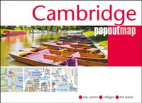
Stadsplattegrond Popout Map Cambridge | Compass Maps
Handig ( borstzak- ) formaat stadsplattegrond met voldoende detail, zodat je ook de kleinere straatjes erop aantreft. Van veel wereldsteden inmidddels leverbaar en dat is mooi, want juist in dit soort steden wil je je handen liever vrij houden en niet teveel hoeven stoeien met het uitvouwen van een grote plattegrond, en/of teveel als "toerist" opvallen. Door het unieke vouwsysteem blijft alles zeer compact en biedt het kaartje een razendvlugge manier van orientatie. Wel is dit product alleen geschikt voor het ( grote ) centrum van de stad.Verder geven de kaartjes uit deze reeks ook de meeste highlights van de stad aan en ( indien van toepassing ) een overzichtskaartje van de metro. Let PopOut Map Cambridge guide you around this historic city. Get to the heart of the historic city of Cambridge with the help of this genuinely pocket-sized, pop-up Cambridge map. Small in size yet big on detail, this compact, dependable, Cambridge city map will ensure you don't miss a thing.   Includes …
7,95

Klanten-reviews van Stadsplattegrond Pocket Street Map Cambridge | A-Z Map Company

Er zijn nog geen beoordelingen voor dit productBen jij de eerste die een review plaatst?

Meer over Stadsplattegrond Pocket Street Map Cambridge | A-Z Map Company

Productomschrijving

Stadsplattegrond van Cambridge in 48 pagina´s, inclusief index met straatnamen en belangrijke plaatsen. Bevat tevens een detail weergave van het centrum.   Navigate your way around Cambridge with detailed street maps from A-Z This up-to-date, folded A-Z street map includes more than 2,000 streets in and around Norwich. As well as the Norwich Cathedral and central Norwich, the other areas covered include Cringleford, Lakenham, Whitlingham Country Park, Thorpe St Andrew, New Catton and Hellesdon. The large scale 1 mile to 5.5 inch (1 km to 8.68 cm) street map includes the following: • Places of interest • One-way streets and car parks • Index to streets, places of interest, place and area names, park and ride sites, national rail stations, hospitals and hospices The perfect reference map for finding your way around Norwich.  
Shopblog.nl maakt gebruik van cookies. Ga je verder op onze website, ga dan akkoord met het plaatsen van cookies en de verwerking van deze data door ons en vermelde partners.