shopblog.nl
Categorieën
  Sluiten

Reisinspiratieboek Wanderlust British and Irish Isles | Gestalten Verlag

From breathtaking nature to timeless culture, explore the hiking trails and the wonders of the British Isles. The British and Irish Isles are a paradise for hikers. They provide a unique blend of breathtaking nature, fascinating local history, and timeless culture. Stunning photography showcases the diverse natural landscapes and rich national hist...
55,95

Webshops met dit product

Webshop
Bezorging
Prijs

Anderen bekeken ook

Reisinspiratieboek Wanderlust Himalaya | Gestalten Verlag
Wanderlust Himalaya explores one of the most appealing regions to hikers around the globe. First-hand tips, informative maps, and an array of spectacular photography for trails in Nepal, India, Pakistan, Tibet (China), and Bhutan provide orientation in an area that would allow lifetime wandering. Expect to be guided through breathtaking nature, diverse cultures, and hikes on different skill levels arranged in an attractive mix of one-day, multi-day, or long-distance trails. Our new release in the Wanderlust series lifts you to the top of the mountains.
44,95
Wandelgids Santorini, Sifnos, Kea - Western and Southern Cyclades | Graf editions
Wandelen op de Griekse Eilanden met deze klein formaat Engelstalige wandelgids Anafi, Folegandros, Ios, Kea, Kimolos, Kithnos, Milos, Santorini, Thirassia, Serifos, Sifnos, Sikinos, bij elke uitgebreid beschreven dagwandeltocht is een gedetailleerde routekaart afgebeeld en foto's ter orientering van de moeilijke, verwarrende trajecten. Van de uitgever This book describes the loveliest old walking trails. With precise descriptions, detailed maps, exact times, GPS points and photos of outstanding places for better orientation. And lots of useful knowledge about the "Islands of Light." It is made for island hoppers who want to drift through the island world by ship and who would also like to hike and swim in this ancient cultural landscape.   The concept „Greek Islands“ conjures up images of white cubical houses twined around with red bougainvillea, unevenly paved alleys below bright blue church domes, dilapidated windmills on top of stormy mountain ridges, shady groves with old gnarle…
19,50
Spoorwegenkaart The British Isles by Train and Ferry | Cosmographics
Plan your journey and explore the British Isles by train and ferry. This attractive, detailed map shows how the rail network, along with ferries to the more isolated areas, allows you to travel to places right across the British Isles and take in the beautiful scenery. The map clearly shows National Parks, Areas of Outstanding Natural Beauty, forest and woodland areas and the Heritage Coast in England and Wales, much of which is accessible by train and ferry. The rail network includes seasonal and heritage railways. There is also a more detailed map of the London National Park City, the world’s first National Park City. Designed to be fully inclusive and accessible for everyone, including those with colour vision deficiency (CVD).   Map includes:   Passenger rail network with the majority of stations. Seasonal and heritage railways Ferry routes National Parks Areas of Outstanding Natural Beauty Main forest and woodland areas Heritage coast in England and Wales Formaat:  74.5cm x…
19,50
Reisinspiratieboek Wanderlust Alps | Gestalten Verlag
Stretching from France all the way down to Slovenia, the Alps are the highest and most expansive mountain range in Europe. For hikers, trekkers and outdoor enthusiasts alike, that means boundless possibilities for adventure. Wanderlust Alps charts the mountain range's best routes and hidden trails away from the crowds. The featured hikes offer a rich mix of single-day jaunts to long-distance treks for hikers of all experience levels, with plenty of stunning nature and charming mountain huts to enjoy along the way.
44,95
Reisinspiratieboek - Reisboek Wanderlust Nordics : Exploring Trails in Scandinavia | Gestalten Verlag
Experience the best hiking routes in the Nordic countries through practical tips, informative maps and stunning visuals. From the Ice Sheet in Greenland, to the arctic tundra and rocky coastline in Sweden, to a plethora of enchanting lakes and forests in Finland - the Nordics offer a breathtaking variety of landscapes and endless options to hike. Wanderlust Nordics invites you to boast into this distinctive wilderness with a wide range and an appealing mix of trails. A book that will have you heading north.
54,95
Reisgids Scottish Highlands and Islands | Rough Guides
Een zeer uitvoerige reisgids voor zowel de zelfstandige als de georganiseerde reiziger. Veel informatie, zowel praktisch als over allerhande achtergronden van het land; met o.a. aandacht voor geschiedenis, taal ,flora & fauna en met veel plattegronden. This Scottish Highlands & Islands guidebook is perfect for independent travellers planning a longer trip. It features all of the must-see sights and a wide range of off-the-beaten-track places. It also provides detailed practical information on preparing for a trip and what to do on the ground. And this Scottish Highlands & Islands travel guidebook is printed on paper from responsible sources, and verified to meet the FSC's strict environmental and social standards.   This Scottish Highlands & Islands guidebook covers: Argyll, the central Highlands, the Great Glen, the north and northwest Highlands, Skye and the small Isles, the Western Isles, Orkney, Shetland.   Inside this Scottish Highlands & Islands travel book, you'll find:   - A wi…
22,50
Reisinspiratieboek Bike Rides of Australia and New Zealand 1 | Lonely Planet
Hit the road with this collection of 200 epic bike rides across Australia and New Zealand. Cycle along Tasmania's Bay of Fires Trail or pedal through the South Island's misty native forest on the Old Ghost Road. Featuring 50 first-person stories and a further 150 ideas for similar trips, you'll find inspiration for a lifetime of biking adventures. Loop around Lake Burley Griffin for the ultimate tour of Canberra's arts and culture scene; descend through the gum forests of the Blue Mountains and discover the natural wonder of Sydney's backyard; explore the reclaimed Timber Trail in rural Waikato on the North Island; or enjoy a diverse and enchanting excursion along the South Island's Heaphy Track. Whether you're a seasoned cyclist or you're looking to embark on your first bikepacking holiday, you'll find expert tips and practical information including when to go and where to stay, to help make planning your trip a total breeze.   Inside Epic Bike Rides of Australia and New Zealand: - …
34,95
Magneetbord - Wandkaart British Isles - Groot Brittannië en Ierland, 61 x 76 cm | National Geographic
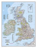
Magneetbord van een wandkaart van Groot Brittannië en Ierland: prachtig kaartbeeld met heel veel details, gemaakt door de gerenommeerde makers van National Geographic. British Isles at 1:1,687,000 on a small wall map, 61 x 76cm (1’11” x 2’5” approx) , from the National Geographic Society showing the constituent parts of the United Kingdom, Irish Republic, Isle of Man and the Channel Islands. Shetland Islands are shown on an inset. The map uses NGS’s classic presentation style of white background plus relief shading to show the topography, with boundaries shown in colour. Within Great Britain, national parks are prominently highlighted. Names of many geographical regions are shown (The Wolds, South Downs, etc.); county boundaries are marked, but county names are indicated only by numbers cross-referenced to lists of counties and unitary authorities in England, with corresponding lists for Scotland, Wales, Northern Ireland and the Irish Republic. Latitude and longitude lines are drawn at…
189,-
Wandkaart Engeland - British Isles roadplanning wall map, 84 X 119 cm | Maps International
Routeplanner map from Maps International's selection of British Isles maps.   Routeplanning map details: British Isles routeplanning map shows the motorways, major roads and transport hubs such as airports and rail routes in the UK. Routeplanner maps shows the major towns and their approximate population in the British Isles. Routeplanner map also contains useful table of towns and their distance apart. Extremely useful in organising journeys - times and routeplanning.   Map Uses: This British Isles routeplanning map is ideal to display in offices or depots.
34,95
Wandelgids Lake District: Low Level and Lake Walks | Cicerone
The Lake District offers some of the best walking in the British Isles, and contained within this book are 30 of the best low-level walks within the Lake District. This is an area that is justly famed for its magnificent scenery: from serene lakes and wooded valleys to spectacular hills and hidden tarns. But you don’t have to climb its highest mountains to appreciate this beauty; some of the region’s best walking can be enjoyed in the valleys and on the low fells.   Those who are new to walking in this much beloved corner of England will find gentle strolls, such as the circuit of Buttermere, as well as walks that provide a straight forward introduction to the low fells, such as High Rigg.   With her intimate knowledge of the National Park, Vivienne Crow knows just where to go to experience the best of the Lake District. In this book, she guides walkers to well-known beauty spots as well as some hidden gems – with background information on both the human and natural history adding to t…
14,50

Klanten-reviews van Reisinspiratieboek Wanderlust British and Irish Isles | Gestalten Verlag

Er zijn nog geen beoordelingen voor dit productBen jij de eerste die een review plaatst?

Meer over Reisinspiratieboek Wanderlust British and Irish Isles | Gestalten Verlag

Productomschrijving

From breathtaking nature to timeless culture, explore the hiking trails and the wonders of the British Isles. The British and Irish Isles are a paradise for hikers. They provide a unique blend of breathtaking nature, fascinating local history, and timeless culture. Stunning photography showcases the diverse natural landscapes and rich national history of the region. The book offers maps, valuable insights on the trails, the best time to hike them, and regional specialties that will help readers make the most of their adventures. Whether you're an avid hiker or an armchair traveler, this new addition to the Wanderlust series will take you from the heart of the Scottish Highlands, to the Lake District, Ireland, and onward to the expansive coastline of the English Riviera. In addition to highlighting the natural and historical monuments of the islands, this book celebrates the best hiking trails and details the best of British and Irish culture, providing readers with some unique spots to relax and unwind after a day of exploration. Experience the warmth and hospitality of the locals, and end your island journey by the fireside, savoring all that these remarkable islands have to offer.

Verken gerelateerde categorieën

Shopblog.nl maakt gebruik van cookies. Ga je verder op onze website, ga dan akkoord met het plaatsen van cookies en de verwerking van deze data door ons en vermelde partners.