shopblog.nl
Categorieën
  Sluiten

Meer Collins

Reisgids - Reisverhaal Atlas of Unusual Borders | Zoran Nikolic

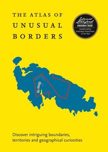
The world is not always what we think it is. This book presents unusual borders, enclaves and exclaves, divided or non-existent cities and islands. Numerous conflicts have left countries divided and often shattered. Remnants of countries can by design or accident be left behind as a legal anomaly in this complex world. Most people believe that a c...
21,50

Webshops met dit product

Webshop
Bezorging
Prijs

Anderen bekeken ook

Reisgids - Reisverhaal Atlas of Unusual Borders | Zoran Nikolic
The world is not always what we think it is. This book presents unusual borders, enclaves and exclaves, divided or non-existent cities and islands. Numerous conflicts have left countries divided and often shattered. Remnants of countries can by design or accident be left behind as a legal anomaly in this complex world. Most people believe that a country's borders are clearly defined: just lines that separate countries. Everything on one side of the line belongs to one country and everything on the other side belongs to another country. This might be the case most of the time, but there are unusual exceptions to this unwritten rule. Examples include: - Campione d'Italia where Italian residents have to travel 15km through Switzerland to reach the nearest available Italian territory. - Tomb of Suleyman Shah which is a tiny Turkish enclave within Syria which was moved closer to Turkey when Lake Assad was created but still stayed in Syria. - Pheasant Island which for half a year belongs …
21,50
Reisverhaal Dreaming of Jupiter | Ted Simon
Ted Simon is the author of the classic travel book JUPITER'S TRAVELS. It documents his four-year journey round the world by motorbike, travelling through Europe, Africa, South and North America, and Asia. A number one bestseller in the late 1970s, it is still regarded as one of the greatest motorcycle books - indeed, one of the greatest travel books - ever written. In 2001, at the age of 69, Ted Simon decided to retrace his journey, and DREAMING OF JUPITER is the result. It took him two and a half years - during which time he revisited all the countries he had travelled through in the 1970s. He found much had changed, and he reflects upon the increased poverty, political upheavals, environmental issues and indeed the changes in himself. But ultimately, DREAMING OF JUPITER is a hugely inspiring read with a positive message at its heart - that even at the age of 70 you can still set off on an adventure, and be surprised and excited by what life throws at you along the way. *'Gloriously l…
14,50
Reisgids - Reisverhaal Pocket Atlas of Remote Islands | Judith Schalan
'Utterly exquisite.' Robert MacFarlane, Guardian'Gorgeous, lyrical and whimsical.' TimeBorn on the wrong side of the Berlin Wall, as a child Judith Schalansky could travel only through the pages of an atlas. Now she has created her own, taking us across the oceans of the world to fifty remote islands. Perfect maps jostle with cryptic tales from the islands, full of rare animals and lost explorers, marooned slaves and lonely scientists, mutinous sailors and forgotten castaways.'By book's end, I felt that I had travelled to all fifty islands.' Washington Post'Rarely has armchair travel been so farflung and romantic.' Time Out Judith Schalansky was born in 1980 on the wrong side of the Berlin Wall. The Soviets wouldn't let anyone travel so everything she learnt about the world came from her parents' battered old atlas. An acclaimed novelist and award-winning graphic designer, she has spent years creating this, her own imaginative atlas of the world's loneliest places. These islands are so…
20,95
Wegenkaart - landkaart Gambia & Senegal | ITMB
Een degelijke kaart met aanduidingen van o.a. nationale parken, vliegveld, benzinepomp, dirt-roads en kleine plattegrond van hoofdstad. Als overzichtskaart goed te gebruiken. Gambia schaal 1:340.000 Senegal schaal 1:740.000 We combined Senegal with Gambia in this edition, but as two completely separate maps - Senegal on one side, and Gambia on the other. During our recent research trip to the two countries, it became obvious to us that the two countries are so inter-linked that it doesn't make sense to show one without the other. This new map has two covers, so the map can be displated Gambia side outwards, or Senegal side outwards. Both maps benefit from improved availability of information, thanks to our visit. Frankly, neither country appears to have progressed significantly over the past 40 years since my first visit, but I'm a cynic. The main east-west highways in both countries are being paved (again) by European countries providing foreign aid (again). No road mainenance camps a…
13,95
Reisgids 1e Wereldoorlog - World War I Battlefields | Bradt Travel Gui
Thoroughly updated for this new 3rd edition, Bradt's World War I Battlefields remains the only compact practical travel guide to cover both French and Belgian battlefield sites involved in one of the deadliest conflicts in human history, which changed the face of foreign policy and European geography forever. The 2014-18 centenary of the First World War was a huge catalyst for battlefield tourism, leading to a proliferation of innovative new museums, memorials, commemorative trails, statues and more - which are comprehensively covered in this update. Co-authored by two award-winning travel writers, this lightweight and pocket-friendly guidebook is perfect for visitors. It covers all the main sites, memorials and museums of the entire Western Front alongside practical information such as travelling there and getting around, and how to book the best guided tours.   In the Belgian section of the book, chapters cover Ypres and the Ypres Salient; Poperinge and Heuvelland; Diksmuide, Veurne …
13,95
Fietsgids Bikeline Danube Bike Trail 5 (Engels - Donau Radweg) | Ester
The fifth part of the Danube Bike Trail begins in Belgrade and ends in Romania on the Black Sea. With a total length of 2,845 kilometres, the Danube is Europe’s second longest river (after the Volga with 3,534 kilometres), and the only one on which kilometres are counted in reverse direction, starting with kilometer zero at the mouth and ending upstream at the source.   The total length of Part 5 of the Danube Bicycle Trail is about 1,400 kilometres. This does not include various side trips and alternative routes. The Danube Bike Trail is part of the Eurovelo-Route 6 and to a great extent identical.   This last part of the Danube Bike Trail mostly follows paved main roads and secondary roads, which you share with a variety of other traffic. It is not unusual in some parts of Bulgaria and Romania that you encounter more horse or mule carts, pedestrians or roaming sheep or geese than motorized traffic. In and around the larger cities, however, you can expect heavy traffic and you should …
15,50
Wegenkaart - landkaart Kgalagadi - Tourist Map of Kgalagadi Transfront
Zeer bijzondere landkaart van het grensgebied van Botswana en Zuid Afrika. Uitermate handig zijn de GPS coordinaten van de meest belangrijke punten als campings of uitzichtpunten. De kaart is gebaseerd op een luchtfoto, waarbij alle details zijn ingetekend. The map: The map consists of a large map of the entire Park on the front of the map. On the back is enlargements of six maps - the South African side, Mabuasehube, Swart Pan area, Gemsbok Wilderness Trail, Mabuasehube Wilderness Trail and of the Kaa Kalahari Concession. Satellite images were used and the roads were tracked by GPS. There are 168 GPS coordinates on this map. Establishment of a Transfrontier Park: On the 7 th of April 1999 Botswana and South Africa signed a bilateral agreement in which they agreed to manage their adjacent national parks, Gemsbok National Park in Botswana and Kalahari Gemsbok National Park in South Africa, as a single ecological unit – the Kgalagadi Transfrontier Park. It is the first formally declared …
17,50
Wegenkaart - landkaart South Pacific Cruising & Samoa | ITMB
Een overzichtskaart van de zuidelijke Stille Oceaan met de cruise routes tussen de verschillende eilanden aangegeven. Op de achterzijde een overzichtskaart van Samoa This is a new venture for ITMB. Cruising is a rapidly-growing segment of the travel industry, experiencing double-digit growth rates annually. Obviously, this is a thriving market. In conjunction with several cruise ship lines, we have prepared a map of the South Pacific Ocean, which extends southwards from Hawai'i to the southern tip of New Zealand and eastwards from central Australia/Papua New Guinea to the Pitcairn Islands. Thus, it does not include the popular South East Asia and China coast routes. We think this has to change at a time when 25,000,000 people are travelling by cruise ships. At the same time, we must keep coverage area relevant for those end users of the artwork. Even at 1:12M, most of the area covered is water, with island countries such as Fiji, Tonga, Kiribati, Tahiti, and the Cook Islands being visi…
13,95

Klanten-reviews van Reisgids - Reisverhaal Atlas of Unusual Borders | Zoran Nikolic

Er zijn nog geen beoordelingen voor dit productBen jij de eerste die een review plaatst?

Meer over Reisgids - Reisverhaal Atlas of Unusual Borders | Zoran Nikolic

Productomschrijving

The world is not always what we think it is. This book presents unusual borders, enclaves and exclaves, divided or non-existent cities and islands. Numerous conflicts have left countries divided and often shattered. Remnants of countries can by design or accident be left behind as a legal anomaly in this complex world. Most people believe that a country's borders are clearly defined: just lines that separate countries. Everything on one side of the line belongs to one country and everything on the other side belongs to another country. This might be the case most of the time, but there are unusual exceptions to this unwritten rule. Examples include: - Campione d'Italia where Italian residents have to travel 15km through Switzerland to reach the nearest available Italian territory. - Tomb of Suleyman Shah which is a tiny Turkish enclave within Syria which was moved closer to Turkey when Lake Assad was created but still stayed in Syria. - Pheasant Island which for half a year belongs to the Spanish city of Irun, and the remaining half, to its French twin-town, Hendaye. - Canadian Stanstead and American Beebe Plain where the boundary line runs along the center of the main street, so that the houses on one side of the street are in Canada and on the other in the United States. These and many more instances are captured in this fascinating book full of strange geographical intrigue.

Productspecificaties

Artikelnummer(s)
Brand
Collins
Shopblog.nl maakt gebruik van cookies. Ga je verder op onze website, ga dan akkoord met het plaatsen van cookies en de verwerking van deze data door ons en vermelde partners.