shopblog.nl
Categorieën
  Sluiten

Meer david-mark
Meer david-mark in Boeken

Into the Woods

If you go into the woods, you're in for a dark surprise. Thirty years ago, three girls followed a stranger into the woods. Only two returned......
16,99

Webshops met dit product

Webshop
Bezorging
Prijs

Anderen bekeken ook

Wegenkaart - landkaart Northern British Columbia | ITMB
British Columbia is big! Gargantuan huge, in fact, although it is lightly populated. ITMB published a map of the more densely populated southern half of the province a number of years ago, and we have been asked to give the same emphasis to the northern half ever since. Here it is! Side 1 is of the western portion, including the Alaskan Panhandle, with the route followed by cruise ships heading north and clearly delineates the border between Canada and the USA that nearly erupted into warfare (54 40 or fight). It also shows the Stewart Highway heading north towards the Yukon, with its branch leading to Hyder, Alaska, the only place in the USA that uses Canadian money and does all its banking in Canada. The second side covers the eastern half of BC’s north, with the Alaska Highway starting in Dawson Creek and extending north to Fort Nelson before veering west into the eastern edge of the Rocky Mountains to the Yukon border. This is true wilderness country. It is virtually unpopulated ou…
14,95
Wegenkaart - landkaart Western Canada | ITMB
Een degelijke kaart met aanduidingen van o.a. nationale parken, vliegveld, benzinepomp, dirt-roads. Als overzichtskaart goed te gebruiken. This is actually our second attempt at mapping the western portion of Canada; the first covered everything from northwestern Ontario to the Pacific Ocean and, while it was an excellent map, the scale that such a huge area covered necessitated severe problems. In this version, all of British Columbia, Alberta, and the Yukon have been mapped from fresh digital data and presented at 1:1.4T scale. This would have been impossible when we prepared the first map. The Northwest Territories portion had to be compressed in two ways; first, the scale is 1:2M; second, only the portion with roads is shown. This is still an extremely large area. One has to consider the actual size of Canada when designing a map. Most countries in Europe would fit into this area, which only covers 20% of Canada. The Fort McMurray forest fire of a year ago covered an area larger th…
13,95
Wandelgids Edinburgh the Walk | Mica Publishing
This guidebook describes a ‘green chain walk’ of 69km (43 miles) around Edinburgh, Scotland's capital city, linking the city’s green spaces, and highlighting the people who shaped its future and the natural forces that created the landscape. Divided into eight sections of between 8km (5 miles) and 11km (6.75miles), the route can be followed as a continuous multi-day walk or as individual day walks. • A 69km (43 miles) walk around Edinburgh divided into eight sections of between 8km (5 miles) and 11km (6.75miles) • The route can be followed as a multi-day walk, or as individual day walks. • Each section is accompanied by details of public transport between the city centre and the section's start and finish points. 45 fully annotated Ordnance Survey Street View maps detail the route. • Geological, historical, architectural and cultural highlights are included in a variety of panels adjacent to the main text. • Edinburgh The Walk guides the walker through glorious cityscape, coastline, ri…
23,95
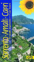
Wandelgids Sorrento, Amalfi Kust and Capri | Sunflower books
Wandelgids: vele dagtochten worden degelijk beschreven met openbaar vervoer informatie, goede routebeschrijvingen en kaartmateriaal. Tevens enkele autotochten. Deze gids staat goed bekend! Engelstalig, want nederlandstalige is uitverkocht en niet meer leverbaar. Landscapes of SORRENTO, the AMALFI COAST and CAPRI: 7 car tours + 72 walk segments   One of Sunflower’s most popular guides ever. Sorrento, Amalfi and Capri are wonderful areas for walkers. The author visits at least once a year to update — but he has ‘eyes and ears on the ground’ as well, so although this is the latest edition with all the changes known to us early spring 2017, always look at the Update page as well for last-minute tips from users or colleagues in this region of Italy.   Accident of history and steepness of terrain have preserved a network of ancient footpaths linking the coastal towns of the Neapolitan Riviera and the surrounding countryside. You can either climb almost from your hotel doorstep up into the…
22,50
Wegenkaart - landkaart Western Canada | ITMB
Een degelijke kaart met aanduidingen van o.a. nationale parken, vliegveld, benzinepomp, dirt-roads. Als overzichtskaart goed te gebruiken. This is actually our second attempt at mapping the western portion of Canada; the first covered everything from northwestern Ontario to the Pacific Ocean and, while it was an excellent map, the scale that such a huge area covered necessitated severe problems. In this version, all of British Columbia, Alberta, and the Yukon have been mapped from fresh digital data and presented at 1:1.4T scale. This would have been impossible when we prepared the first map. The Northwest Territories portion had to be compressed in two ways; first, the scale is 1:2M; second, only the portion with roads is shown. This is still an extremely large area. One has to consider the actual size of Canada when designing a map. Most countries in Europe would fit into this area, which only covers 20% of Canada. The Fort McMurray forest fire of a year ago covered an area larger th…
13,95
Wandelgids Trekking in the Apennines - Apennijnen | Cicerone
Uitstekende wandelgids die in etappes de route nauwkeurig beschijft; ook de zijtakken en alternatieve routes koman aan bod. Kaarten zijn schetsmatig en in onze ogen onvoldoende bij slechte weersomstandigheden. Wij raden dan ook om er losse kaarten bij te kopen, voor zover verkrijgbaar! Guidebook to the Grand Apennines Trek, or Grande Escursione Appenninica (GEA). Through Tuscany and Emilia-Romagna and two National Parks, this 400km, 23 day trail explores the mountains, forests and hills of central Italy. Suitable for a range of walkers, it can be split into shorter sections or day walks if needed. This guidebook describes the Grande Escursione Appenninica (GEA), a nearly 400km long, three week trek crossing the Appenines in 23 stages, from Bocca Trabaria to Passo Due Santi on the edge of Liguria. The route dips in and out of Tuscany and Emilia-Romagna, never dropping below 400 metres. Best walked between spring and autumn, it is suitable for any reasonably fit walker. Highlights includ…
22,95
Wonders of the Wild Series Statue Dire Wolf 28 cm
Introducing the extraordinary Dire Wolf Polyresin Statue, a captivating addition to the renowned Wonders of the Wild series by Star Ace. Immerse yourself in the ancient realms of the Americas and East Asia with this meticulously crafted masterpiece, paying homage to the formidable Dire Wolf that once roamed these lands over 10,000 years ago. Sculpted by famed prehistoric creature expert Sean Cooper, the Dire Wolf Polyresin Statue stands as a testament to the artistry and attention to detail that sets Star Ace apart. This lifelike portrayal isn't just a statue - it's a glimpse into a bygone era, an opportunity to witness the majesty of the ancient world's apex predators. Perched atop a finely crafted rock base and measuring a remarkable 28 cm in length, this exquisitely detailed Dire Wolf statue captures the essence of this powerful creature in breathtaking accuracy. From its robust build to its fierce countenance, every aspect has been expertly sculpted, showcasing the dedication to pr…
349,50

Klanten-reviews van Into the Woods

Er zijn nog geen beoordelingen voor dit productBen jij de eerste die een review plaatst?

Meer over Into the Woods

Productomschrijving

If you go into the woods, you're in for a dark surprise. Thirty years ago, three girls followed a stranger into the woods. Only two returned...

Productspecificaties

Artikelnummer(s)
EAN
9788728287675
Brand
david-mark

Verken gerelateerde categorieën

Shopblog.nl maakt gebruik van cookies. Ga je verder op onze website, ga dan akkoord met het plaatsen van cookies en de verwerking van deze data door ons en vermelde partners.