shopblog.nl
Categorieën
  Sluiten

Historische wereldkaart Wereld antiek 1651 90,5 x 69 cm | Freytag & Berndt

Historische wereldkaart uit het jaar 1651. Deze papieren wereldkaart wordt geleverd in een stevige plastic koker.    The map is marked with the names of countries, major cities and ports of the time, along with the charted seas and islands. The exceptions are the extreme north of America, and Australia, which is alluded to as 'Psittacorum Regio or ...
19,95

Webshops met dit product

Webshop
Bezorging
Prijs

Anderen bekeken ook

Wegenkaart - landkaart Corsica - Korsika | Freytag & Berndt
Deze bijzonder gedetailleerde Freytag & Berndt Wegenkaart van Corsica is aan één kant geprint en heeft een schaal van 1:150.000. Op deze kaart staan o.a. fietsroutes, lange afstandswandelpaden, toeristische wegen en bezienwaardigheden aangegeven. In de omslag van de kaart is een apart boekje geniet met een korte beschrijving van de TOP 10 van bezienswaardigheden, een uitgebreide index en plattegrondjes van enkele toeristische plaatsen. Explore the Mediterranean island of Corsica with this Freytag & Berndt single-sided road and leisure map. The best way to plan your trip, prepare your itinerary, and to travel independently on this region. As with all Freytag & Berndt maps, the cartography is clear and detailed with the topography shown with relief shading with plenty of spot heights.   This map features a full map of the island. Using Freytag & Berndt's icon system, important tourist information is shown. You will see icons for tourist information such as:   Picturesque towns and panora…
14,95
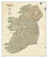
Wandkaart Ierland, antiek, 76 x 92 cm | National Geographic
National Geographic Maps' new Ireland wall map is one of the most authoritative maps yet published of the Emerald Isle. Of the nearly 1,000 place-names shown on this map, all within the Republic of Ireland adhere to that nation's constitution—that the Irish and English language share official status. Thus, Gaelic (Irish) place-names, along with their English variants in parentheses, are shown within Irish-speaking regions while English place-names, along with their Gaelic variants, are shown outside these areas.   Ireland Classic is ideal for those researching their Irish ancestry, a perfect tool for business reference, and a beautiful addition to any décor. It’s one of the largest and most detailed wall maps specifically for Ireland available today. Shown on the map are over 1,000 named places including primary and secondary towns, counties, political boundaries, infrastructure, and selected historical sites for both Ireland and Northern Ireland.   Place-name Details: Per the Republic…
25,95
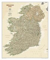
Wandkaart Ierland, antiek, 76 x 92 cm | National Geographic
National Geographic Maps' new Ireland wall map is one of the most authoritative maps yet published of the Emerald Isle. Of the nearly 1,000 place-names shown on this map, all within the Republic of Ireland adhere to that nation's constitution—that the Irish and English language share official status. Thus, Gaelic (Irish) place-names, along with their English variants in parentheses, are shown within Irish-speaking regions while English place-names, along with their Gaelic variants, are shown outside these areas.   Ireland Classic is ideal for those researching their Irish ancestry, a perfect tool for business reference, and a beautiful addition to any décor. It’s one of the largest and most detailed wall maps specifically for Ireland available today. Shown on the map are over 1,000 named places including primary and secondary towns, counties, political boundaries, infrastructure, and selected historical sites for both Ireland and Northern Ireland.   Place-name Details: Per the Republic…
31,95
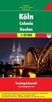
Stadsplattegrond Keulen - Köln | Freytag & Berndt
Stadsplattegrond met register. Helder kaartbeeld waarbij de naamgeving goed leesbaar is weergegeven. Met de toeristische bezienswaardigheden in symbolen weergeven: monumenten, musea, stadions e.a. Daarnaast handige zaken als postkantoren, parkeergarages en stations. Veelal ook met een openbaar vervoer of metro kaart als inzet Indexed street map of Cologne at 1:20,000 from Freytag & Berndt with an enlargement of central Cologne at 1:10,000. Mapping is bright, colourful and clear, with one-way streets shown, as well as the U-bahn, bus and tram networks with stops clearly indicated.   Points of interest such as Cologne cathedral, the Romano-Germanic museum, theatres and parks are marked, as are local facilities. The enlargement of the central Cologne shares the same mapping but with more clarity, and is indexed along with the main map on the reverse.
13,95
Wandelkaart - Wegenkaart - landkaart Chios - Hios | Freytag & Berndt
Freytag & Berndt kaarten op schaal 1:50.000 (of kleiner) zijn zeer overzichtelijk, wandelpaden werden erop ingekleurd, ze bevatten voldoende details om een wandeltocht in te schatten en worden meestal geleverd met een wandelgids waarin beknopte gegevens van wandelingen naar almen en hutten terug te vinden is alsook heel wat nuttige toeristische informatie en een tabel met GPS-punten. gedetailleerde landkaart met toeristische informatie, ook te gebuiken als fietskaart - met uitgebreide legenda en plaatsnamenregister.  Explore Chios with this Freytag & Berndt road map. The best way to plan your trip, prepare your itinerary, and to travel independently in this country.    As with all Freytag & Berndt maps the cartography is clear and detailed with the topography shown by relief shading with plenty of spot heights.   The map includes a detailed index and legend, along with tourist information and National Park information.   Distances between points are shown as well as indications of stee…
14,95
Wegenkaart - landkaart Trinidad & Tobago | Freytag & Berndt
Goede gedetailleerde wegenkaart van Trinidad & Tobago. Met natuurparken, Bezienswaardigheden. De afstand worden aangegeven in kilometers. Very clear map of the two islands with road information and place names easy to read. The map has the same geographic content as that published by Rough Guides, but with different colouring and the presentation of the topography - here with vivid relief shading rather than with contours and altitude tinting, and without the bathymetric tinting over the surrounding sea. Altitudes for a few peaks are marked, and swamps and reefs are also shown.   The clear road detail includes minor roads and tracks, with intermediate driving distances marked on main routes and selected petrol stations. Internal administrative boundaries and names are clearly marked, and reserves and protected areas are shown. Symbols show airports, harbours and many other tourism features and landmarks e.g. golf courses, zoos, botanical gardens, waterfalls, beaches and watersport site…
14,95
Wereldkaart World pacific-centred wall map, 136 x 100 cm | Maps International
View the world from a different perspective with Maps International's Pacific centred world wall map with flags.    Map details: This Pacific centred wall map shows the world centred along the 150° line of longitude. Instead of parting the map along the Pacific Ocean (as most world wall maps are), this one parts the map along the Atlantic Ocean meaning Europe and the Americas are in separate sides of the map!    Pacific centred world wall map has countries marked in different colours according to international country boundaries. Capital cities (including approximate population size) and hill shading are also shown. Mountain peaks and depths are given on this Pacific centred world wall map. Pacific centred map comes with a panel of country flags displayed on the base of the map.    Map uses: Great for re-learning about world and its geography. Ideal for use in secondary school classrooms and who those wishing to challenge their thinking.   Afwerking: geplastificeerd De wandkaart word…
37,95
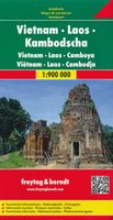
Wegenkaart - landkaart Vietnam - Laos - Cambodia (Cambodja) | Freytag & Berndt
Zeer goede overzichtskaart van het hele gebied van Vietnam, Laos en Cambodja. Zeker als je meerdere landen gaat combineren is dit een prima kaart waar nog veel op staat. Veel plaatsen, maar ook allerlei toeristisch interessante plekken die met symbolen zijn aangegeven. Detailed, double-sided road map Vietnam, Cambodia, and Laos, ideal for route-planning. Clearly shows the national road network and selected provincial and local roads, with each class of road clearly indicated and road numbers shown. Intermediate driving distances between locations are shown in kilometres alongside the road, motorway filling stations are shown and motorway junctions are indicated. Topography is shown with relief shading and some spot heights. International and provincial boundaries are clearly marked, as are National Parks, nature reserves and restricted military areas. Symbols indicate various sights & locations of tourist interest, such as churches, leisure & sports destinations, panoramas & viewing po…
14,95
Wandelkaart - Wegenkaart - landkaart Liparische eilanden | Freytag & Berndt
Gedetailleerde wegenkaart en wandelkaart (géén wandelroutes ingetekend!) met uitgebreide legenda en plaatsnamenregister. Meer wegenkaart dan wandelkaart. Aeolian (Lipari) Islands at 1:20,000 from Freytag & Berndt on a double-sided map which presents on the reverse coverage of Italy south of Rome at 1:600,000 and shows ferry access to the islands from the mainland or Sicily.   On one side the islands are shown in a series of panels, with the three largest: Salina, Lipari and Vulcano together, and Alicudi, Filicudi, Panarea and Basiluzzo plus Stromboli as separate insets. Topography is shown by contours at 50m intervals enhanced by relief shading, with names of peaks, valleys, etc. All place names are in large, easy to read print.   Road network includes country tracks and a selection of hiking paths. Various places of interest and facilities are highlighted, including beaches, marinas, campsites, etc. Each individual inset has latitude and longitude lines at intervals of 1’.   Ferry por…
14,95
Stadsplattegrond Barcelona | Freytag & Berndt
Stadsplattegrond met register. Helder kaartbeeld waarbij de naamgeving goed leesbaar is weergegeven. Met de toeristische bezienswaardigheden in symbolen weergeven: monumenten, musea, stadions e.a. Daarnaast handige zaken als postkantoren, parkeergarages en stations. Veelal ook met een openbaar vervoer of metro kaart als inzet. Explore Barcelona with this Freytag & Berndt map. The best way to plan your trip, prepare your itinerary, and to travel independently in this country. As with all Freytag & Berndt maps the cartography is clear and detailed with the topography shown by relief shading with plenty of spot heights.   One side features a detailed map of the city of Barcelona, as well as an inset of the greater area around the city in Spain. The flipside features the index for the map.    Freytag & Berndt maps make good use of an icon system. Icons show tourist information such as:   Places of interest Churches, museums and theatres Parks and gardens   Distances between points are show…
13,95

Klanten-reviews van Historische wereldkaart Wereld antiek 1651 90,5 x 69 cm | Freytag & Berndt

Er zijn nog geen beoordelingen voor dit productBen jij de eerste die een review plaatst?

Meer over Historische wereldkaart Wereld antiek 1651 90,5 x 69 cm | Freytag & Berndt

Productomschrijving

Historische wereldkaart uit het jaar 1651. Deze papieren wereldkaart wordt geleverd in een stevige plastic koker.    The map is marked with the names of countries, major cities and ports of the time, along with the charted seas and islands. The exceptions are the extreme north of America, and Australia, which is alluded to as 'Psittacorum Regio or the Country of Parrots, soo called from ye extreaordinary and almost incredible bignes of those birds there'.   Surrounding the map are many interesting insets: the celestial hemispheres are shown, along with their  constellations; two diagrams explain pictorially how solar and lunar eclipses occur; 'A Figure of the Sphere' and 'The Heavens and Elements' occupy the top corners; and portraits of four notable explorers including Magellan and Drake are also shown.
Shopblog.nl maakt gebruik van cookies. Ga je verder op onze website, ga dan akkoord met het plaatsen van cookies en de verwerking van deze data door ons en vermelde partners.