shopblog.nl
Categorieën
  Sluiten

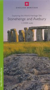
Historische Kaart Exploring the World Heritage Site - Stonehenge and A

The Stonehenge and Avebury World Heritage Site is internationally important for its outstanding prehistoric monuments. Stonehenge is the most architecturally sophisticated prehistoric stone circle in the world, while Avebury is the largest. Around them lie numerous other monuments and sites, which demonstrate over 2,000 years of continuous use. Tog...
14,95

Webshops met dit product

Webshop
Bezorging
Prijs

Anderen bekeken ook

Historische Kaart Exploring the World Heritage Site - Stonehenge and A
The Stonehenge and Avebury World Heritage Site is internationally important for its outstanding prehistoric monuments. Stonehenge is the most architecturally sophisticated prehistoric stone circle in the world, while Avebury is the largest. Around them lie numerous other monuments and sites, which demonstrate over 2,000 years of continuous use. Together they form a unique prehistoric landscape. There is no better way to learn about an experience the monuments than to go out and explore the World Heritage Site on foot. This map is ideal for walkers and others wishing to explore the fascinating landscape of the two areas of the World Heritage Site. The map uses an Ordnance Survey 1:10,000 base and draws upon information from the English Heritage Archive and recent archaeological investigations. With Stonehenge on one side and Avebury on the other, the map shows and describes both visible and hidden remains, with information about where you can find out more. The map is divided into two p…
14,95
Historische Kaart An Archaeological Map of Hadrian's Wall | English He
It was more than just a wall: it was a whole military zone designed to control movement across the northern frontier of the Roman province of Britannia. Great earthwork barriers survive, along with the remains of forts and temporary camps; watch-towers and fortified gates; civilian settlements, temples, cemeteries, bath-houses, roads and bridges. Stretching across the spine of England from the North-East coast to the Irish Sea, the line of the frontier extends for over 100 miles through every type of landscape: from the streets of urban Tyneside, through arable fields; along the crags of the wild Whin Sill; to the sands of the Solway, and down the coast of Cumbria. Drawing upon the extensive expertise and unrivalled archives of English Heritage, and those of its partners, this map depicts the fruits of modern archaeological research: in field survey, geophysics, excavation, and the analysis of aerial photographs. Using Ordnance Survey 1:25,000 data - the ideal scale for walkers - this …
14,95
Wandelgids 100 outstanding British Walks | Ordnance Survey
Beschrijving van de 100 mooiste Pathfinder wandelingen in Engeland, Wales en Schotland. Uitstekende beschrijving van de route met een zeer duidelijke topografische kaart waarop de route is ingetekend.  This magnificent compendium of outstanding British walks brings together the finest selection of Pathfinder Walks in Britain s officially designated places of scenic beauty and historic interest: National Parks, Areas of Outstanding Natural Beauty, National Scenic Areas, Heritage Coast, National Trails and UNESCO World Heritage Sites. There are 100 walking gems in this collection, recommended by a group of experienced authors and guides. The walks span a range of distances and degrees of challenge and are organised by region with coverage across England, Wales and Scotland. 100 Outstanding British Walks is lavishly illustrated with stunning landscape photography and informative introductions to each of the walks. It is designed to be enjoyed at home, while the OS Maps app provides the pr…
27,95
Wegenkaart - landkaart 3303 Adventure Map Ireland - Ierland | National
Wegenkaart van Ierland met vermelding van veel bezienswaardigheden, nationale parken en attrakties. Watervast en scheurvast. Juist door deze vermeldingen onderscheidt de kaart zich van andere wegenkaarten. National Geographic's Ireland Adventure Map is designed to meet the unique needs of adventure travelers—detailed, durable, and accurate. Ireland includes the locations of thousands of major cities and towns with an index for easily locating them, plus a clearly marked road network complete with distances and designations for major highways, limited access highways and more.   What sets National Geographic Adventure Maps apart from traditional road maps are the hundreds of points-of-interest that highlight the diverse, unique, and exotic destinations within Ireland including national parks and preserves, World Heritage sites, castles, archeological sites, monuments, scenic viewpoints, beaches, natural points of interest, and important travel aids like airports, airstrips, rail lines, …
17,50
Historische Kaart Verdun - Eerste Wereldoorlog | War travel
Themakaart over de geschiedenis van de Eerste Wereldoorlog in en rond Verdun. Met gedetailleerde inzetten van Verdun, Argonne en Saint-Michel. Aandacht voor monumenten, musea, vestingen, loopgraven en kerkhoven.  Mooi kleurgebruik, veel detail en heel gedetailleerd. Gedrukt op stone-paper, dat gaat echt veel langer mee.   Van de uitgever Discover Verdun and its surroundings. This double-sided printed map shows the locations of cemeteries, monuments, forts, trenches and museums in and around Verdun. The map is printed on Stone Paper, 100% water-repellent, very durable in use and paper-free. Folded size 12.5 * 25 cm, unfolded 70 * 100 cm.   Discover 10 destroyed villages, 66 World War I cemeteries (37 French, 28 German and 1 American), 30 fortresses, 40 monuments, 16 trenches and 10 World War I museums using this highly detailed map.   The map is divided into 4 sections:   The city of Verdun. Visit the underground Citadelle, the beautiful Victory Monument, the old town in Vauban style an…
15,-
Wegenkaart - landkaart 3303 Adventure Map Ireland - Ierland | National
Wegenkaart van Ierland met vermelding van veel bezienswaardigheden, nationale parken en attrakties. Watervast en scheurvast. Juist door deze vermeldingen onderscheidt de kaart zich van andere wegenkaarten. National Geographic's Ireland Adventure Map is designed to meet the unique needs of adventure travelers—detailed, durable, and accurate. Ireland includes the locations of thousands of major cities and towns with an index for easily locating them, plus a clearly marked road network complete with distances and designations for major highways, limited access highways and more.   What sets National Geographic Adventure Maps apart from traditional road maps are the hundreds of points-of-interest that highlight the diverse, unique, and exotic destinations within Ireland including national parks and preserves, World Heritage sites, castles, archeological sites, monuments, scenic viewpoints, beaches, natural points of interest, and important travel aids like airports, airstrips, rail lines, …
17,50
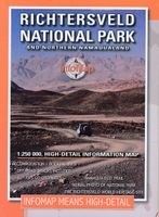
Wegenkaart - landkaart Richtersveld National Park and Northern Namaqua
Wegenkaart met toeristische informatie en geschikt voor gebruik met GPS   The original InfoMap! Now in its 8th edition this map remains as popular as ever. For those who don’t know, the Richtersveld National Park is a 160 000 hectare national park found on the banks of the Orange River in South Africa’s Northern Cape. It is the only mountain desert park in Southern Africa and is one of the few national parks in which you are not confined to your car. Dry, arid with a feeling of isolation, life in the park is influenced by the mist created by the cold Atlantic Ocean. Known to the local Nama people as ‘malmokkie’ it brings moisture to an otherwise parched land. Despite its lack of rainfall the area is rich in flora containing many species, like the Halfmens, which exist nowhere else on earth.   The area has long been a favorite for botanists, photographers, lovers of remote places and 4×4 enthusiasts who flock to this corner of South Africa for its unique character, isolation and feel…
15,95

Klanten-reviews van Historische Kaart Exploring the World Heritage Site - Stonehenge and A

Er zijn nog geen beoordelingen voor dit productBen jij de eerste die een review plaatst?

Meer over Historische Kaart Exploring the World Heritage Site - Stonehenge and A

Productomschrijving

The Stonehenge and Avebury World Heritage Site is internationally important for its outstanding prehistoric monuments. Stonehenge is the most architecturally sophisticated prehistoric stone circle in the world, while Avebury is the largest. Around them lie numerous other monuments and sites, which demonstrate over 2,000 years of continuous use. Together they form a unique prehistoric landscape. There is no better way to learn about an experience the monuments than to go out and explore the World Heritage Site on foot. This map is ideal for walkers and others wishing to explore the fascinating landscape of the two areas of the World Heritage Site. The map uses an Ordnance Survey 1:10,000 base and draws upon information from the English Heritage Archive and recent archaeological investigations. With Stonehenge on one side and Avebury on the other, the map shows and describes both visible and hidden remains, with information about where you can find out more. The map is divided into two parts on a durable double sided waterproof sheet.
Shopblog.nl maakt gebruik van cookies. Ga je verder op onze website, ga dan akkoord met het plaatsen van cookies en de verwerking van deze data door ons en vermelde partners.