shopblog.nl
Categorieën
  Sluiten

Meer Phaidon
Meer Phaidon in Feestversiering

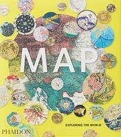
Fotoboek Map | Phaidon

300 stunning maps from all periods and from all around the world, exploring and revealing what maps tell us about history and ourselves. Map: Exploring the World brings together more than 300 fascinating maps from the birth of cartography to cutting-edge digital maps of the twenty-fist century. The book's unique arrangement, with the maps organized...
51,50

Webshops met dit product

Webshop
Bezorging
Prijs

Anderen bekeken ook

Fotoboek Map | Phaidon
300 stunning maps from all periods and from all around the world, exploring and revealing what maps tell us about history and ourselves. Map: Exploring the World brings together more than 300 fascinating maps from the birth of cartography to cutting-edge digital maps of the twenty-fist century. The book's unique arrangement, with the maps organized in complimentary or contrasting pairs, reveals how the history of our attempts to make flat representations of the world has been full of beauty, ingenuity and innovation. Selected by an international panel of curators, academics and collectors, the maps reflect the many reasons people make maps, such as to find their way, to assert ownership, to record human activity, to establish control, to encourage settlement, to plan military campaigns or to show political power. The selection includes the greatest names in cartography, such as James Cook, Gerard Mercator, Matthew Fontaine Maury and Phyllis Pearsall, as well as maps from indigenous cul…
51,50
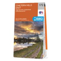
Wandelkaart - Topografische kaart 172 OS Explorer Map Chiltern Hills E
Discover the east Chiltern Hills where they meet the Thames Valley, replete with lovely countryside, beautiful views and rich history. Delight in the unrivalled sailing reaches of Maidenhead; the Georgian architecture of High Wycome, the onetime furniture capital of England and the market town of Rickmansworth, set in beautiful country but a stone’s throw from London.    Bathe in natural beauty, from carpets of bluebells in the beech woods to red kites on the chalk grasslands and wildflower meadows where rare butterflies like the Adonis Blue flutter  Discover stately homes and historic houses including the gorgeous Italianate mansion of Clevedon, the charming Tudor manor Chenies and Milton’s Cottage where Paradise Lost was finished  Walk, cycle or hike a wide range of recreational paths including the Chiltern Way, South Bucks Way, Shakespeare’s Way and the Thames Path  Met zijn 4cm voor 1 km (2 ½ cm voor 1 mijl) schaal, is de OS Explorer kaartenserie de ideale en meest gedetailleerd…
19,50
Wandelkaart - Topografische kaart 124 OS Explorer Map Hastings & Bexhi
Experience the history-rich countryside where the High Weald, an Area of Outstanding Natural Beauty, sweeps down to the shore where the fate of Britain was decided in 1066. Explore Battle and visit the actual spot where the Battle of Hastings took place, now a beautiful wildflower meadow dotted with the ruins of a grand abbey built in penance for the slaughter.  Visit the seaside towns of Hastings and Bexhill with their medieval Old Towns, Victorian and Edwardian seafronts and pavilions  Glimpse wild deer and boar roaming in the forests near Robertsbridge and Dartwell Reservoir in the High Weald  Walk or cycle in the footsteps of William the Conqueror on the 1066 Path, or start the Saxon Shore Way from Hastings to head north to Winchelsea  Met zijn 4cm voor 1 km (2 ½ cm voor 1 mijl) schaal, is de OS Explorer kaartenserie de ideale en meest gedetailleerde kaartenreeks voor mensen die graag outdoor-activiteiten zoals fietsen, wandelen, paardrijden, klimmen en watersporten. Deze kaart …
19,50
Reisgids Eyewitness Travel Southwest USA and National Parks | Dorling
Prachtig geillustreerde reisgids met o.a. 3D tekeningen, fraaie kaarten en geweldige foto’s. Daarnaast uitgebreide achtergrondbeschrijvingen. Echt om in de stemming te komen! Groot formaat gids. Engelstalig. Embark on an outdoor adventure across the Southwest USA and its many varied and wonderful National Parks! Whether you want to unleash your inner cowboy on the ranches in Utah, take in the truly spectacular sight of the Grand Canyon, or test your luck in the casinos of Las Vegas, your DK Eyewitness travel guide makes sure you experience it all! Inside the pages of this Southwest USA and National Parks travel guide, you’ll discover:    • Our pick of Southwest USA’s must-sees, top experiences, hidden gems, and the best spots to eat, drink, shop, and stay     • Detailed maps and walks make navigating the cities and towns easy     • Easy-to-follow itineraries to help you plan your trip    • Expert advice and travel tips to help you get ready, get around and stay safe    • Color-coded …
20,95
Reisgids Mini Rough Guide Caribbean Ports of Call | Rough Guides
Een kleinere versie in zakformaat van de grotere versies van de Rough Guides. Als altijd weer vol met goede informatie over cultuur en praktische zaken. Achterin kleine plattegronden.   his pocket-sized guide is a convenient, quick-reference companion to discovering the beauty of Caribbean cruising. From the glitzy ships to islands as different as Barbados and St-Barthélemy, this guide aims to cover the popular ports of call, including places not considered part of the region, such as the Bahamas, Mexico and Central America, but which are often found on Caribbean cruise itineraries. This title has been fully updated post-COVID-19.   This Mini Rough Guide to Caribbean Ports of Call covers: Mexico and Central America, the Bahamas, the Western Caribbean, Eastern Caribbean, St-Martin, the Southern Caribbean.   In this travel guide you will find:   RECOMMENDATIONS FOR EVERY TYPE OF TRAVELLER Whether you want to slap on the sun lotion, read a good book and bask in the sun, dive in th…
12,50
Wegenkaart - landkaart 3012 Adventure Map India Northeast - Noordoost
Wegenkaart van Noordoost India met vermelding van veel bezienswaardigheden, nationale parken en attrakties. Watervast en scheurvast.   National Geographic's India Northeast Adventure Map is designed to meet the unique needs of adventure travelers with its durability and detailed, accurate information. The map includes the locations of thousands of cities and towns with a user-friendly index, as well as a clearly marked road network complete with distances and designations for highways, major routes and secondary roads.   The India Northeast Adventure Map differs from a traditional road map for it includes hundreds of points of interest that highlight the diverse and unique destinations found in this region. The map features UNESCO World Heritage sites, archaeological sites, wildlife sanctuaries, Hindu and Buddhist temples, forts, ruins, caves and other points of interest, making it an invaluable resource to travelers hoping to experience all the history and culture this part of India h…
17,50
Reisgids Mini Rough Guide Caribbean Ports of Call | Rough Guides
Een kleinere versie in zakformaat van de grotere versies van de Rough Guides. Als altijd weer vol met goede informatie over cultuur en praktische zaken. Achterin kleine plattegronden.   his pocket-sized guide is a convenient, quick-reference companion to discovering the beauty of Caribbean cruising. From the glitzy ships to islands as different as Barbados and St-Barthélemy, this guide aims to cover the popular ports of call, including places not considered part of the region, such as the Bahamas, Mexico and Central America, but which are often found on Caribbean cruise itineraries. This title has been fully updated post-COVID-19.   This Mini Rough Guide to Caribbean Ports of Call covers: Mexico and Central America, the Bahamas, the Western Caribbean, Eastern Caribbean, St-Martin, the Southern Caribbean.   In this travel guide you will find:   RECOMMENDATIONS FOR EVERY TYPE OF TRAVELLER Whether you want to slap on the sun lotion, read a good book and bask in the sun, dive in th…
12,50

Klanten-reviews van Fotoboek Map | Phaidon

Er zijn nog geen beoordelingen voor dit productBen jij de eerste die een review plaatst?

Meer over Fotoboek Map | Phaidon

Productomschrijving

300 stunning maps from all periods and from all around the world, exploring and revealing what maps tell us about history and ourselves. Map: Exploring the World brings together more than 300 fascinating maps from the birth of cartography to cutting-edge digital maps of the twenty-fist century. The book's unique arrangement, with the maps organized in complimentary or contrasting pairs, reveals how the history of our attempts to make flat representations of the world has been full of beauty, ingenuity and innovation. Selected by an international panel of curators, academics and collectors, the maps reflect the many reasons people make maps, such as to find their way, to assert ownership, to record human activity, to establish control, to encourage settlement, to plan military campaigns or to show political power. The selection includes the greatest names in cartography, such as James Cook, Gerard Mercator, Matthew Fontaine Maury and Phyllis Pearsall, as well as maps from indigenous cultures around the world, rarely seen maps from lesser'known cartographers, and maps of outstanding beauty and surprising individuality from the current generation of map makers.

Productspecificaties

Artikelnummer(s)
Brand
Phaidon

Verken gerelateerde categorieën

Shopblog.nl maakt gebruik van cookies. Ga je verder op onze website, ga dan akkoord met het plaatsen van cookies en de verwerking van deze data door ons en vermelde partners.