shopblog.nl
Categorieën
  Sluiten

Meer Cicerone
Meer Cicerone in Thrillers & fantasy boeken

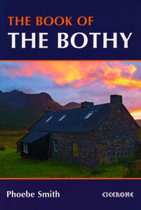
Accommodatiegids - Wandelgids The Book of the Bothy | Cicerone

A celebration of 26 of the author's favourite bothies, as she shares her memories of her favourite 'stone tents' all over the UK in remote and wild locations. Packed with expert advice on how to make use of these 'free, old, empty houses' from packing lists to bothy etiquette and the best walks into these remote locations. Seasons   Bothies are acc...
18,50

Webshops met dit product

Webshop
Bezorging
Prijs

Anderen bekeken ook

Accommodatiegids - Wandelgids The Book of the Bothy | Cicerone
A celebration of 26 of the author's favourite bothies, as she shares her memories of her favourite 'stone tents' all over the UK in remote and wild locations. Packed with expert advice on how to make use of these 'free, old, empty houses' from packing lists to bothy etiquette and the best walks into these remote locations. Seasons   Bothies are accessible year-round.   Centres   Wales: Snowdonia, Brecon Beacons, Devil's Bridge. England: Buttermere and Mosedale (Lake District), Dufton (Pennines), Kielder Forest Park (Northumberland). Scotland: Highlands and Isle of Skye, Glenduror Forest, Fort Augustus, Spean Bridge, Rannoch Moor, Cairngorms, Galloway Forest, Fisherfield, Sandwood Bay, Oykel Bridge.   Difficulty   Good level of fitness and ability required. Some of the bothies featured can be reached in a half day's walk, on easy to follow bridleways and paths; others require technical and/or navigation skills, especially in winter, with some river crossings or scrambling.   Must See   …
18,50
Wandelgids The Southern Upland Way | Cicerone
Uitstekende wandelgids van de Southern Upland Way, waarbij naast alle noodzakelijke informatie ook gebruik gemaakt wordt van de echte topografische kaart.   The Southern Upland Way is Scotland's coast-to-coast walk and the longest of the nation's Great Trails. 215 miles long, it links the pretty harbour village of Portpatrick on the west coast with Cockburnspath, a little south of Dunbar, in the east. The walk is at times a strenuous one, crossing the remote high moorland of the Galloway Hills, Carsphairn range, Lowthers, Ettrick Hills and Lammermuirs, calling for competence, fitness and self-reliance.    This guide presents advice on how best to plan and tackle this challenging but highly rewarding journey. The waymarked trail is presented in fourteen stages of 9–19 miles and suggestions for a rest day exploring Moffat and its environs are also included. It is possible either to backpack, taking advantage of five bothies and unlimited wild camping possibilities, or to stay in towns…
20,95
Wandelgids The West Highland Way | Birlinn
The West Highland Way Official Guide is de officiele gids met wandelroutekaart voor de meest beroemde lange afstandswandelroute door Schotland. Zeer handig is de bijgevoegde wandelkaart van Harvey. ‘If the objective of a guide book is to impart essential information, then this guide achieves that and famously; minute directional detail, location of campsites, bunkhouses, hostels, huts and bothies, services and supplies, equipment, training and preparation, countryside code, even a map ... But this guide exceeds that purpose. It is an evocation of all that is best about Scotland and its countryside’ – Bruce Sandison, The Herald   Opened in 1980, the West Highland Way was Scotland’s first Long Distance Route and remains the most popular, with more than 15,000 walkers tackling it each year. It runs from Milngavie, on the outskirts of Glasgow, to Fort William. The 152km route passes along the east of Loch Lomond, the largest expanse of fresh water in Britain, and across Rannoch Moor, Scotl…
25,95
Wandelgids Walking in the Cairngorms | Cicerone
Uitstekende wandelgids, sommige meerdaags, voor dit uitdagende wandelgebied in Schotland. This guidebook contains over 100 routes for walking in the Scottish Cairngorms. It includes 18 Munro summits and smaller viewpoint hills. Walks range in length from 1 to 26 miles and are graded for difficulty.    For the adventurous there are the best of the area's rocky scrambles, and the classic through-routes including the Lairig Ghru. For those looking for a more gentle alternative, there are easy, sandy trails wandering among the tall pines and along the banks of the great rivers Spey, Nethy and Dee.    Britain's biggest mountain range is home to exceptional and varied scenery - from the ancient Caledonian forest to the granite plateau, the glacial glens and high corries where green lochans lie below great crags of the plateau rim.  Along with the main Cairngorm range between Speyside and Deeside, the guidebook covers Lochnagar. It includes practical information on snack stops, public t…
20,95
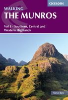
Wandelgids Walking The Munros Vol 1 Southern, Central and Western High
Uitstekende wandelgids van het zuiden, midden en westen van de Schotse Hooglanden. Goed beschreven met veel praktische informatie om de route te kunnen lopen, inclusief redelijke kaarten. Guidebook to walking the Munros in southern, central and western Highlands. Describes 69 challenging routes across 139 of the iconic 3000ft+ mountains covering areas such as Glencoe, Bridge of Orchy and Mull. Includes routes up Ben More, Ben Alder, Ben Lomond and Ben Nevis, the highest mountain in the British Isles. Volume 1 of two guidebooks.   Seasons The guide is intended for summer hillwalkers (usually April/May to October in Scotland). In winter conditions the routes become more serious mountaineering expeditions requiring appropriate skills, equipment and experience.   Centres Arrochar, Crianlarich, Killin, Pitlochry, Tyndrum, Glencoe, Fort William, Spean Bridge, Dalwhinnie, Braemar, Glenshee   Difficulty Most of the Munros are straightforward walks but some involve ridge walking, scr…
20,95
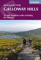
Wandelgids Walking the Galloway Hills | Cicerone
Uitstekende wandelgids van galloway!   This guide covers 35 day walks and one long-distance route in the wild and remote hills of Galloway. Although there are some shorter and easier routes, many of these hill walks are long and on rugged terrain, so are more suitable for experienced walkers. The walks cover the evocative areas of The Merrick, The Awful Hand, The Rhinns of Kells, the Minnigaff hills and Cairnsmore of Fleet, among others.   The guide uses OS 1:50,000 maps with detailed route descriptions and inspirational photos accompanying each route. Key information such as distance, time, and ascent are given. A 'harshness' grade gives an indication of how rough the ground is expected to be, and suggestions of variants, shortcuts and ways to extend each walk are also given. Plenty of background information is given on the region's fascinating and important history.   If you like your wild landscape really wild… If you like your lakes to have whooper swans in the middle and no ice-cr…
18,50

Klanten-reviews van Accommodatiegids - Wandelgids The Book of the Bothy | Cicerone

Er zijn nog geen beoordelingen voor dit productBen jij de eerste die een review plaatst?

Meer over Accommodatiegids - Wandelgids The Book of the Bothy | Cicerone

Productomschrijving

A celebration of 26 of the author's favourite bothies, as she shares her memories of her favourite 'stone tents' all over the UK in remote and wild locations. Packed with expert advice on how to make use of these 'free, old, empty houses' from packing lists to bothy etiquette and the best walks into these remote locations. Seasons   Bothies are accessible year-round.   Centres   Wales: Snowdonia, Brecon Beacons, Devil's Bridge. England: Buttermere and Mosedale (Lake District), Dufton (Pennines), Kielder Forest Park (Northumberland). Scotland: Highlands and Isle of Skye, Glenduror Forest, Fort Augustus, Spean Bridge, Rannoch Moor, Cairngorms, Galloway Forest, Fisherfield, Sandwood Bay, Oykel Bridge.   Difficulty   Good level of fitness and ability required. Some of the bothies featured can be reached in a half day's walk, on easy to follow bridleways and paths; others require technical and/or navigation skills, especially in winter, with some river crossings or scrambling.   Must See   Bothies in this book cover some of the UK's wildest spots. Highlights included Sandwood Bay, Fisherfield forest, the Isle of Skye, Mosedale in the Lake District, the Torridon coastline, Rannoch Moor, Ben Alder, the Cairngorms National Park, Galloway Forest and Snowdonia's Carneddau.

Productspecificaties

Artikelnummer(s)
Brand
Cicerone

Verken gerelateerde categorieën

Shopblog.nl maakt gebruik van cookies. Ga je verder op onze website, ga dan akkoord met het plaatsen van cookies en de verwerking van deze data door ons en vermelde partners.