shopblog.nl
Categorieën
  Sluiten

Meer ITMB
Meer ITMB in Literatuur boeken

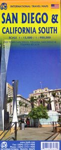
Wegenkaart - landkaart - Stadsplattegrond San Diego - California south

Wegenkaart en stadsplattegrond in een kaart: aan de ene zijde San Diego stadsplattegrond en op de andere kant een kaart van het zuiden van Californië. San Diego on a clear, well presented street plan from ITMB, with a transit system diagram, a road map of the city and its environs, and a street plan of central Tijuana, plus on the reverse a road ma...
13,95

Webshops met dit product

Webshop
Bezorging
Prijs

Anderen bekeken ook

Wegenkaart - landkaart - Stadsplattegrond San Diego - California south
Wegenkaart en stadsplattegrond in een kaart: aan de ene zijde San Diego stadsplattegrond en op de andere kant een kaart van het zuiden van Californië. San Diego on a clear, well presented street plan from ITMB, with a transit system diagram, a road map of the city and its environs, and a street plan of central Tijuana, plus on the reverse a road map of the US/Mexico border region extending east beyond El Paso and within USA north to Las Vegas.   On one side is an indexed street plan of San Diego, covering the city’s central districts (as indicated in our coverage image), including the downtown area, the Old Town for which an enlargement is provided, Balboa Park, University Heights, the Mission Bay Park with the SeaWorld, and the city’s international airport. The plan clearly shows the MTS and other public transit stations, highlights main traffic arteries and indicates one way streets. Also marked are recommended cycle routes. Streets are annotated with selected block numbers for easie…
13,95
Stadsplattegrond Hanoi & North Vietnam - Noord Vietnam | ITMB
Overzichtelijke stadsplattegrond met register, schaal 1:15700 en een kaart van  Noord Vietnam op schaal 1:920.000. Double-sided map with north Vietnam on one side and a street plan of Hanoi on the reverse. The road map at 1:920,000 shows the area’s road and rail networks and local airports. National parks, nature reserves, beaches and numerous places of interest are highlighted. Provincial boundaries are marked and names of administrative regions prominently shown. Topography is indicated by altitude colouring. Latitude and longitude lines are drawn at 30’ intervals. On the reverse is a street plan of Hanoi at 1:15,700 annotated with numerous places of interest, accommodation, and various facilities. An enlargement shows the Old Town at 1:10,000, and a further inset covers the city’s suburbs area at 1:920,000. Both the road map and the street plan are indexed. All place names are shown in the Roman alphabet but with scrupulous transliteration, since the map was prepared by a company wi…
13,95
Wegenkaart - landkaart 174 California - Californie - Nevada | Michelin
Bijzonder goed leesbare kaart van een deel van de Verenigde Staten - USA, in dit geval het gebied van de staten Californie en Nevada.   Op deze kaart zijn de Nationale Parken goed zichtbaar ingetekend met een heldere achtergrondkleur. Wegnummers, register, afstanden tussen steden en bijvoorbeeld de beroemde groene wegenaanduiding van Michelin ontbreken niet.    Met stadsplattegronden (alleen het centrum)  van Las Vegas, Los Angeles, Phoenix, Salt Lake City, San Diego en San Francisco   Michelin USA California, Nevada Map 174 (scale: 1:1,267,000)—part of Michelin's brand-new US regional map series with bright green covers—zooms in close for comprehensive coverage of California and Nevada, as well as western Utah and Arizona. It contains city maps for easy driving in Las Vegas, Los Angeles, Phoenix, Salt Lake City, San Diego and San Francisco. Michelin star-rated sights and a selection of not-to-be-missed annual events and festivals serve as inspiration for future road trips. Outdoor ent…
9,95
Wegenkaart - landkaart South Africa: Swartberg & Klein-Karoo | Slingsb
All roads from National Highways to minor gravel roads are shown; the many classifications that indi- cate the quality of each road help you plan your route No less than 28 mountain passes are shown — all are public roads! Distances are clearly shown; comprehensive 4 x 4 information GPS coordinates in DD MM SS format are provided for every road-junction All tourism facilities and accommodation establishments are shown in the out-of-town areas; there are insets of the major towns The map links to our maps of the Baviaanskloof, the Garden Route, Overberg and the Tankwa-Karoo Additional info:   Swartberg and Klein-Karoo region on a contoured and GPS compatible, double-sided, waterproof and   tear-resistant map at 1:160,000 from Slingsby Maps, with excellent topographic detail and plenty of tourist information, including street plans of ten main towns.   The map provides a very detailed picture of this mountainous terrain, with altitude colouring, shading, con- tours at 20m intervals and n…
29,95
Wegenkaart - landkaart 3119 California - Nevada | National Geographic
Mooie kaart van de bekende kaartenmaker National Geographic. Veel details door kleurgebruik. De wegen zijn met kleuren verdeeld in drukke en minder drukke, de wegnummers zijn goed terug te vinden. De kaart onderscheidt zich van andere series door de hoeveelheid topografische details als counties, plaatsnamen en waterwegen en het bevat een register waarin het eenvoudig zoeken is. Daarnaast is de kaart gedrukt op scheur- en watervast papier. The United States California and Nevada Adventure Map will guide you through two of the most spectacular and diverse states in the country. California and Nevada contain Yosemite and Sequoia & Kings Canyon National Parks, Death Valley and the Mohave Desert, the Sierra Nevada Mountains, Lake Tahoe, and dozens of magnificent National Monuments, Forests, and Wilderness Areas. The map includes the cities of Los Angeles, San Francisco, San Diego, and Las Vegas as well as the breathtaking Pacific coast of California. It covers western Utah and Arizona, inc…
17,50
Wegenkaart - landkaart 01 Kaapstad - Cape Town and Surrounding Attract
Het overzicht is soms misschien een beetje onduidelijk. maar de details in de inzetten en delen van de kaart zijn prima en voldoen goed voor het rondrijden met een eigen auto. Double-sided map, with a general road map on one side, plus numerous street plans and descriptions of four special routes on the reverse. The main map covers an area within reach as day trips from Cape Town, extending east to Swellendam and north to Langebaan. Road classification includes unsurfaced roads, intermediate driving distances on main and secondary roads, toll routes with gates, and mountain passes. Railways are shown with local stations. An impression of relief is provided by elevation tinting (perhaps somewhat confusing for regular map users - the higher the altitude, the greener the colour!), spot heights for main peaks, and names of mountain ranges. Nature and forest reserves, plus salt pans and marshes are indicated. Symbols mark local airfields, historical sites, caravan parks, many wine estates, …
16,95
Reisgids Southern California Road Trips | Moon
Hit the beach, hike hidden trails, or soak up some desert sun: the outdoor adventures are endless with Moon Southern California Road Trips- Pick Your Road Trip: Find flexible getaways throughout SoCal like three-day routes up the coast, through Death Valley, Ojai, and more, or combine them for an epic two-week driving tour. - Eat, Sleep, Stop and Explore: With lists of the best beaches, hikes, wineries, and more, you can tour backlots in Los Angeles, feel like a kid again at Disneyland, and feast on tacos and craft beer in San Diego. Climb Joshua Tree's rock formations to stunning views, ski and surf in the same day, and get a taste of the laidback lifestyle in Santa Barbara and Palm Springs.   - Maps and Driving Tools: Easy-to-use maps keep you oriented on and off the highway, along with site-to-site mileage, driving times, detailed directions, and full-colour photos throughout. - Local Expertise: San Diego native, brew enthusiast, and avid surfer Ian Anderson shares his tips on where…
23,95
Stadsplattegrond München | Freytag & Berndt
Stadsplattegrond met register. Helder kaartbeeld waarbij de naamgeving goed leesbaar is weergegeven. Met de toeristische bezienswaardigheden in symbolen weergeven: monumenten, musea, stadions e.a. Daarnaast handige zaken als postkantoren, parkeergarages en stations. Veelal ook met een openbaar vervoer of metro kaart als inzet   Large street plan of Munich within its administrative boundaries, with an enlargement of the city centre, a plan of its airport, a diagram of the U and S-Bahn networks and a map of the outer suburbs all conveniently placed in a separate booklet.    The main plan covers Munich at 1:22,500, showing the city’s public transport network: tram and bus routes with stops and line numbers, plus U- and S-Bahn stations. Campsites and youth hostels are marked, as well as the usual range of facilities shown on street plans; public buildings, religious establishments, police, etc.   Map legend which includes English is in a separate booklet attached to the map cover. The book…
13,95
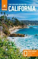
Reisgids California - Californië | Rough Guides
Zeer goede reisgids voor zowel de georganiseerde maar vooral voor de zelfstandige reiziger. Boordevol informatie over reizen, slapen, eten, maar ook musea en cultuur. Voor veel landen meestal completer en beter dan de Lonely Planet ! The Rough Guide to CaliforniaMake the most of your time on Earth with the ultimate travel guides. World-renowned 'tell it like it is' travel guide, now with free eBook. Discover California with this comprehensive and entertaining travel guide, packed with practical information and honest recommendations by our independent experts.   Whether you plan to hit the surf and seaside rollercoasters of Santa Cruz, hike in the Sierra Nevada, roam the Napa Valley's wineland, or embark on a Route 66 road trip, the Rough Guide to California will help you discover the best places to explore, eat, drink, shop and sleep along the way. Features of this travel guide to California:- Detailed regional coverage: provides practical information for every kind of trip, from o…
26,50

Klanten-reviews van Wegenkaart - landkaart - Stadsplattegrond San Diego - California south

Er zijn nog geen beoordelingen voor dit productBen jij de eerste die een review plaatst?

Meer over Wegenkaart - landkaart - Stadsplattegrond San Diego - California south

Productomschrijving

Wegenkaart en stadsplattegrond in een kaart: aan de ene zijde San Diego stadsplattegrond en op de andere kant een kaart van het zuiden van Californië. San Diego on a clear, well presented street plan from ITMB, with a transit system diagram, a road map of the city and its environs, and a street plan of central Tijuana, plus on the reverse a road map of the US/Mexico border region extending east beyond El Paso and within USA north to Las Vegas.   On one side is an indexed street plan of San Diego, covering the city’s central districts (as indicated in our coverage image), including the downtown area, the Old Town for which an enlargement is provided, Balboa Park, University Heights, the Mission Bay Park with the SeaWorld, and the city’s international airport. The plan clearly shows the MTS and other public transit stations, highlights main traffic arteries and indicates one way streets. Also marked are recommended cycle routes. Streets are annotated with selected block numbers for easier identification of addresses. Symbols highlight various places of interest, including numerous hotels. An enlargement presents San Diego’s Old Town in greater detail. Other insets show the town centre of Tijuana, plus a road map of the environs of San Diego and Tijuana, indicating which areas are covered by the street plans.

Productspecificaties

Artikelnummer(s)
Brand
ITMB

Verken gerelateerde categorieën

Shopblog.nl maakt gebruik van cookies. Ga je verder op onze website, ga dan akkoord met het plaatsen van cookies en de verwerking van deze data door ons en vermelde partners.