shopblog.nl
Categorieën
  Sluiten

Meer Insight Guides

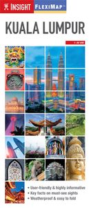
Wegenkaart - landkaart - Stadsplattegrond Fleximap Kuala Lumpur | Insi

Geplastificeerde kaart van Kuala Lumpur, met register. Voor de 'gewone' toerist een handige kaart, geen groot formaat, overzichtelijk met alle belangrijke plaatsen goed weergegeven.   Flexi Map Kuala Lumpur is a laminated, tear-resistant map which has 3 separate maps, each one accompanied by its own index.    It includes a list - with descriptio...
9,95

Webshops met dit product

Webshop
Bezorging
Prijs

Anderen bekeken ook

Wegenkaart - landkaart - Stadsplattegrond Fleximap Kuala Lumpur | Insi
Geplastificeerde kaart van Kuala Lumpur, met register. Voor de 'gewone' toerist een handige kaart, geen groot formaat, overzichtelijk met alle belangrijke plaatsen goed weergegeven.   Flexi Map Kuala Lumpur is a laminated, tear-resistant map which has 3 separate maps, each one accompanied by its own index.    It includes a list - with descriptions and some photographs - of 30 recommended sights, divided by theme and linked to the mapping by numbered markers. There is also a handy information section with concise details on getting around, tourist offices, money, tipping, opening times, public holidays, telecommunications, emergency telephone numbers and climate.   On one side is a street plan of the city, shown at a scale of 1:12 500 (1cm = 0.125km), the accompanying index is categorised for ease of use. One way streets, car parks and pedestrian zones are clearly shown and many prominent public buildings, hotels and other places of interest are highlighted and listed in the extens…
9,95
Stadsplattegrond City map Kuala Lumpur | Lonely Planet
De stadsplattegronden van Lonely Planet zijn uitgevoerd op scheur- en watervast papier, zijn lichtgewicht en kennen een handig formaat. Het centrum van de stad is in heldere kleuren in beeld gebracht met straatnamen, bezienswaardigheden en symbolen voor openbaar vervoer. Op de achterzijde staat informatie over de toeristische hoogtepunten en in de meeste gevallen een schematische plattegrond van het openbaar vervoer. Met een register. Durable and waterproof, with a handy slipcase and an easy-fold format, Lonely Planet's Kuala Lumpur City Map is your conveniently sized passport to travelling with ease. Get more from your map and your trip with images and information about top city attractions, walking tour routes, transport maps, itinerary suggestions, an extensive street and site index, and practical travel tips and directory. With this easy-to-use, full-colour navigation tool in your back pocket, you can truly get to the heart of Kuala Lumpur, so begin your journey now!   Durable a…
10,95
Wegenkaart - landkaart - Stadsplattegrond Fleximap Shanghai | Insight
Geplastificeerde centrumkaart van Shanghai, met register. Voor de 'gewone' toerist een handige kaart, geen groot formaat, overzichtelijk met alle belangrijke plaatsen goed weergegeven.   Flexi Map Shanghai is laminated, tear-resistant comprising 2 separate maps featuring the city and its surroundings; each map has its own index which has been categorised for ease of use.    It includes a list - with descriptions and some photographs - of 37 recommended sights, divided by theme and linked to the mapping by numbered markers. There is also a handy information section with concise details on getting around, tourist offices, money, tipping, opening times, public holidays, telecommunications, emergency tel...ephone numbers and climate.   On one side is a street plan of the city's central districts at a scale of 1:18 500 (1cm = 0.18km). One way streets, car parks, train and metro routes are clearly shown, in addition a Metro map is located on the back cover for easy reference. Many promi…
9,95
Wegenkaart - landkaart Kuala Lumpur & Malay Peninsula | ITMB
Goede stadsplattegrond van Kuala Lumpur. Met register en suburban treinsysteem. De echt verre buitenwijken van deze megastad staan er niet op. Aan de achterzijde een overzichtskaart van het vasteland van Maleisië met een schaal van 730.000 Street map of Kuala Lumpur at 1:10,000 covering the city from the Sentul Terminal and the Setapak Park in the north to the Chinese Cemetery in the south, and from the Parliament House (Bangunan Paliament) in the west to the Royal Selangor Golf Club in the east. TDetail includes markets, notable and public buildings, shopping malls, various religious buidings, accommodation, museums, theatres and cinemas, points of interest, post offices and police stations, bus terminals. Various railway systems and pedestrian roads are also indicated alongside land use, e.g. parks, markets, industrial areas, attractions, etc. Includes an extensive index of place names.
13,95
Wegenkaart - landkaart - Stadsplattegrond Fleximap Hong Kong | Insight
Geplastificeerde stadskaart van Hong Kong. Goede overzichtelijke kaart met een grof overzicht van de hele stad en een gedetailleerde kaart van het centrumdeel. Flexi Map Hong Kong is much more than just a laminated map. The Tourist Information section includes detailed descriptions and some stunning photographs of a carefully selected number of recommended sights, these sights are linked to the mapping by easy to find numbered markers. There is also an abundance of helpful information on getting around, tipping, opening times, public holidays, emergency telephone numbers and much more.    The comprehensive index has been divided into different categories to make locatin...g places as easy as possible. The laminated, tear-resistant finish is tough, weatherproof and can be written on using a non-permanent marker.   The main map shows Hong Kong at a scale of 1:130 000 (1cm = 1.3km) and clearly shows the region's road network and ferry routes.    On the reverse is a map of the New T…
9,95
Stadsplattegrond Fleximap Copenhagen - Kopenhagen | Insight Guides
Geplastificeerde kaart van Kopenhagen, met register. Voor de 'gewone' toerist een handige kaart, geen groot formaat, overzichtelijk met alle belangrijke plaatsen goed weergegeven.   Flexi Map Copenhagen is a laminated, tear-resistant map which has 3 maps, each accompanied by its own index.  It includes a list - with descriptions and some photographs - of 23 recommended sights, divided by theme and linked to the mapping by numbered markers. There is also a handy information section with concise details on getting around, tourist offices, money, tipping, opening times, public holidays, telecommunications, emergency telephone numbers and climate.   On the main map, shown at a scale of 1:11,000 (1cm = 0.110km), streets are named and a selection of hotels, public buildings and key sights are prominently marked, pedestrian areas and one-way systems are also shown. The comprehensive index is divided into categories for ease of use. A detailed Metro plan is located on the back cover for easy …
9,95
Reisgids Pocket Kuala Lumpur and Melaka | Lonely Planet
Pocket reisgidsen van Lonely Planet zijn een kleinere versie dan de 'echte' Planets. Vaak echter van bijzondere bestemmingen binnen een bepaald land waardoor er meer aandacht is en uitgebreidere tips zijn voor die bepaalde streek i.v.m. de grote Planets. Handzaam formaat, makkelijk in de binnenzak! Toch ook deze vol met praktische informatie. Lonely Planet's Pocket Kuala Lumpur & Melaka is our colourful, easy to use and handy guide that literally fits in your pocket, and is packed with the best sights and experiences for a short trip or weekend away.   It's your passport to the most relevant, up-to-date advice on what to see and skip, and what hidden discoveries await you. Take in the views from the Petronas Towers, soak up the past in Merdeka Square, and make a pilgrimage to the sacred Batu Caves - all with your trusted travel companion. Get to the heart of Kuala Lumpur & Melaka and begin your journey now!   Inside Lonely Planet's Pocket Kuala Lumpur & Melaka:   Colour maps an…
12,95

Klanten-reviews van Wegenkaart - landkaart - Stadsplattegrond Fleximap Kuala Lumpur | Insi

Er zijn nog geen beoordelingen voor dit productBen jij de eerste die een review plaatst?

Meer over Wegenkaart - landkaart - Stadsplattegrond Fleximap Kuala Lumpur | Insi

Productomschrijving

Geplastificeerde kaart van Kuala Lumpur, met register. Voor de 'gewone' toerist een handige kaart, geen groot formaat, overzichtelijk met alle belangrijke plaatsen goed weergegeven.   Flexi Map Kuala Lumpur is a laminated, tear-resistant map which has 3 separate maps, each one accompanied by its own index.    It includes a list - with descriptions and some photographs - of 30 recommended sights, divided by theme and linked to the mapping by numbered markers. There is also a handy information section with concise details on getting around, tourist offices, money, tipping, opening times, public holidays, telecommunications, emergency telephone numbers and climate.   On one side is a street plan of the city, shown at a scale of 1:12 500 (1cm = 0.125km), the accompanying index is categorised for ease of use. One way streets, car parks and pedestrian zones are clearly shown and many prominent public buildings, hotels and other places of interest are highlighted and listed in the extensive index. A diagram of the city's Rail Transit System is located on the back cover for easy reference.   The reverse side shows a map of the Kuala Lumpur area, at a scale of 1:110 000 (1cm = 1.1km), and a map of Peninsular Malaysia at 1:3.75 million (1cm = 37.5km). Both maps show places of interest and have their own indexes.

Productspecificaties

Artikelnummer(s)
Brand
Insight Guides
Shopblog.nl maakt gebruik van cookies. Ga je verder op onze website, ga dan akkoord met het plaatsen van cookies en de verwerking van deze data door ons en vermelde partners.