shopblog.nl
Categorieën
  Sluiten

Meer Insight Guides

Wegenkaart - landkaart - Stadsplattegrond Fleximap Dubai | Insight Gui

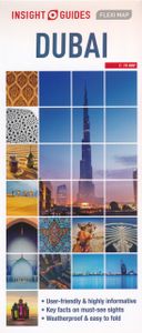
Geplastificeerde centrumkaart van Dubai, met register. Voor de 'gewone' toerist een handige kaart, geen groot formaat, overzichtelijk met alle belangrijke plaatsen goed weergegeven. Flexi Map Dubai is a laminated, tear-resistant map which includes 3 maps, each accompanied by separate indexes that are categorized for ease of use. The main map depict...
9,95

Webshops met dit product

Webshop
Bezorging
Prijs

Anderen bekeken ook

Wegenkaart - landkaart - Stadsplattegrond Fleximap Dubai | Insight Gui
Geplastificeerde centrumkaart van Dubai, met register. Voor de 'gewone' toerist een handige kaart, geen groot formaat, overzichtelijk met alle belangrijke plaatsen goed weergegeven. Flexi Map Dubai is a laminated, tear-resistant map which includes 3 maps, each accompanied by separate indexes that are categorized for ease of use. The main map depicts Central Dubai at a scale of 1:15 000 and identifies places of interest, public buildings, selected hotels, parks and shopping areas. Both main and minor roads are named, car parks and one-way systems are clearly shown. The Dubai area is shown  at a scale of 1:100 000, Main roads are named, and numbered where applicable, and the Metro system is clearly marked.  An overview map of the United Arab Emirates, at a scale of 1:1 million, shows the road network with intermediate driving distances. Points of interest are shown as well as other features, such as, water springs, coral reefs, shipwrecks and offshore oilfields.   Flexi Map Dubai also gi…
9,95
Wegenkaart - landkaart - Stadsplattegrond Fleximap Seoul | Insight Gui
Geplastificeerde stadskaart van Seoul, de hoofdstad van Zuid Korea. Goede overzichtelijke kaart met een grof overzicht van de hele stad en een gedetailleerde kaart van het centrumdeel. Fleximap Seoul is a laminated, tear-resistant map which includes 4 maps of Seoul and the surrounding area, each with individual indexes. The main map shows central Seoul at a scale of 1:14 000 on which places of interest are prominently highlighted. A map of the Seoul area is included on the reverse at a scale of 1: 110 000 together with overview maps of South Korea and Korea & Japan. The public transport network is shown on the back cover.   In addition to the mapping, Fleximap Seoul also gives a list - with des...criptions and some photographs - of 23 recommended sights, divided by theme and linked to the mapping by numbered markers. There is also a handy information section with concise details on getting around, tourist offices, money, tipping, opening times, public holidays, telecommunications, emer…
9,95
Stadsplattegrond Fleximap Copenhagen - Kopenhagen | Insight Guides
Geplastificeerde kaart van Kopenhagen, met register. Voor de 'gewone' toerist een handige kaart, geen groot formaat, overzichtelijk met alle belangrijke plaatsen goed weergegeven.   Flexi Map Copenhagen is a laminated, tear-resistant map which has 3 maps, each accompanied by its own index.  It includes a list - with descriptions and some photographs - of 23 recommended sights, divided by theme and linked to the mapping by numbered markers. There is also a handy information section with concise details on getting around, tourist offices, money, tipping, opening times, public holidays, telecommunications, emergency telephone numbers and climate.   On the main map, shown at a scale of 1:11,000 (1cm = 0.110km), streets are named and a selection of hotels, public buildings and key sights are prominently marked, pedestrian areas and one-way systems are also shown. The comprehensive index is divided into categories for ease of use. A detailed Metro plan is located on the back cover for easy …
9,95
Wegenkaart - landkaart - Stadsplattegrond Fleximap Shanghai | Insight
Geplastificeerde centrumkaart van Shanghai, met register. Voor de 'gewone' toerist een handige kaart, geen groot formaat, overzichtelijk met alle belangrijke plaatsen goed weergegeven.   Flexi Map Shanghai is laminated, tear-resistant comprising 2 separate maps featuring the city and its surroundings; each map has its own index which has been categorised for ease of use.    It includes a list - with descriptions and some photographs - of 37 recommended sights, divided by theme and linked to the mapping by numbered markers. There is also a handy information section with concise details on getting around, tourist offices, money, tipping, opening times, public holidays, telecommunications, emergency tel...ephone numbers and climate.   On one side is a street plan of the city's central districts at a scale of 1:18 500 (1cm = 0.18km). One way streets, car parks, train and metro routes are clearly shown, in addition a Metro map is located on the back cover for easy reference. Many promi…
9,95
Stadsplattegrond - Wegenkaart - landkaart Fleximap Prague - Praag | In
Geplastificeerde kaart van Praag, met register. Voor de 'gewone' toerist een handige kaart, geen groot formaat, overzichtelijk met alle belangrijke plaatsen goed weergegeven.   Flexi Map Prague is a laminated, tear-resistant map which includes 3 maps, each accompanied by separate indexes. The main map depicts Prague at a scale of 1:12 500, the index has been categorized for ease of use. Streets are named along with public buildings and selected hotels.   A Prague Environs map can be found on the reverse and this shows the various routes into the city. A detailed Metro plan is located on the back cover for easy reference.   Also included is a map of western Czech Republic which is depicted at a scale of 1:900 000, in addition to the road and rail networks, this map provides a detailed picture of the topography through the use of relief shading with gradients given for steep ascents.    Flexi Map Prague also gives a list - with descriptions and some photographs - of 21 recommended sight…
9,95
Wegenkaart - landkaart - Stadsplattegrond Fleximap Hong Kong | Insight
Geplastificeerde stadskaart van Hong Kong. Goede overzichtelijke kaart met een grof overzicht van de hele stad en een gedetailleerde kaart van het centrumdeel. Flexi Map Hong Kong is much more than just a laminated map. The Tourist Information section includes detailed descriptions and some stunning photographs of a carefully selected number of recommended sights, these sights are linked to the mapping by easy to find numbered markers. There is also an abundance of helpful information on getting around, tipping, opening times, public holidays, emergency telephone numbers and much more.    The comprehensive index has been divided into different categories to make locatin...g places as easy as possible. The laminated, tear-resistant finish is tough, weatherproof and can be written on using a non-permanent marker.   The main map shows Hong Kong at a scale of 1:130 000 (1cm = 1.3km) and clearly shows the region's road network and ferry routes.    On the reverse is a map of the New T…
9,95

Klanten-reviews van Wegenkaart - landkaart - Stadsplattegrond Fleximap Dubai | Insight Gui

Er zijn nog geen beoordelingen voor dit productBen jij de eerste die een review plaatst?

Meer over Wegenkaart - landkaart - Stadsplattegrond Fleximap Dubai | Insight Gui

Productomschrijving

Geplastificeerde centrumkaart van Dubai, met register. Voor de 'gewone' toerist een handige kaart, geen groot formaat, overzichtelijk met alle belangrijke plaatsen goed weergegeven. Flexi Map Dubai is a laminated, tear-resistant map which includes 3 maps, each accompanied by separate indexes that are categorized for ease of use. The main map depicts Central Dubai at a scale of 1:15 000 and identifies places of interest, public buildings, selected hotels, parks and shopping areas. Both main and minor roads are named, car parks and one-way systems are clearly shown. The Dubai area is shown  at a scale of 1:100 000, Main roads are named, and numbered where applicable, and the Metro system is clearly marked.  An overview map of the United Arab Emirates, at a scale of 1:1 million, shows the road network with intermediate driving distances. Points of interest are shown as well as other features, such as, water springs, coral reefs, shipwrecks and offshore oilfields.   Flexi Map Dubai also gives a list - with descriptions and some photographs - of 24 recommended sights, divided by theme and linked to the mapping by numbered markers. There is also a handy information section with concise details on getting around, tourist offices, money, tipping, opening times, public holidays, telecommunications, emergency telephone numbers and climate.

Productspecificaties

Artikelnummer(s)
Brand
Insight Guides
Shopblog.nl maakt gebruik van cookies. Ga je verder op onze website, ga dan akkoord met het plaatsen van cookies en de verwerking van deze data door ons en vermelde partners.