shopblog.nl
Categorieën
  Sluiten

Meer ITMB
Meer ITMB in Literatuur boeken

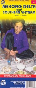
Wegenkaart - landkaart Mekong Delta & Southern Vietnam | ITMB

Een degelijke kaart met aanduidingen van o.a. nationale parken, vliegveld, benzinepomp en dirt-roads. Als overzichtskaart goed te gebruiken. Double-sided indexed map with street plans of central Ho Chi Min City, Da Lat and Can Tho. The main map at 1:800,000 shows the area’s road and rail networks and local airports. The Ho Chi Minh Trail is highlig...
13,95

Webshops met dit product

Webshop
Bezorging
Prijs

Anderen bekeken ook

Wegenkaart - landkaart Mekong Delta & Southern Vietnam | ITMB
Een degelijke kaart met aanduidingen van o.a. nationale parken, vliegveld, benzinepomp en dirt-roads. Als overzichtskaart goed te gebruiken. Double-sided indexed map with street plans of central Ho Chi Min City, Da Lat and Can Tho. The main map at 1:800,000 shows the area’s road and rail networks and local airports. The Ho Chi Minh Trail is highlighted, as are national parks, nature reserves, beaches, numerous places of interest, fuel supplies, etc. Provincial boundaries are marked and names of administrative regions prominently shown. Topography is indicated by altitude colouring. Latitude and longitude lines are drawn at 30’ intervals. On the reverse, the Mekong Delta is shown in greater detail at 1:500,000 with many small waterways. The map also includes street plans of central Ho Chi Minh City, Can Tho and Da Lat, annotated with symbols showing accommodation, various facilities and places of interest. Further insets show Phu Quoc Island at 1:200,000 and, for travelers venturing fur…
13,95
Wegenkaart - landkaart Vietnam - Laos - Cambodia | ITMB
Een degelijke kaart met aanduidingen van o.a. nationale parken, vliegveld, benzinepomp, dirt-roads. Als overzichtskaart goed te gebruiken. The former French-dominated region of Indochina evolved into three separate countries in the early 1950s. Vietnam, Laos, and Cambodia still retain strong ties and it is easy to travel from one country to another. Each has its particular charm, with a Top Attractions list highlighting the most popular attractions. Side 1 concentrates on the southern portion of the region and includes an inset map of Ho Chi Minh City; the second side covers the area from Sien Riep in Cambodia to the Chinese border areas of both Laos and Vietnam. An inset map of Hanoi is one this side. The region is prospering after many years of civil unrest, is friendly, safe, and easy to reach since Covid restrictions were removed last year. The new Chinese-built rail line through northern Laos to Chiang Kong in Thailand, and to Vientiane, Laos, is shown for the first time. This lin…
13,95
Wegenkaart - landkaart 770 Vietnam - Laos - Cambodja | Michelin
Zoals je van Michelin mag verwachten is deze kaart zeer overzichtelijk en heeft een duidelijk helder kaartbeeld. De kaart geeft uitgebreide toeristische informatie weer. De perfecte overzichtskaart!   This Vietnam - Laos - Cambodia map from Michelin is part of their red national map series. These are perfect for route planning as well as getting around by car once you're there. They clearly mark out major roads and also show many of the more important minor roads. A street plan of central Lima that highlights the city's mai attractions is included.   The map's simple folding design with durable paper cover, allows it to be read like a book and easily folded back together. Road numbers and intermediate distances are clearly displayed with the more scenic routes highlighted in green.   The map also features:   Political boundaries Regional and National Parks Important sights (points of interest, historic sites, etc.) Driving Times and Distances Road Safety Information A legend in multipl…
12,95
Wegenkaart - landkaart Peru | ITMB
Een degelijke kaart met aanduidingen van o.a. nationale parken, vliegveld, dirt-roads en kleine plattegrond van hoofdstad. Als overzichtskaart goed te gebruiken. Peru at 1:1,500,000 on a double-sided, waterproof and tear-resistant, indexed map from ITMB, with large, clear street plans of central Lima and Cusco, highlighting accommodation, places of interest and various facilities. The map divides the country north/south, approximately along the line between the Cordillera Blanca and Cordillera Huyahuash, with very little overlap between the two sides. Topography is very effectively presented by altitude colouring, with spot heights and additional graphics for swamps and marshland, glaciers and volcanos. The map shows the country’s road network distinguishing between all-weather and seasonable roads and indicates driving distances on main routes. Railway lines, including the popular routes linking Cusco with Puno and Arequipa, are very clearly shown. The map also shows local airports an…
13,95
Wegenatlas Travel Atlas Thailand, Vietnam, Laos & Cambodia | ITMB
Atlas, gebonden, A5 formaat The Indochina Region consists of five countries, including that portion of Burma that sweeps down the western part of the Malay Peninsula. The four other countries form a cohesive entity for travel, especially now that border and visa requirements for travel have been reduced. Thailand itself is definitely the Number One reason for visiting the region. The first portion of the atlas is devoted to Thailand, including detailed page-size maps of Bangkok, Chiang Mai, and Pattaya. Vietnam is the next most-popular destination and is shown in great detail, with inset maps of Hanoi, Hoi An, Hue, Da Nang, Da Lat, Can Tho, and the central Saigon portion of Ho Chi Minh City. Laos and Cambodia are shown with the same degree of attention to detail, including insets of Vientiane, Phnom Penh, and two maps concentrating on Angkor Wat. This is a compact and convenient way for visitors to the region to have everything they need in one format - easy to catty, easy to use Legen…
16,50
Wegenkaart - landkaart Ethiopia Ethiopië - Eritrea | ITMB
Een degelijke kaart met aanduidingen van o.a. nationale parken, vliegveld, benzinepomp, dirt-roads en kleine plattegrond van hoofdstad. Als overzichtskaart goed te gebruiken. This is the latest updating of one of the most interesting countries in Africa. There isn’t anything brilliantly innovative to report. We have tidied up the different layers of the artwork, have updated the road system, and have added more tourist information. We have also modernized the cover design and changed the ISBN – printed on paper, single-sided, inset map of Addis Ababa. Legend Includes: roads by classification, Airports, Ports, Gasolines, Polices, Post Offices, Bus Stations, Hospitals, Schools, Universities, Buildings, Point of Interests, Bridges, Lodgings, Campsites or Huts, Museums, and many more   Double-sided map from ITMB presenting on one side a road map of Ethiopia at 1:2,000,000 accompanied by a street plan of Addis Ababa, with on the reverse Eritrea at 1:900,000 with a plan of Asmara. Both road…
13,95
Wegenkaart - landkaart Planning Map Vietnam | Lonely Planet
From Lonely Planet, the world's leading travel guide publisher Durable and waterproof, with a handy slipcase and easy-fold format, Lonely Planet's Vietnam Planning Map helps you get around with ease. Get more from your map and your trip with images and information about top country attractions, itinerary suggestions, a transport guide, planning information, themed lists and practical travel tips. With this easy-to-use, full-colour map in your back pocket, you can truly get to the heart of Vietnam. Durable and waterproof Easy-fold format and convenient size Handy slipcase Full colour and easy to use Before-you-go info Beautiful imagery Tailored itineraries Can't-miss regional highlights Detailed town index Transport planner Themed lists Covers Hanoi, Halong Bay, Ha Giang Province, Sapa, Hoi An, Phong Nha-Ke Bang National Park, Hue, DMZ, Con Dao Islands, Mui Ne, Bai Xep, Ho Chi Minh City, Cu Chi, Cat Tien National Park, Dalat, Kon Tum, Phu Quoc Island, Can Tho, Sam Mounta…
10,95

Klanten-reviews van Wegenkaart - landkaart Mekong Delta & Southern Vietnam | ITMB

Er zijn nog geen beoordelingen voor dit productBen jij de eerste die een review plaatst?

Meer over Wegenkaart - landkaart Mekong Delta & Southern Vietnam | ITMB

Productomschrijving

Een degelijke kaart met aanduidingen van o.a. nationale parken, vliegveld, benzinepomp en dirt-roads. Als overzichtskaart goed te gebruiken. Double-sided indexed map with street plans of central Ho Chi Min City, Da Lat and Can Tho. The main map at 1:800,000 shows the area’s road and rail networks and local airports. The Ho Chi Minh Trail is highlighted, as are national parks, nature reserves, beaches, numerous places of interest, fuel supplies, etc. Provincial boundaries are marked and names of administrative regions prominently shown. Topography is indicated by altitude colouring. Latitude and longitude lines are drawn at 30’ intervals. On the reverse, the Mekong Delta is shown in greater detail at 1:500,000 with many small waterways. The map also includes street plans of central Ho Chi Minh City, Can Tho and Da Lat, annotated with symbols showing accommodation, various facilities and places of interest. Further insets show Phu Quoc Island at 1:200,000 and, for travelers venturing further north, the environs of Hue at 1:250,000. All place names are shown in the Roman alphabet but with scrupulous transliteration, since the map was prepared by a company with strong Vietnamese connections and a number of local cartographers.

Productspecificaties

Artikelnummer(s)
Brand
ITMB

Verken gerelateerde categorieën

Shopblog.nl maakt gebruik van cookies. Ga je verder op onze website, ga dan akkoord met het plaatsen van cookies en de verwerking van deze data door ons en vermelde partners.