shopblog.nl
Categorieën
  Sluiten

Meer Freytag & Berndt
Meer Freytag & Berndt in Reisgidsen & talen boeken

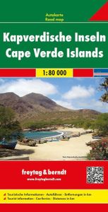
Wegenkaart - landkaart Kaapverdische Eilanden - Cabo Verde | Freytag &

Uitstekende kaart van alle Kaapverdische eilanden met sommigen op een zodanige schaal dat er ook mee gewandeld kan worden. Cape Verde Islands on a large double-sided map from Freytag & Berndt, with the larger islands shown both individually and in groups with the surrounding islands, all presented at a convenient scales and with tourist information...
14,95

Webshops met dit product

Webshop
Bezorging
Prijs

Anderen bekeken ook

Wegenkaart - landkaart Kaapverdische Eilanden - Cabo Verde | Freytag &
Uitstekende kaart van alle Kaapverdische eilanden met sommigen op een zodanige schaal dat er ook mee gewandeld kan worden. Cape Verde Islands on a large double-sided map from Freytag & Berndt, with the larger islands shown both individually and in groups with the surrounding islands, all presented at a convenient scales and with tourist information. Relief shading and spot heights indicate the topography, with roads clearly marked and icons highlighting main ports, ferries, archaeological sights and other places of interest. A general map of the whole Cape Verde archipelago shows frequency of ferry connections between various islands. Latitude and longitude lines are shown on all island maps. Multilingual map legend includes English. Larger islands at 1:80,000 Fogo; Santiago; Santo Antão; Sao Nicolau; São Vicente; Brava (at 1;30,000). Maps of groups at 1:150,000: Boavista and Sal; Santo Antão, Sao Vicente, Santa Luzia, Ilheu Braco, Ilheu Razo, and São Nicolau; Santiago and Maio; Fogo a…
14,95
Reisgids Cabo Verde Kapverdische Inseln - Kaapverdische Eilanden | Rei
Uitstekende - meest uitgebreide - reisgids van de Kaapverdische Eilanden. Hoge kwaliteit, veel kaartjes en praktische informatie. Duits, 612 (!) bladzijden. Die neun Kapverdischen Inseln Sal, Boa Vista, Maio, Santiago, Fogo, Brava, São Vicente, Santo Antão und São Nicolau begeistern Reisende mit ihrer Vielfalt. Jede der Inseln, 570 Kilometer vor der Westküste Afrikas gelegen, ist eine kleine Welt für sich. Sie bieten faszinierende Landschaften wie Berge, Schluchten, Wüsten und grüne Täler, weite Strände und kleine Buchten. Die kreolische Kultur ist abwechslungsreich und lebendig, die Kapverdianer sind bekannt für ihre kosmopolitische Offenheit.   Folgen Sie den Autoren an die kilometerlangen hellen Sandstrände und den Hafenort Palmeira auf Sal, tauchen Sie durch die reiche Unterwasserfauna auf Boa Vista, wandern Sie abseits der Touristenzentren auf Maio oder durch 500 Jahre alte Kulturlandschaften auf Fogo. Genießen Sie den Trubel der Hauptstadt Praia auf Santiago und die Architektur d…
26,95
Wandelkaart - Wegenkaart - landkaart Liparische eilanden | Freytag & B
Gedetailleerde wegenkaart en wandelkaart (géén wandelroutes ingetekend!) met uitgebreide legenda en plaatsnamenregister. Meer wegenkaart dan wandelkaart. Aeolian (Lipari) Islands at 1:20,000 from Freytag & Berndt on a double-sided map which presents on the reverse coverage of Italy south of Rome at 1:600,000 and shows ferry access to the islands from the mainland or Sicily.   On one side the islands are shown in a series of panels, with the three largest: Salina, Lipari and Vulcano together, and Alicudi, Filicudi, Panarea and Basiluzzo plus Stromboli as separate insets. Topography is shown by contours at 50m intervals enhanced by relief shading, with names of peaks, valleys, etc. All place names are in large, easy to read print.   Road network includes country tracks and a selection of hiking paths. Various places of interest and facilities are highlighted, including beaches, marinas, campsites, etc. Each individual inset has latitude and longitude lines at intervals of 1’.   Ferry por…
14,95
Wegenkaart - landkaart Virgin Islands - Maagden eilanden | Borch
The soft-laminated map of the Virgin Islands includes: US Virgin Islands 1:80 000, St. Croix 1:80 000, Charlotte Amalie 1:15 000, Charlotte Amalie Historic District 1:7 500, Cruz Bay 1:15 000, Christiansted, Frederiksted 1:15 000, British Virgin Islands 1:80 000, Anegada 1:80 000, Road Town, The Valley (Spanish Town) 1:15 000, Lesser Antilles 1:7 000 000, Virgin Islands administrative / time zones; interesting statistics British / US Virgin Islands: conversion chart for temperatures, weights and measures; climate chart with temperatures, sunshine hours, precipitation and humidity; hotels, museums, markets and much more.   Virgin Islands is the name of two groups of small islands east of Puerto Rico which form the Virgin Islands archipelago. They lie between the Caribbean Sea and the Atlantic Ocean. One of the groups which consists of St. Croix, St. John and St. Thomas islands, together with many nearby islets, is called the U.S. Virgin Islands. The other group including Anegada, Jost v…
11,50
Wegenkaart - landkaart Kaapverdische Eilanden - Cabo Verde | Reise Kno
Tweetalige kaart (Engels en Duits). Door ingetekende lengte- en breedtegraden is het gebruik van GPS mogelijk. Met hoogtelijnen en uitgebreid wegennetwerk: daarnaast worden ook de afstanden tussen belangrijke plaatsen duidelijk leesbaar weergegeven. Het kleurgebruik is zodanig dat je een goede indruk krijgt van hoogteverschillen en soorten landschap. Natuurlijk staan de toeristische bezienswaardigheden duidelijk vermeld: 6 deelkaarten voor de verschillende eilanden, 1 overzichtskaart.   Gedrukt op water- en scheurvast papier! Polyart is een synthetisch product vrij van giftige stoffen dus duurzaam. Het papier gaat echt lang mee.   Topography is indicated by altitude colouring with numerous spot heights and names of mountain ranges and passes. Salt lakes, swamps, seasonal rivers and glacier are also shown. Detailed presentation of the road network includes minor roads and tracks and railways are also shown.   Internal administrative units are presented with their boundaries and names. N…
15,50
Reisgids Cape Verde - Kaapverdische Eilanden | Marco Polo
Handige en overzichtelijke, kleine reisgids voor een eerste kennismaking met de vakantiebestemming. Globale uitklapkaart achterin, makkelijk binnenzakformaat. Let Marco Polo Cape Verde guide you around this beautiful country. Explore Cape Verde with this handy, pocket-sized, authoritative guide, packed with Insider Tips. Discover boutique hotels, authentic restaurants, the islands' trendiest places, and get tips on shopping and what to do on a limited budget. There are plenty of ideas for travel with kids, and a summary of all the festivals and events that take place. Cape Verde is all about colour: the turquoise ocean, lush tropical valleys, beaches of black and white sand, the bright yellow of the bananas, the orange-coloured papayas, green heads of cabbage and red peppers. Colourful fishing boats lie on the white sandy beaches, the deep blue ocean glitters as far as the eye can see, a gentle breeze cools off the scorching sun. Let Marco Polo Cape Verde guide show you all this wonde…
13,95
Wandelkaart - Wegenkaart - landkaart Liparische eilanden | Freytag & B
Gedetailleerde wegenkaart en wandelkaart (géén wandelroutes ingetekend!) met uitgebreide legenda en plaatsnamenregister. Meer wegenkaart dan wandelkaart. Aeolian (Lipari) Islands at 1:20,000 from Freytag & Berndt on a double-sided map which presents on the reverse coverage of Italy south of Rome at 1:600,000 and shows ferry access to the islands from the mainland or Sicily.   On one side the islands are shown in a series of panels, with the three largest: Salina, Lipari and Vulcano together, and Alicudi, Filicudi, Panarea and Basiluzzo plus Stromboli as separate insets. Topography is shown by contours at 50m intervals enhanced by relief shading, with names of peaks, valleys, etc. All place names are in large, easy to read print.   Road network includes country tracks and a selection of hiking paths. Various places of interest and facilities are highlighted, including beaches, marinas, campsites, etc. Each individual inset has latitude and longitude lines at intervals of 1’.   Ferry por…
14,95
Reisgids Reise-Taschenbuch Kapverdische Inseln | Cabo Verde | Dumont
Fraai ogende gids, handzaam formaat en toch uitgebreid over de Kaapverdische Eilanden. Deze serie reisgidsen zijn algemene reisgidsen en bevatten een brede selectie aan bezienswaardigheden, excursies, achtergronden, praktische tips en een uitneembare kaart. Über das Buch Reif für die Insel? Aber für welche? Jede der Kapverden-Inseln ist ein eigener Kosmos in der Einsamkeit des Atlantiks. Überall gibt es Orte mit marode- kolonialem Charme, aus der Zeit gefallene Dörfer, bunte Märkte und herzliche Einheimische, die nicht nur bei ihrer Ouril-Passion zu Meistern der Muße werden. Jede Insel versprüht ein ganz eigenes Ambiente, das die Autoren Susanne Lipps und Oliver Breda auf zahlreichen Touren und Lieblingsorten einfangen. Mal sattgrün, mal karg und fast immer steil ragt das Wanderparadies Santo Antão empor, wo ein Original zur Vesper bittet und eine Wanderführerin die Schönheit der Landschaft besingt. Höchsten Genuss verspricht auch das gebirgige São Nicolau, wo der archipelweit größte D…
21,95

Klanten-reviews van Wegenkaart - landkaart Kaapverdische Eilanden - Cabo Verde | Freytag &

Er zijn nog geen beoordelingen voor dit productBen jij de eerste die een review plaatst?

Meer over Wegenkaart - landkaart Kaapverdische Eilanden - Cabo Verde | Freytag &

Productomschrijving

Uitstekende kaart van alle Kaapverdische eilanden met sommigen op een zodanige schaal dat er ook mee gewandeld kan worden. Cape Verde Islands on a large double-sided map from Freytag & Berndt, with the larger islands shown both individually and in groups with the surrounding islands, all presented at a convenient scales and with tourist information. Relief shading and spot heights indicate the topography, with roads clearly marked and icons highlighting main ports, ferries, archaeological sights and other places of interest. A general map of the whole Cape Verde archipelago shows frequency of ferry connections between various islands. Latitude and longitude lines are shown on all island maps. Multilingual map legend includes English. Larger islands at 1:80,000 Fogo; Santiago; Santo Antão; Sao Nicolau; São Vicente; Brava (at 1;30,000). Maps of groups at 1:150,000: Boavista and Sal; Santo Antão, Sao Vicente, Santa Luzia, Ilheu Braco, Ilheu Razo, and São Nicolau; Santiago and Maio; Fogo and Brava.

Productspecificaties

Artikelnummer(s)
Brand
Freytag & Berndt

Verken gerelateerde categorieën

Shopblog.nl maakt gebruik van cookies. Ga je verder op onze website, ga dan akkoord met het plaatsen van cookies en de verwerking van deze data door ons en vermelde partners.