shopblog.nl
Categorieën
  Sluiten

Meer MapStudio

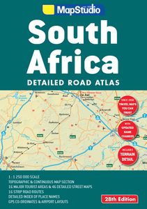
Wegenatlas South Africa - Zuid-Afrika | MapStudio

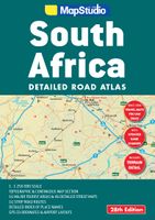
Goede wegenatlas met register en andere handige zaken. Grote toegevoegde waarde zit hem in de stadsplattegronden en detailkaarten van toeristische gebieden. • Updated Place name changes • Includes satellite towns • Terrain detail (topography) • GPS co-ordinates at major road junctions • 34 page continuous map section • Scale of 1 : 1 250 0...
19,95

Webshops met dit product

Webshop
Bezorging
Prijs

Anderen bekeken ook

Wegenatlas South Africa - Zuid-Afrika | MapStudio
Goede wegenatlas met register en andere handige zaken. Grote toegevoegde waarde zit hem in de stadsplattegronden en detailkaarten van toeristische gebieden. • Updated Place name changes • Includes satellite towns • Terrain detail (topography) • GPS co-ordinates at major road junctions • 34 page continuous map section • Scale of 1 : 1 250 000   • Tourist Regions, 16 detailed maps covering: Cape Peninsula, South-Western Cape, Overberg, Garden Route, Eastern Cape, Kwa-Zulu Natal coastline, Drakensburg, Midlands Meander, Kwa-Zulu Natal Battlefields, St. Lucia (iSimangaliso), uMfolozi Hluhluwe region, Gauteng Region, Magaliesburg, Sun City, Pilanesberg & Kruger National Park.   • 46 detailed Street Maps of: Bhisho, Bloemfontein, Cape Town, Durban, East London, George, Gqeberha (Port Elizabeth), Hartbeespoort, Johannesburg ‘ring road’ & Central, Kimberly, Klerksdorp, Knysna, Kroonstad, Ladysmith, Langebaan, Mafikeng, Makhanda (Grahamstown), Margate, Midrand, Mossel Bay, Mthat…
19,95
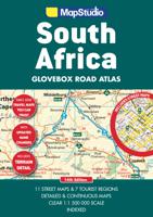
Wegenatlas Glovebox South Africa - Zuid-Afrika | A5-Formaat | Ringband
Handzame pocket atlas, A5 formaat, voor Zuid Afrika. Schaal 1 op 1.500.000 en in handige ringband.   This wiro bound Road Atlas South Africa Glovebox is a revised and updated compact atlas.   It includes: Detailed and continuous map section Highlights seven major tourist areas Features eleven street maps Freeways National roads Route numbers Nature reserves and parks Places of interest Tourist information Index to place names and GPS co-ordinates   This edition also features GPS co-ordinates at main interchanges.   COVERAGE: Includes a detailed map of South Africa at a scale of 1 : 1 500 000. The 7 major tourist areas of the Cape Peninsula, South Western Cape and Overberg Region, Garden Route, Gauteng, Kruger National Park, Drakensberg and Kwazulu-Natal coast. The 11 street maps are of Pietermaritzburg, Durban, Nelspruit, Polokwane, Pretoria, Johannesburg, Bloemfontein, Kimberley, East London, Port Elizabeth and Cape Town.
18,95
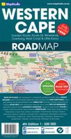
Wegenkaart - landkaart 10 Western Cape Road Map | MapStudio
Road map of the Western Cape Province with an enlargement for the Cape Peninsula and 27 street plans of the central areas in main towns. The map is annotated numerous places of interest, vineyards, etc. GPS coordinates are provides for main road junctions. This new edition Western Cape Road Map covers the whole of the Western Cape. It features easy-to-read full colour maps with GPS co-ordinates. The map provides tourist-friendly text, highlights places of interest and lists accommodation information. This map is perfect for scenic drives and includes information boxes on activities of interest.   Coverage includes the Garden Route & Route 62, South Western Cape, Winelands and Overberg, West Coast Flower Region and Little Karoo. The map features small detailed street plans of Cape Town CBD, Montagu, Barrydale, Ladismith, Oudtshoorn, Mossel Bay, Knysna, Plettenberg Bay, Humansdorp, George, Stellenbosch, Franschhoek, Paarl, Wellington, Hermanus, Swellendam, Robertson, Ceres, Tulbagh, Lang…
16,95
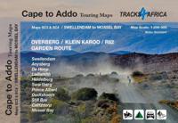
Wegenkaart - landkaart SC3&SC4 Swellendam to Mossel Bay | Tracks4Afric
The Cape to Addo map series covers the southern parts of the Western Cape of South Africa in a series of eight highly detailed maps, printed on four sheets of A1 durable paper.   We start in Cape Town in the west and move along the southern coast through the Overberg, Winelands, Garden Route, Klein Karoo R62, Baviaanskloof to eventually arrive in the Addo National Park up to Gqeberha (Port Elizabeth) in the east.   The maps are highly detailed and well researched. Our map scale is 1:200 000 which allows us to show a lot of detail including minor gravel roads, hiking trails, farm boundaries and points of interest which are relevant to self-drive tourists.   The size of the paper is kept small enough to allow this to be the perfect road tripping map. We use Duraflex paper and print two maps per sheet of A1 paper, making this a four-sheet series. Each map sheet is individually packed in a plastic protective sleeve.   The maps are perfect for day drives, overlanding or just doing road trip…
29,95
Wegenkaart - landkaart 3204 Adventure Map South Africa - Zuid Afrika |
Wegenkaart van Zuid Afrika met vermelding van veel bezienswaardigheden, nationale parken en attrakties. Watervast en scheurvast. Juist door deze vermeldingen onderscheidt de kaart zich van andere wegenkaarten. National Geographic’s South Africa Adventure Map is designed to meet the unique needs of adventure travelers—detailed, durable, and accurate. It includes the locations of thousands of major cities and towns with an index for easily locating them, plus a clearly marked road network complete with distances and designations for major highways, limited access highways, and more. Both paved and unpaved roads, tracks, and trails are marked for those adventurers who wish to explore less traveled routes.   What sets National Geographic Adventure Maps apart from traditional road maps are the hundreds of points-of-interest that highlight the diverse, unique, and exotic destinations within South Africa including national parks and reserves, sanctuaries, World Heritage sites, archeological s…
17,50
Reisgids South Africa | Eyewitness
Whether you're hoping to catch a glimpse of nature's most majestic animals, get an adrenaline fix scaling the heights of Table Mountain or simply soak up the summer sunshine with a glass of world-class wine, your DK Eyewitness travel guide makes sure you experience all that South Africa has to offer. Inside you'll also find a detailed guide to the country's animals, terrain and flora as well as information on local conservation efforts. From vibrant city life to abundant wildlife, rugged vistas to beautiful beaches, prehistoric paintings to cutting edge contemporary art, South Africa has it all.   This vast and varied country offers so many travel possibilities you'll be spoilt for choice. Our updated 2023 guide brings South Africa to life, transporting you there like no other travel guide does with expert-led insights, trusted travel advice, detailed breakdowns of all the must-see sights, photographs on practically every page, and our hand-drawn illustrations which place you inside th…
24,95
Wegenkaart - landkaart 3204 Adventure Map South Africa - Zuid Afrika |
Wegenkaart van Zuid Afrika met vermelding van veel bezienswaardigheden, nationale parken en attrakties. Watervast en scheurvast. Juist door deze vermeldingen onderscheidt de kaart zich van andere wegenkaarten. National Geographic’s South Africa Adventure Map is designed to meet the unique needs of adventure travelers—detailed, durable, and accurate. It includes the locations of thousands of major cities and towns with an index for easily locating them, plus a clearly marked road network complete with distances and designations for major highways, limited access highways, and more. Both paved and unpaved roads, tracks, and trails are marked for those adventurers who wish to explore less traveled routes.   What sets National Geographic Adventure Maps apart from traditional road maps are the hundreds of points-of-interest that highlight the diverse, unique, and exotic destinations within South Africa including national parks and reserves, sanctuaries, World Heritage sites, archeological s…
17,50

Klanten-reviews van Wegenatlas South Africa - Zuid-Afrika | MapStudio

Er zijn nog geen beoordelingen voor dit productBen jij de eerste die een review plaatst?

Meer over Wegenatlas South Africa - Zuid-Afrika | MapStudio

Productomschrijving

Goede wegenatlas met register en andere handige zaken. Grote toegevoegde waarde zit hem in de stadsplattegronden en detailkaarten van toeristische gebieden. • Updated Place name changes • Includes satellite towns • Terrain detail (topography) • GPS co-ordinates at major road junctions • 34 page continuous map section • Scale of 1 : 1 250 000   • Tourist Regions, 16 detailed maps covering: Cape Peninsula, South-Western Cape, Overberg, Garden Route, Eastern Cape, Kwa-Zulu Natal coastline, Drakensburg, Midlands Meander, Kwa-Zulu Natal Battlefields, St. Lucia (iSimangaliso), uMfolozi Hluhluwe region, Gauteng Region, Magaliesburg, Sun City, Pilanesberg & Kruger National Park.   • 46 detailed Street Maps of: Bhisho, Bloemfontein, Cape Town, Durban, East London, George, Gqeberha (Port Elizabeth), Hartbeespoort, Johannesburg ‘ring road’ & Central, Kimberly, Klerksdorp, Knysna, Kroonstad, Ladysmith, Langebaan, Mafikeng, Makhanda (Grahamstown), Margate, Midrand, Mossel Bay, Mthatha, Nelspruit, Oudtshoorn, Phalaborwa, Plettenberg Bay, Polokwane, Port Alfred, Potchefstroom, Pretoria, Richards Bay, Rosebank (Jhb), Rustenberg, Sandton (Jhb), Simonstown, Stellenbosch, Swellendam, Ulundi, Upington, Welkom, White River, Witbank (Emalahleni) & Worcester.   • 3 Airport layouts of O.R. Tambo, King Shaka and Cape Town • 16 accurate and easy-to-use strip planning maps

Productspecificaties

Artikelnummer(s)
Brand
MapStudio
Shopblog.nl maakt gebruik van cookies. Ga je verder op onze website, ga dan akkoord met het plaatsen van cookies en de verwerking van deze data door ons en vermelde partners.