shopblog.nl
Categorieën
  Sluiten

Meer Cicerone
Meer Cicerone in Reisgidsen & talen boeken

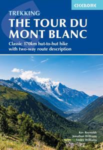
Wandelgids Trekking the Tour du Mont Blanc | Cicerone

Uitstekende wandelgids die in etappes de route nauwkeurig beschijft; ook de zijtakken en alternatieve routes koman aan bod. Kaarten zijn schetsmatig en in onze ogen onvoldoende bij slechte weersomstandigheden. Wij raden dan ook om er losse kaarten bij te kopen. A guidebook to hiking the Tour du Mont Blanc (TMB), a spectacular circuit around Mont B...
25,95

Webshops met dit product

Webshop
Bezorging
Prijs

Anderen bekeken ook

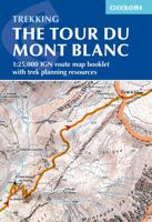
Wandelatlas Tour du Mont Blanc | Cicerone
A booklet of all the mapping needed to complete the Tour du Mont Blanc (TMB), a spectacular circuit around Mont Blanc, Western Europe's highest mountain. Covering 170km (105 miles), the TMB takes around 11 days to walk from its official start at Les Houches (France), passing through Courmayeur (Italy) and Champex (Switzerland) before returning to France via the Chamonix valley. A well-serviced introduction to high-level mountain trekking for walkers with good levels of fitness, it can also be run, fastpacked or hiked in 5–9 days.   The full route line is shown on 1:25,000 IGN maps The map booklet can be used to walk the TMB in either direction Handy facilities planner, route summary tables and accommodation listings help you plan your itinerary Includes urban maps of Les Houches, Les Contamines, Courmayeur, Champex and Chamonix Alternative stages via Col de Tricot (Stage 1A) and Fenêtre d'Arpette (Stage 8A) are also provided An accompanying Cicerone guidebook – Trekking the Tour du Mon…
21,95
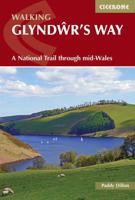
Wandelgids Glyndwr's Way - Wales | Cicerone
Een beschrijving van de Glyndwr's way, goede beschrijving met gedetailleerd kaartmateriaal..Ook praktische informatie en hoogteprofielen per etappe. Guidebook to walking Glyndwr's Way, a long-distance National Trail through mid-Wales. The 135 mile route from Knighton via Machynlleth to Welshpool takes 9 days to walk, and 2 days (29 miles) to complete the loop down the Offa's Dyke Path to create a circular trail. A lovely trail through quiet hills, forests and rolling countryside.   A complete guide to walking Glyndŵr's Way National Trail. This guidebook divides the 135 mile trail into nine day stages, starting at Knighton and ending at Welshpool. Days 10 and 11 follow the Offa's Dyke Path National Trail for those who prefer a circular route. The step-by-step route descriptions are accompanied by OS map extracts, photographs and lots of information on facilities available and historical points of interest along the way. Glyndŵr's Way is clearly waymarked throughout and there is accommod…
23,95
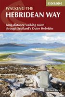
Wandelgids The Hebridean Way | Cicerone
Uitstekende wandelgids van de Hebridean Way, waarbij naast alle noodzakelijke informatie ook gebruik gemaakt wordt van de echte topografische kaart. Officially launched in 2017, the Hebridean Way offers walkers the opportunity to experience the magic of Scotland's Outer Hebrides in one inspirational journey. The waymarked route stretches 247km (155 miles) from Vatersay to Stornaway, linking ten major islands of the archipelago by means of causeways and two ferry crossings: Vatersay, Barra, Eriskay, South Uist, Benbecula, Grimsay, North Uist, Berneray, Harris and Lewis. Suitable for most walkers with a moderate level of fitness, it can be completed in 8-14 days and is rich in natural, historical and cultural interest.   This guidebook presents the Hebridean Way in 10 stages of 16-35km (10-22 miles), plus two additional stages to extend the route to the Butt of Lewis in line with future plans. Detailed route description is accompanied by 1:50,000 OS mapping, stunning photography to wh…
20,95
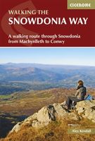
Wandelgids Snowdonia Way | Cicerone
Een beschrijving van de Snowdonia Way, goede beschrijving met gedetailleerd kaartmateriaal..Ook praktische informatie en hoogteprofielen per etappe.   This guidebook describes the Snowdonia Way in Wales, a long-distance route through Snowdonia National Park from Machynlleth to Conwy. A low-level route of 97 miles (in 6 stages of between 13 and 21 miles) passes through the heart of Snowdonia’s stunning mountain scenery and includes Pass of Aberglaslyn, Ogwen Valley and Aber Falls. It is suitable for walkers of average fitness and stamina, though days are long. An alternative mountain route covers 122 miles in 9 stages of 12–18 miles giving a spectacular journey over the most famous peaks such as Cadair Idris, Snowdon and Glyders. The high-level route is more physically challenging and requires good navigation skills. Full route descriptions for each stage are accompanied by OS maps and profiles. The guide also includes lists of accommodation and transport providers and a table of facili…
20,95
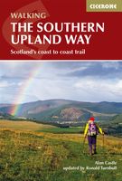
Wandelgids The Southern Upland Way | Cicerone
Uitstekende wandelgids van de Southern Upland Way, waarbij naast alle noodzakelijke informatie ook gebruik gemaakt wordt van de echte topografische kaart.   The Southern Upland Way is Scotland's coast-to-coast walk and the longest of the nation's Great Trails. 215 miles long, it links the pretty harbour village of Portpatrick on the west coast with Cockburnspath, a little south of Dunbar, in the east. The walk is at times a strenuous one, crossing the remote high moorland of the Galloway Hills, Carsphairn range, Lowthers, Ettrick Hills and Lammermuirs, calling for competence, fitness and self-reliance.    This guide presents advice on how best to plan and tackle this challenging but highly rewarding journey. The waymarked trail is presented in fourteen stages of 9–19 miles and suggestions for a rest day exploring Moffat and its environs are also included. It is possible either to backpack, taking advantage of five bothies and unlimited wild camping possibilities, or to stay in towns…
20,95
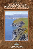
Wandelgids Wales: The Ceredigion and Snowdonia Coast Paths | Cicerone
As part of the Wales Coast Path, the Ceredigion Coast Path and Snowdonia Coast Path trace a curve of 233km (145 miles) of coastal and inland walking down Cardigan Bay. This guidebook describes a 16-stage guide to the walk from Porthmadog to St Dogmaels covering the trail between the Llyn Peninsula and the Pembrokeshire Coast Path. .In 16 day stages from Porthmadog to St Dogmaels, this guidebook offers all the information walkers need to complete the 233km (145 miles) section of the Wales Coast Path that curve down Cardigan Bay, passing through a range of contrasting landscapes.   Six days are spent on the Snowdonia Coast Path, two around the Dyfi Estuary, seven on the Ceredigion Coast Path and one from Cardigan to St Dogmaels.   Linking the Llyn Peninsula Coast Path with that of the Pembrokeshire Coastal Path, this section takes in Snowdonia National Park’s splendid coastal plains, leads inland through beautiful hill country around the Dyfi Estuary and follows some of the finest coastl…
18,50

Klanten-reviews van Wandelgids Trekking the Tour du Mont Blanc | Cicerone

Er zijn nog geen beoordelingen voor dit productBen jij de eerste die een review plaatst?

Meer over Wandelgids Trekking the Tour du Mont Blanc | Cicerone

Productomschrijving

Uitstekende wandelgids die in etappes de route nauwkeurig beschijft; ook de zijtakken en alternatieve routes koman aan bod. Kaarten zijn schetsmatig en in onze ogen onvoldoende bij slechte weersomstandigheden. Wij raden dan ook om er losse kaarten bij te kopen. A guidebook to hiking the Tour du Mont Blanc (TMB), a spectacular circuit around Mont Blanc, Western Europe's highest mountain. Covering 170km (105 miles), the TMB takes around 11 days to walk from its official start at Les Houches (France), passing through Courmayeur (Italy) and Champex (Switzerland) before returning to France via the Chamonix valley. A well-serviced introduction to high-level mountain trekking for walkers with good levels of fitness, it can also be run, fastpacked or hiked in 5–9 days.   The route is described in both directions in 11 daily stages between 7 and 21km (5–13 miles) in length. Variant routes and alternative stages are also provided, giving the option of visiting cols, refuges and viewpoints not included on the official TMB route.   Contains step-by-step description of the route alongside 1:100,000 maps Handy facilities planner, route summary tables and accommodation listings help you plan your itinerary Includes transport info, a French–English glossary, notes on local history and sites of interest An accompanying map booklet, containing 1:25,000 IGN mapping and route line, is available separately from Cicerone GPX files available to download

Productspecificaties

Artikelnummer(s)
Brand
Cicerone

Verken gerelateerde categorieën

Shopblog.nl maakt gebruik van cookies. Ga je verder op onze website, ga dan akkoord met het plaatsen van cookies en de verwerking van deze data door ons en vermelde partners.