shopblog.nl
Categorieën
  Sluiten

Meer Cicerone

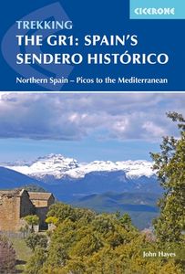
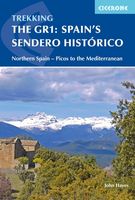
Wandelgids Spain's Sendero Historico: the GR1 | Cicerone

A step by step guide to walking the 1250km long Sendero Historico (the GR1) across northern Spain. Travelling from west to east, the GR1 starts at the Puerto de Tarna, on the border of Asturias and Castilla y Leon, heads east along the southern flank of the Cantabrian Mountains and the foothills of the Pyrenees before finishing on the Mediterranean...
26,50

Webshops met dit product

Webshop
Bezorging
Prijs

Anderen bekeken ook

Wandelgids Spain's Sendero Historico: the GR1 | Cicerone
A step by step guide to walking the 1250km long Sendero Historico (the GR1) across northern Spain. Travelling from west to east, the GR1 starts at the Puerto de Tarna, on the border of Asturias and Castilla y Leon, heads east along the southern flank of the Cantabrian Mountains and the foothills of the Pyrenees before finishing on the Mediterranean coast near L'Escala. Arguably one of Spain's best long-distance paths, it follows gently graded paths, making a long but easy walk suitable for a reasonably fit walker. The complete trail requires around 53 days to complete end to end, but the guidebook splits the route into 7 sections, each with a start or endpoint that can be easily reached by train or bus, allowing walkers to explore the route in manageable chunks. The guidebook also describes how to extend the route to Finisterre and the Atlantic using GR routes. As well as extensive notes on the history of modern Spain, from medieval times to more recent events such as the Civil War, th…
26,50
Wandelgids Trekking in the Stubaier Alps | Cicerone
Uitstekende wandelgids van Cicerone over de Stubaier Alpen, waarbij de nadruk ligt op een tweetal meerdaagse routes: Huttentochten voor een gemiddelde en wat meer gevorderde wandelaar. Goede praktische informatie, kaartmateriaal beperkt. Aanbevolen wandelkaarten bij deze gids Schaal 1:25.000 Wandelkaart 31/1 Alpenvereinskarte Stubaier Alpen - Hochstubai Wandelkaart 31/2 Alpenvereinskarte Stubaier Alpen - Sellrain Of schaal 1:50.000 Wandelkaart 83 Stubaier Alpen Kompass Of all the many Alpine areas, few can match the Stubai in the Austrian Tyrol as a venue for a first Alpine season. Shapely peaks, good paths and some of the best huts in the Alps make it ideal for the novice who wants to extend their experience beyond Britain. Of all the many Alpine areas, few can match the Stubai in the Austrian Tyrol as a venue for a first Alpine season. Shapely peaks, good paths and some of the best huts in the Alps make it ideal for the novice who wants to extend their experience beyond Britain. This…
21,95
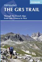
Wandelgids The GR5 Trail - The Alps | Cicerone
Engelsetalige wandelgids van het beroemde GR 5 pad in de Franse Alpen. Dezse gids beschrijft de gehele route van de GR 5 van het meer van Geneve tot aan Nice en de Middellandse zee. Goede beschrijvingen en informatie; kaartmateriaal is vrij beperkt. An essential guidebook for walking the GR5, one of the world's most spectacular long-distance trails. The GR5 makes its way through the Alps from the shores of Lac Léman at Geneva to the Mediterranean at Nice. A route of 674km (420 miles), it can be trekked in a month, or split over a series of summer trips. The GR5 is well within the reach of fit and moderately experienced walkers and backpackers. There is good signposting and waymarking, and accommodation, food and drink are all available at regular intervals. The paths and tracks are generally well graded, while steep climbs are tackled on zigzag paths, so the overall gradient is not so severe. Every summer, thousands of walkers embark on this trek.   This guidebook also describes some s…
26,95
Wandelgids Trekking in the Stubaier Alps | Cicerone
Uitstekende wandelgids van Cicerone over de Stubaier Alpen, waarbij de nadruk ligt op een tweetal meerdaagse routes: Huttentochten voor een gemiddelde en wat meer gevorderde wandelaar. Goede praktische informatie, kaartmateriaal beperkt. Aanbevolen wandelkaarten bij deze gids Schaal 1:25.000 Wandelkaart 31/1 Alpenvereinskarte Stubaier Alpen - Hochstubai Wandelkaart 31/2 Alpenvereinskarte Stubaier Alpen - Sellrain Of schaal 1:50.000 Wandelkaart 83 Stubaier Alpen Kompass Of all the many Alpine areas, few can match the Stubai in the Austrian Tyrol as a venue for a first Alpine season. Shapely peaks, good paths and some of the best huts in the Alps make it ideal for the novice who wants to extend their experience beyond Britain. Of all the many Alpine areas, few can match the Stubai in the Austrian Tyrol as a venue for a first Alpine season. Shapely peaks, good paths and some of the best huts in the Alps make it ideal for the novice who wants to extend their experience beyond Britain. This…
21,95
Wandelgids The Cleveland way and the Yorkshire Wolds way | Cicerone
Uitstekende wandelgids van de Cotswolds Way, waarbij naast alle noodzakelijke informatie ook gebruik gemaakt wordt van de echte topografische kaart. Inclusief gidsje met routekaarten van 1:25000 Guidebook to the Cleveland Way and Yorkshire Wolds Way National Trails, plus the Tabular Hills Walk link route. The guidebook also contains a 1:25,000 scale OS route map booklet of the Cleveland Way.   The Cleveland Way National Trail, described in seven day stages, is a fine 177km (110 miles) walk around the North York Moors National Park from Helmsley to Filey. The Yorkshire Wolds Way is one of the quietest of Britain's National Trails and wanders for 130km (80 miles) through gentle, cultivated and sparsely populated countryside. Described here in nine day stages, from Hessle near Redcar to Filey, it links end-to-end with the Cleveland Way on the coast. Also described is the three-day, 80km (50 mile) Tabular Hills Walk, a Regional Trail that allows walkers to close the loop of the Cleveland W…
25,95
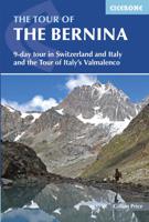
Wandelgids The Tour of the Bernina | Cicerone
Uitstekende wandelgids van een meerdaagse tocht in Zwitserland en Italië in het Bernina-gebied. Goede beschrijvingen, veel praktische informatie en redelijke kaarten al zullen deze niet helemaal voldoende zijn.   This guidebook explores two treks in the Bernina region of the Swiss-Italian Alps. The Tour of the Bernina is an 9-stage trek circling the Piz Bernina massif, 119km long and suitable for beginner trekkers. Also included in this guide is the 8-stage Alta Via Valmalenco just to the south of the Bernina. Although shorter, at 94km long, this is a more challenging route suitable for trekkers with more experience.   Whether skirting above St. Moritz and below snow-capped giants on the Tour of the Bernina, or climbing over wild, high passes and through isolated mountains in the Italian Valmalenco by Monte Disgrazia, the treks offer incredible experiences. Both feature spectacular peaks towering over snow fields and perfect alpine pastures, with accommodation in comfortable alpine gue…
24,50
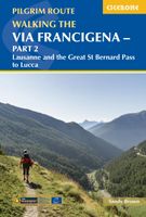
Wandelgids - Pelgrimsroute Via Francigena part 2 | Cicerone
Guidebook to the Via Francigena pilgrim route from Lausanne to Lucca. Starting at Lake Geneva (Lac Léman), the 725km route crosses the Alps at historic Great Saint Bernard Pass, descends the Po Valley, then climbs to cross the Cisa Pass into Tuscany. Described in 32 stages, with information on facilities and pilgrim hostels.   Seasons Suitable for walking in spring, summer and autumn. The Great Saint Bernard Pass is fully open to hikers only in August and September.   Centres Lausanne, Martigny, Great Saint Bernard Pass, Aosta, Ivrea, Vercelli, Pavia, Piacenza, Pontremoli, Pietrasanta, Lucca.   Difficulty Each stage is graded for difficulty (1-4). A few mountainous stages include steep and slippery slopes. No special gear is required to walk the Via Francigena in season, but off-season crossings of the Great Saint Bernard Pass require winter mountain gear and careful attention to changing mountain conditions.   Must See Dazzling Lake Geneva, the 1500-year-old Abbey of Saint…
22,95
Wandelgids Trekking in the Apennines - Apennijnen | Cicerone
Uitstekende wandelgids die in etappes de route nauwkeurig beschijft; ook de zijtakken en alternatieve routes koman aan bod. Kaarten zijn schetsmatig en in onze ogen onvoldoende bij slechte weersomstandigheden. Wij raden dan ook om er losse kaarten bij te kopen, voor zover verkrijgbaar! Guidebook to the Grand Apennines Trek, or Grande Escursione Appenninica (GEA). Through Tuscany and Emilia-Romagna and two National Parks, this 400km, 23 day trail explores the mountains, forests and hills of central Italy. Suitable for a range of walkers, it can be split into shorter sections or day walks if needed. This guidebook describes the Grande Escursione Appenninica (GEA), a nearly 400km long, three week trek crossing the Appenines in 23 stages, from Bocca Trabaria to Passo Due Santi on the edge of Liguria. The route dips in and out of Tuscany and Emilia-Romagna, never dropping below 400 metres. Best walked between spring and autumn, it is suitable for any reasonably fit walker. Highlights includ…
22,95
Wandelgids - Pelgrimsroute Via Francigena part 2 | Cicerone
Guidebook to the Via Francigena pilgrim route from Lausanne to Lucca. Starting at Lake Geneva (Lac Léman), the 725km route crosses the Alps at historic Great Saint Bernard Pass, descends the Po Valley, then climbs to cross the Cisa Pass into Tuscany. Described in 32 stages, with information on facilities and pilgrim hostels.   Seasons Suitable for walking in spring, summer and autumn. The Great Saint Bernard Pass is fully open to hikers only in August and September.   Centres Lausanne, Martigny, Great Saint Bernard Pass, Aosta, Ivrea, Vercelli, Pavia, Piacenza, Pontremoli, Pietrasanta, Lucca.   Difficulty Each stage is graded for difficulty (1-4). A few mountainous stages include steep and slippery slopes. No special gear is required to walk the Via Francigena in season, but off-season crossings of the Great Saint Bernard Pass require winter mountain gear and careful attention to changing mountain conditions.   Must See Dazzling Lake Geneva, the 1500-year-old Abbey of Saint…
22,95

Klanten-reviews van Wandelgids Spain's Sendero Historico: the GR1 | Cicerone

Er zijn nog geen beoordelingen voor dit productBen jij de eerste die een review plaatst?

Meer over Wandelgids Spain's Sendero Historico: the GR1 | Cicerone

Productomschrijving

A step by step guide to walking the 1250km long Sendero Historico (the GR1) across northern Spain. Travelling from west to east, the GR1 starts at the Puerto de Tarna, on the border of Asturias and Castilla y Leon, heads east along the southern flank of the Cantabrian Mountains and the foothills of the Pyrenees before finishing on the Mediterranean coast near L'Escala. Arguably one of Spain's best long-distance paths, it follows gently graded paths, making a long but easy walk suitable for a reasonably fit walker. The complete trail requires around 53 days to complete end to end, but the guidebook splits the route into 7 sections, each with a start or endpoint that can be easily reached by train or bus, allowing walkers to explore the route in manageable chunks. The guidebook also describes how to extend the route to Finisterre and the Atlantic using GR routes. As well as extensive notes on the history of modern Spain, from medieval times to more recent events such as the Civil War, there is a wealth of advice on planning the walk, accommodation, transport, and equipment. Detailed mapping accompanies the description of the trek, along with useful information about the towns and villages passed along the way." Dorpen en Steden Reinosa, Vitoria, Olite, Murillo de Gállego, Graus and Gironella Etappes 1 Puerto de Tarna to Reinosa Stage 1 Puerto de Tarna to Salamon Stage 2 Salamon to Prioro Stage 3 Prioro to Camporredondo de Alba Stage 4 Camporredondo de Alba to Cervera de Pisuerga Stage 5 Cervera de Pisuerga to Brañosera Stage 6 Brañosera to Reinosa 2 Corconte to Berantevilla Stage 1 Corconte to Pedrosa de Valdeporres Stage 2 Pedrosa de Valdeporres to Salazar Stage 3 Salazar to Paresotas Stage 4 Paresotas to Bóveda Stage 5 Bóveda to Espejo Stage 6 Espejo to Fontecha Stage 7 Fontecha to Berantevilla 3 Berantevilla to Olite Stage 1 Berantevilla to Peñacerrada Stage 2 Peñacerrada to Bernedo Stage 3 Bernedo to Santa Cruz de Campezo Stage 4 Santa Cruz de Campezo to Los Arcos Stage 5 Los Arcos to Larraga Stage 6 Larrage to Olite 4 Olite to Murillo de Gállego Stage 1 Olite to Ujué Stage 2 Ujué to Sos del Rey Católico Stage 3 Sos del Rey Católico to Petilla de Aragón Stage 4 Petilla de Aragón to Biel Stage 5 Biel to Murillo de Gállego 5 Murillo de Gállego to Graus Stage 1 Murillo de Gállego to Loarre Stage 2 Loarre to Bolea Stage 3 Bolea to Arguis Stage 4 Arguis to Nocito Stage 5 Nocito to Paúles de Sarsa Stage 6 Paúles de Sarsa to Ligüerre de Cinca Stage 7 Ligüerre de Cinca to Tierrantona Stage 8 Tierrantona to Salinas de Trillo Stage 9 Salinas de Trillo to Graus 6 Graus to Gironella Stage 1 Graus to Lascuarre Stage 2 Lascuarre to Puente de Montañana Stage 3 Puente de Montañana to Àger Stage 4 Àger to Hostal Roig Stage 5 Hostal Roig to Messanés Stage 6 Massanés to Oliana Stage 7 Oliana to Cambrils Stage 8 Cambrils to Sant Llorenç de Morunys Stage 9 Sant Llorenç de Morunys to Sant Lleïr de la Vall d’Ora Stage 10 Sant Lleïr de la Vall d’Ora to L’Espunyola Stage 11 L’Espunyola to Gironella 7 From Gironella to the coast Stage 1 Gironella to Lluçà Stage 2 Lluçà to Alpens Stage 3 Alpens to Ripoll Stage 4 Ripoll to Sant Pau de Segúries Stage 5 Sant Pau de Segúries to Oix Stage 6 Oix to Besalú Stage 7 Besalú to Banyoles Stage 8 Banyoles to Orriols Stage 9 Orriols to Sant Martí d’Empúries
Productspecificaties

Artikelnummer(s)
Brand
Cicerone
Shopblog.nl maakt gebruik van cookies. Ga je verder op onze website, ga dan akkoord met het plaatsen van cookies en de verwerking van deze data door ons en vermelde partners.