shopblog.nl
Categorieën
  Sluiten

Meer Hallewell Publications
Meer Hallewell Publications in Auto-onderdelen

Wandelgids Exmoor | Hallewell Publications

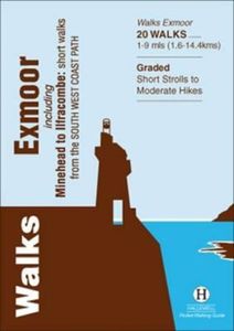
Rewalked and revised in 2021, Walks Exmoor features walks in the Exmoor National Park - a beautiful area including moorland, farmland, wooded valleys and stunning coastal scenery. (The major settlements - Minehead, Ilfracombe and Barnstaple - are all just outside the area.) The 20 walks in the guide range from 1 to 9 miles (1.6 14.4km). The bulk of...
5,95

Webshops met dit product

Webshop
Bezorging
Prijs

Anderen bekeken ook

Wandelgids Exmoor | Hallewell Publications
Rewalked and revised in 2021, Walks Exmoor features walks in the Exmoor National Park - a beautiful area including moorland, farmland, wooded valleys and stunning coastal scenery. (The major settlements - Minehead, Ilfracombe and Barnstaple - are all just outside the area.) The 20 walks in the guide range from 1 to 9 miles (1.6 14.4km). The bulk of the routes are in the northern coastal strip (the guide contains a number of short walks from the South West Coast Path), including the path from Lynmouth to the stunning Valley of Rocks and a group of linked walks on Bossington Hill (by Minehead). Elsewhere there is a fine riverside walk to the ancient footbridge of Tarr Steps. Walks Exmoor is part of a popular series of A6 pocket walking guides which describe routes which are suitable for walkers of all abilities and to suit all tastes. Route descriptions are accompanied by 2-colour sketch maps. The guides are illustrated with line illustrations, and will provide walkers with a good introd…
5,95
Wandelgids Fife | Hallewell Publications
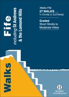
Rewalked and updated in 2021, Walks Fife including St Andrews & the Lomond Hills covers the county of Fife, which lies between the estuaries of the Rivers Forth and Tay. There are a lot of coastal walks (along sections of the Fife Coastal Path), plus walks in and around the historic town of St Andrews and some good hill walks in the Lomond Hills. The 27 walks featured range from 0.5 miles to 13 miles (1.5-21km). Routes include: West and East Lomond, Bishop Hill and St Andrews to Crail. Now on its 3rd edition, Walks Fife is part of a popular series of A6 pocket walking guides which describe routes which are suitable for walkers of all abilities and to suit all tastes. Route descriptions are accompanied by 2-colour sketch maps. The guides are illustrated with line illustrations, and will provide walkers with a good introduction to what each area covered has to offer.
5,95
Wandelgids South Dartmoor | Hallewell Publications
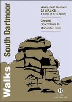
Rewalked and revised in 2021, Walks South Dartmoor features walks in and around the southern half of the Dartmoor National Park - an area famous for its rolling moorland, ponies and dramatic tors (weathered granite outcrops rising from the moorland). This guide covers the area north of Ivybridge and south of an east-west line just north of Tavistock. (For the northern half of the area, see Walks North Dartmoor.) The 22 walks in the guide range from 1 to 8 miles (1.6 12.8km). The bulk of the high moorland walks are in the north of this area, passing such features as Great Mis Tor and Foxtor Mires (thought to be the inspiration for Grimpen Mire in The Hound of the Baskervilles). In the south there are more river and woodland walks, including paths from Burrator Reservoir and to the dramatic Dewterstone. Walks South Dartmoor is part of a popular series of A6 pocket walking guides which describe routes which are suitable for walkers of all abilities and to suit all tastes. Route descriptio…
5,95
Wandelgids Oban and North Argyll | Hallewell Publications
Rewalked and updated in 2018, Walks Oban & North Argyll covers the area around the popular coastal town of Oban, the offshore islands which can be reached from the town, and inland as far as Bridge of Orchy. The coastal area and islands are fairly gentle in character, but there are some fine, challenging hill walks inland. The 26 walks featured range from 0.5 miles to 14 miles (1-23km). Routes include: Oban to Gallanach, two routes on Lismore, Ben Cruachan and Bridge of Orchy to Tyndrum. Part of a popular series of A6 pocket walking guides which describe routes which are suitable for walkers of all abilities and to suit all tastes. Route descriptions are accompanied by 2-colour sketch maps. The guides are illustrated with line illustrations, and will provide walkers with a good introduction to what each area covered has to offer.
5,95
Fietskaart Cycling guides Exmoor - North Devon | Goldeneye
Scheur- en watervast foetskaart van Exmoor en Noord Devon met ingetekende fietsroutes.   Our maps are double-sided, printed on an A2 sheet with a concertina fold. This allows for easy folding and folding, and an ease of access to the mapping. The material is rain and tear-resistant. Our early maps were designed at the scale of 2 miles to 1 inch/1:126,720. The later designs along with digitalisation are 1: 100,000. We were encouraged by the Cycle Touring Club to convert our cartography toward the cycle market (to replace the out-of-print Bartholomew series). As time and the series progressed we have added more data: The National Cycle Network routes, Regional Routes, and Traffic-Free Family Routes, as and when they are developed. These routes are in addition to the Circular Routes Goldeneye Commissioned at the outset of our publishing schedule. We are also adding to new editions; bike shops, cycle hire, and tea rooms, along with the tourist attractions already featured. Our plan is to m…
12,95
Wandelgids East Lothian | Hallewell Publications
Rewalked and updated in 2017, Walks East Lothian including Haddington, North Berwick & Dunbar covers the county of East Lothian, which lies to the east of Edinburgh. Walks include a number of coastal paths along the Firth of Forth and the North Sea, some paths through the county's fertile farmland plus some hill walks on the edge of the Lammermuir Hills. The 21 walks featured range from 0.5 miles to 11 miles (1-18km). Routes include: Dunbar Clifftop Trail, Traprain Law, Haddington Riverside and Gullane to North Berwick. Part of a regularly updated popular series of A6 pocket walking guides which describe routes which are suitable for walkers of all abilities and to suit all tastes. Route descriptions are accompanied by 2-colour sketch maps. The guides are illustrated with line illustrations, and will provide walkers with a good introduction to what each area covered has to offer.
5,95
Wandelgids Padstow to Falmouth | Hallewell Publications
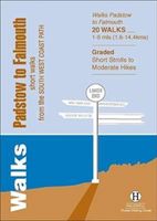
Walks Padstow to Falmouth features a selection of the best short walks from the section of South West Coast Path which runs between the towns of Padstow in the north and Falmouth in the south. The 20 walks featured range from 1 to 9 miles (1.6 - 14.4kms) and range from a short strolls to moderately testing hikes - along cliffs, through dunes, by sandy beaches and muddy creeks. Highlights of the book include cliff walks from picturesque harbour at Padstow, a route from the popular town of St Ives, and a walk to Land's End - the most westerly point on the English mainland. This is a highly attractive area with a mass of good walks and the towns and villages along the coast make excellent bases for walking. Part of a popular series of A6 pocket walking guides which describe routes which are suitable for walkers of all abilities and to suit all tastes. Route descriptions are accompanied by 2-colour sketch maps. The guides are illustrated with line illustrations, and will provide walkers wi…
5,95

Klanten-reviews van Wandelgids Exmoor | Hallewell Publications

Er zijn nog geen beoordelingen voor dit productBen jij de eerste die een review plaatst?

Meer over Wandelgids Exmoor | Hallewell Publications

Productomschrijving

Rewalked and revised in 2021, Walks Exmoor features walks in the Exmoor National Park - a beautiful area including moorland, farmland, wooded valleys and stunning coastal scenery. (The major settlements - Minehead, Ilfracombe and Barnstaple - are all just outside the area.) The 20 walks in the guide range from 1 to 9 miles (1.6 14.4km). The bulk of the routes are in the northern coastal strip (the guide contains a number of short walks from the South West Coast Path), including the path from Lynmouth to the stunning Valley of Rocks and a group of linked walks on Bossington Hill (by Minehead). Elsewhere there is a fine riverside walk to the ancient footbridge of Tarr Steps. Walks Exmoor is part of a popular series of A6 pocket walking guides which describe routes which are suitable for walkers of all abilities and to suit all tastes. Route descriptions are accompanied by 2-colour sketch maps. The guides are illustrated with line illustrations, and will provide walkers with a good introduction to what each area covered has to offer.

Productspecificaties

Artikelnummer(s)
Brand
Hallewell Publications

Verken gerelateerde categorieën

Shopblog.nl maakt gebruik van cookies. Ga je verder op onze website, ga dan akkoord met het plaatsen van cookies en de verwerking van deze data door ons en vermelde partners.