shopblog.nl
Categorieën
  Sluiten

Meer Freytag & Berndt

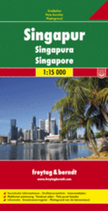
Stadsplattegrond Singapore | Freytag & Berndt

Stadsplattegrond met register. Helder kaartbeeld waarbij de naamgeving goed leesbaar is weergegeven. Met de toeristische bezienswaardigheden in symbolen weergeven: monumenten, musea, stadions e.a. Daarnaast handige zaken als postkantoren, parkeergarages en stations. Veelal ook met een openbaar vervoer of metro kaart als inzet This city map of Singa...
13,95

Webshops met dit product

Webshop
Bezorging
Prijs

Anderen bekeken ook

Stadsplattegrond Salzburg | Freytag & Berndt
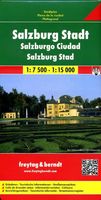
Stadsplattegrond met register. Helder kaartbeeld waarbij de naamgeving goed leesbaar is weergegeven. Met de toeristische bezienswaardigheden in symbolen weergeven: monumenten, musea, stadions e.a. Daarnaast handige zaken als postkantoren, parkeergarages en stations. Veelal ook met een openbaar vervoer of metro kaart als inzet Explore Salzburg and surroundings, the city of Mozart, with this Freytag & Berndt street map. The best way to plan your trip, prepare your itinerary, and to travel independently in the capital of the Austrian Salzburg-Land.   The map includes a full index on the reverse side and tourist information and places of interest are clearly marked by a range of icons. There is also an inset map showing an enlargment of the city centre in better detail and another inset showing Salzburg and its environs.
13,95
Stadsplattegrond Rome | Freytag & Berndt
Stadsplattegrondkaart met register. De benaming is goed leesbaar door het helder kaartbeeld. Met de toeristische bezienswaardigheden in symbolen weergeven: monumenten, musea, stadions e.a. Daarnaast handige zaken als postkantoren, parkeergarages en stations. Veelal ook met een openbaar vervoer of metro kaart als inzet.    Symbolen geven de plaats aan van  toeristische bezienswaardigheden, monumenten, historisch belangrijke plekken, uitzichtpunten, postkantoren, parkeergarages en stations. In de inzet vind je meer informatie over het openbaar vervoer of metro. Explore Rome with this Freytag & Berndt street map. The best way to plan your trip, prepare your itinerary, and to travel independently in the Italian capital.   Der Stadtplan Rom 1:10.000 bietet zahlreiche Zusatzinformationen wie öffentliche Verkehrsmittel und touristische Informationen. Im umfangreichen Index finden Sie außerdem jede Adresse. Alle Inhalte werden natürlich regelmäßig aktualisiert. Details: Touristische Informati…
14,95
Stadsplattegrond Jerusalem - Jeruzalem | Freytag & Berndt
Stadsplattegrond met register. Helder kaartbeeld waarbij de naamgeving goed leesbaar is weergegeven. Met de toeristische bezienswaardigheden in symbolen weergeven: monumenten, musea, stadions e.a. Daarnaast handige zaken als postkantoren, parkeergarages en stations. Veelal ook met een openbaar vervoer of metro kaart als inzet Large, general street plan of the city with a clear enlargement of the Old City at 1:4,500. The main plan extends west to beyond the Jerusalem Forest and east to Mount of Olives. Coverage north/south is from Ramat Polin and Beit Khanina to Gilo. Public buildings a highlighted and symbols mark places of worships, monuments, etc. A large inset provides more detailed coverage of the Old City, indicating various places of worship and historical monuments, car parks, etc. All place names are in Roman alphabet only. Multilingual map legend included English and Hebrew.
13,95
Stadsplattegrond Streetwise Budapest | Michelin
REVISED 2023Streetwise Budapest Map is a laminated city center map of Budapest, Hungary. The accordion-fold pocket size travel map has an integrated metro map including lines & stations. Coverage includes:Main Budapest Map Front 1: 17,000Main Budapest Map Back 1:11,000Budapest City Center Map 1:11,000Millennium City Center Map 1:17,000Budapest Metro MapDimensions: 4" x 8.5" folded, 8.5" x 27" unfoldedPeople say Budapest is the Paris of Central Europe.   Maybe that statement is true because it combines a combination of western luxuries, architectural beauty, and cosmopolitan European traditions. But this baroque city is still connected to its Eastern European heritage with the steaming baths, incredibly complex language and lusty cuisine. Budapest straddles a curve in the river Danube which bisects two distinct parts.   The east side is known as Pest and the west side is known as Buda, hence Budapest. It's a very logical, well laid out city. Castle Hill is the premier destination for vi…
9,95
Stadsplattegrond Singapore | Borch
Borch Singapore is een duidelijke, geplastificeerde plattegrond van het centrum met informatie over openbaar vervoer en bezienswaardigheden. Inclusief straatnamenregister. Our soft-laminated folded map of Singapore shows: Singapore City 1:14 000, Singapore 1:120 000, Sentosa Island 1:25 000, Changi Airport 1:4 000 and the Public Transportation SMRT schematic map. Borch Maps are easy to fold, durable and water-repellent with a wipeable surface. Borch Maps show hotels, museums, monuments, markets, public transport, top sights and points of interest, useful statistics, conversion charts for temperatures, weights and measurements, climate charts showing temperatures, sunshine hours, precipitation and sea temperatures, overview maps and much more...   The Republic of Singapore (also known as "Lion City", although history tells us Singapore's founder probably meant "tigers") is a very clean and orderly city-state located on the southern tip of the Malay Peninsula, with Changi airport usually…
10,25
Stadsplattegrond Brussel | Freytag & Berndt
Stadsplattegrond met register. Helder kaartbeeld waarbij de naamgeving goed leesbaar is weergegeven. Met de toeristische bezienswaardigheden in symbolen weergeven: monumenten, musea, stadions e.a. Daarnaast handige zaken als postkantoren, parkeergarages en stations. Veelal ook met een openbaar vervoer of metro kaart als inzet. Explore Brussels with this Freytag & Berndt street map. The best way to plan your trip, prepare your itinerary, and to travel independently in the capital of Belgium.   The map includes an inset map of Central Belgium and Brussels subway lines and a detailed street index. Tourist information and places of interest are clearly marked by a range of icons, including pedestrian streets, parks and gardens, museums, monuments, live theatres, parkings, post offices, police stations, hospitals, subway stations, churches, synagogues.   The legend is in English, French, German, Dutch, Spanish, Italian, Czech, Polish, Slovak, and Hungarian.
13,95
Stadsplattegrond Streetwise Rome | Michelin
Handige stadsplattegrond van Rome in de vorm van een uitklapkaart, die aan twee zijden bedrukt is. Prettig leesbaar, helder kaartbeeld, met een register en een kleine kaart van het openbaar vervoer. Deze kaart is geplastificeerd   REVISED 2023Streetwise Rome Map is a laminated city center map of Rome, Italy. The accordion-fold pocket size travel map has an integrated metro map including subway & railway lines and stations. Coverge includes:Main Rome Map 1:17,000Rome Historic District Map 1:8,700Rome Metro MapDimensions: 4" x 8.5" folded, 8.5" x 32" unfoldedA great map can be the key to discovering all the city has to offer.   Our STREETWISE (R) Rome Map provides a comprehensive and fully detailed map of Rome to aid you in finding your way to all there is to do and see in this great center of history and culture. From Vatican City to the southeast corner of Palatine, the STREETWISE (R) Rome Map covers the entire city in full-color, including graphic representations of the major building…
10,50

Klanten-reviews van Stadsplattegrond Singapore | Freytag & Berndt

Er zijn nog geen beoordelingen voor dit productBen jij de eerste die een review plaatst?

Meer over Stadsplattegrond Singapore | Freytag & Berndt

Productomschrijving

Stadsplattegrond met register. Helder kaartbeeld waarbij de naamgeving goed leesbaar is weergegeven. Met de toeristische bezienswaardigheden in symbolen weergeven: monumenten, musea, stadions e.a. Daarnaast handige zaken als postkantoren, parkeergarages en stations. Veelal ook met een openbaar vervoer of metro kaart als inzet This city map of Singapore at 1: 15,000 by Freytag & Berndt clearly shows tourists attractions, public transport and feature a small inset of central Singapore and a useful index at the back. The map covers an area which extends from the Queenstown New Town district in the west to the Bedok Reservoir in the east and from Bishan metro station and MacRitchie Reservoir Park in the north to the northern part of Sentosa island in the south. The roads network is clearly represented and shows the main motorways reaching the city as well as main and secondary roads and symbols locate the car parks around the city. Colourful lines and symbols illustrate metro lines and stations, ferry connections and terminals, cable car lines, etc. This map is rich in tourist information; symbols not only highlight various places of interest like theatres, museums, temples and monuments but also shopping malls, sport fields, swimming pools, golf courses, etc. A small inset represents Padang, Raffles City and the northern Colonial District at 1: 10,000. The multilingual legend includes English. On the reverse of the map there is the street index.

Productspecificaties

Artikelnummer(s)
Brand
Freytag & Berndt
Shopblog.nl maakt gebruik van cookies. Ga je verder op onze website, ga dan akkoord met het plaatsen van cookies en de verwerking van deze data door ons en vermelde partners.