shopblog.nl
Categorieën
  Sluiten

Meer Freytag & Berndt

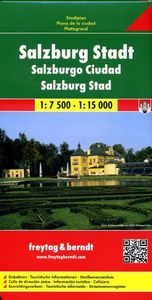
Stadsplattegrond Salzburg | Freytag & Berndt

Stadsplattegrond met register. Helder kaartbeeld waarbij de naamgeving goed leesbaar is weergegeven. Met de toeristische bezienswaardigheden in symbolen weergeven: monumenten, musea, stadions e.a. Daarnaast handige zaken als postkantoren, parkeergarages en stations. Veelal ook met een openbaar vervoer of metro kaart als inzet Explore Salzburg and s...
13,95

Webshops met dit product

Webshop
Bezorging
Prijs

Anderen bekeken ook

Stadsplattegrond Salzburg | Freytag & Berndt
Stadsplattegrond met register. Helder kaartbeeld waarbij de naamgeving goed leesbaar is weergegeven. Met de toeristische bezienswaardigheden in symbolen weergeven: monumenten, musea, stadions e.a. Daarnaast handige zaken als postkantoren, parkeergarages en stations. Veelal ook met een openbaar vervoer of metro kaart als inzet Explore Salzburg and surroundings, the city of Mozart, with this Freytag & Berndt street map. The best way to plan your trip, prepare your itinerary, and to travel independently in the capital of the Austrian Salzburg-Land.   The map includes a full index on the reverse side and tourist information and places of interest are clearly marked by a range of icons. There is also an inset map showing an enlargment of the city centre in better detail and another inset showing Salzburg and its environs.
13,95
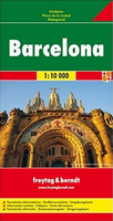
Stadsplattegrond Barcelona | Freytag & Berndt
Stadsplattegrond met register. Helder kaartbeeld waarbij de naamgeving goed leesbaar is weergegeven. Met de toeristische bezienswaardigheden in symbolen weergeven: monumenten, musea, stadions e.a. Daarnaast handige zaken als postkantoren, parkeergarages en stations. Veelal ook met een openbaar vervoer of metro kaart als inzet. Explore Barcelona with this Freytag & Berndt map. The best way to plan your trip, prepare your itinerary, and to travel independently in this country. As with all Freytag & Berndt maps the cartography is clear and detailed with the topography shown by relief shading with plenty of spot heights.   One side features a detailed map of the city of Barcelona, as well as an inset of the greater area around the city in Spain. The flipside features the index for the map.    Freytag & Berndt maps make good use of an icon system. Icons show tourist information such as:   Places of interest Churches, museums and theatres Parks and gardens   Distances between points are show…
13,95
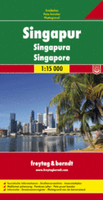
Stadsplattegrond Singapore | Freytag & Berndt
Stadsplattegrond met register. Helder kaartbeeld waarbij de naamgeving goed leesbaar is weergegeven. Met de toeristische bezienswaardigheden in symbolen weergeven: monumenten, musea, stadions e.a. Daarnaast handige zaken als postkantoren, parkeergarages en stations. Veelal ook met een openbaar vervoer of metro kaart als inzet This city map of Singapore at 1: 15,000 by Freytag & Berndt clearly shows tourists attractions, public transport and feature a small inset of central Singapore and a useful index at the back. The map covers an area which extends from the Queenstown New Town district in the west to the Bedok Reservoir in the east and from Bishan metro station and MacRitchie Reservoir Park in the north to the northern part of Sentosa island in the south. The roads network is clearly represented and shows the main motorways reaching the city as well as main and secondary roads and symbols locate the car parks around the city. Colourful lines and symbols illustrate metro lines and sta…
13,95
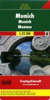
Stadsplattegrond München | Freytag & Berndt
Stadsplattegrond met register. Helder kaartbeeld waarbij de naamgeving goed leesbaar is weergegeven. Met de toeristische bezienswaardigheden in symbolen weergeven: monumenten, musea, stadions e.a. Daarnaast handige zaken als postkantoren, parkeergarages en stations. Veelal ook met een openbaar vervoer of metro kaart als inzet   Large street plan of Munich within its administrative boundaries, with an enlargement of the city centre, a plan of its airport, a diagram of the U and S-Bahn networks and a map of the outer suburbs all conveniently placed in a separate booklet.    The main plan covers Munich at 1:22,500, showing the city’s public transport network: tram and bus routes with stops and line numbers, plus U- and S-Bahn stations. Campsites and youth hostels are marked, as well as the usual range of facilities shown on street plans; public buildings, religious establishments, police, etc.   Map legend which includes English is in a separate booklet attached to the map cover. The book…
13,95
Stadsplattegrond Berlijn | Freytag & Berndt
Stadsplattegrond met register. Helder kaartbeeld waarbij de naamgeving goed leesbaar is weergegeven. Met de toeristische bezienswaardigheden in symbolen weergeven: monumenten, musea, stadions e.a. Daarnaast handige zaken als postkantoren, parkeergarages en stations. Veelal ook met een openbaar vervoer of metro kaart als inzet. Explore Berlin with this Freytag&Berndt street map. The best way to plan your trip, prepare your itinerary, and to travel independently in the capital of Germany.   On one side is the main city-plan with highway, surface-street and small roads clearly labeled. On the reverse are smaller inset maps detailing the downtown or primary tourist areas, along with metro overviews and regional maps showing where Berlin is located within Germany.    The legend is in several languages inlcuding English.
13,95
Stadsplattegrond Brussel | Freytag & Berndt
Stadsplattegrond met register. Helder kaartbeeld waarbij de naamgeving goed leesbaar is weergegeven. Met de toeristische bezienswaardigheden in symbolen weergeven: monumenten, musea, stadions e.a. Daarnaast handige zaken als postkantoren, parkeergarages en stations. Veelal ook met een openbaar vervoer of metro kaart als inzet. Explore Brussels with this Freytag & Berndt street map. The best way to plan your trip, prepare your itinerary, and to travel independently in the capital of Belgium.   The map includes an inset map of Central Belgium and Brussels subway lines and a detailed street index. Tourist information and places of interest are clearly marked by a range of icons, including pedestrian streets, parks and gardens, museums, monuments, live theatres, parkings, post offices, police stations, hospitals, subway stations, churches, synagogues.   The legend is in English, French, German, Dutch, Spanish, Italian, Czech, Polish, Slovak, and Hungarian.
13,95
Stadsplattegrond Streetwise Budapest | Michelin
REVISED 2023Streetwise Budapest Map is a laminated city center map of Budapest, Hungary. The accordion-fold pocket size travel map has an integrated metro map including lines & stations. Coverage includes:Main Budapest Map Front 1: 17,000Main Budapest Map Back 1:11,000Budapest City Center Map 1:11,000Millennium City Center Map 1:17,000Budapest Metro MapDimensions: 4" x 8.5" folded, 8.5" x 27" unfoldedPeople say Budapest is the Paris of Central Europe.   Maybe that statement is true because it combines a combination of western luxuries, architectural beauty, and cosmopolitan European traditions. But this baroque city is still connected to its Eastern European heritage with the steaming baths, incredibly complex language and lusty cuisine. Budapest straddles a curve in the river Danube which bisects two distinct parts.   The east side is known as Pest and the west side is known as Buda, hence Budapest. It's a very logical, well laid out city. Castle Hill is the premier destination for vi…
9,95

Klanten-reviews van Stadsplattegrond Salzburg | Freytag & Berndt

Er zijn nog geen beoordelingen voor dit productBen jij de eerste die een review plaatst?

Meer over Stadsplattegrond Salzburg | Freytag & Berndt

Productomschrijving

Stadsplattegrond met register. Helder kaartbeeld waarbij de naamgeving goed leesbaar is weergegeven. Met de toeristische bezienswaardigheden in symbolen weergeven: monumenten, musea, stadions e.a. Daarnaast handige zaken als postkantoren, parkeergarages en stations. Veelal ook met een openbaar vervoer of metro kaart als inzet Explore Salzburg and surroundings, the city of Mozart, with this Freytag & Berndt street map. The best way to plan your trip, prepare your itinerary, and to travel independently in the capital of the Austrian Salzburg-Land.   The map includes a full index on the reverse side and tourist information and places of interest are clearly marked by a range of icons. There is also an inset map showing an enlargment of the city centre in better detail and another inset showing Salzburg and its environs.

Productspecificaties

Artikelnummer(s)
Brand
Freytag & Berndt
Shopblog.nl maakt gebruik van cookies. Ga je verder op onze website, ga dan akkoord met het plaatsen van cookies en de verwerking van deze data door ons en vermelde partners.