shopblog.nl
Categorieën
  Sluiten

Meer Freytag & Berndt
Meer Freytag & Berndt in Geschiedenis & politiek boeken

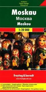
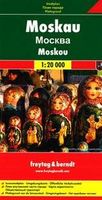
Stadsplattegrond Moskou | Freytag & Berndt

Stadsplattegrond met register. Helder kaartbeeld waarbij de naamgeving goed leesbaar is weergegeven. Met de toeristische bezienswaardigheden in symbolen weergeven: monumenten, musea, stadions e.a. Daarnaast handige zaken als postkantoren, parkeergarages en stations. Veelal ook met een openbaar vervoer of metro kaart als inzet Street plan of Moscow ...
13,95

Webshops met dit product

Webshop
Bezorging
Prijs

Anderen bekeken ook

Stadsplattegrond Moskou | Freytag & Berndt
Stadsplattegrond met register. Helder kaartbeeld waarbij de naamgeving goed leesbaar is weergegeven. Met de toeristische bezienswaardigheden in symbolen weergeven: monumenten, musea, stadions e.a. Daarnaast handige zaken als postkantoren, parkeergarages en stations. Veelal ook met een openbaar vervoer of metro kaart als inzet Street plan of Moscow showing hotels, theatres, metro stations, bus route numbers and much besides. Minor streets are named in the Russian alphabet (so you can read the street signs) with major streets in Russian and Roman script. The main landmarks are named in Russian and English. An enlargement of the city centre is included, and also a further enlargement of the Kremlin and its immediate environs.
13,95
Stadsplattegrond München | Freytag & Berndt
Stadsplattegrond met register. Helder kaartbeeld waarbij de naamgeving goed leesbaar is weergegeven. Met de toeristische bezienswaardigheden in symbolen weergeven: monumenten, musea, stadions e.a. Daarnaast handige zaken als postkantoren, parkeergarages en stations. Veelal ook met een openbaar vervoer of metro kaart als inzet   Large street plan of Munich within its administrative boundaries, with an enlargement of the city centre, a plan of its airport, a diagram of the U and S-Bahn networks and a map of the outer suburbs all conveniently placed in a separate booklet.    The main plan covers Munich at 1:22,500, showing the city’s public transport network: tram and bus routes with stops and line numbers, plus U- and S-Bahn stations. Campsites and youth hostels are marked, as well as the usual range of facilities shown on street plans; public buildings, religious establishments, police, etc.   Map legend which includes English is in a separate booklet attached to the map cover. The book…
13,95
Stadsplattegrond Keulen - Köln | Freytag & Berndt
Stadsplattegrond met register. Helder kaartbeeld waarbij de naamgeving goed leesbaar is weergegeven. Met de toeristische bezienswaardigheden in symbolen weergeven: monumenten, musea, stadions e.a. Daarnaast handige zaken als postkantoren, parkeergarages en stations. Veelal ook met een openbaar vervoer of metro kaart als inzet Indexed street map of Cologne at 1:20,000 from Freytag & Berndt with an enlargement of central Cologne at 1:10,000. Mapping is bright, colourful and clear, with one-way streets shown, as well as the U-bahn, bus and tram networks with stops clearly indicated.   Points of interest such as Cologne cathedral, the Romano-Germanic museum, theatres and parks are marked, as are local facilities. The enlargement of the central Cologne shares the same mapping but with more clarity, and is indexed along with the main map on the reverse.
13,95
Stadsplattegrond Praag | Freytag & Berndt
Stadsplattegrond van Praag: duidelijk leesbaar, klein register. Stadsplattegrond met register. Helder kaartbeeld waarbij de naamgeving goed leesbaar is weergegeven. Met de toeristische bezienswaardigheden in symbolen weergeven. Veelal ook met een openbaar vervoer of metro kaart als inzet. Large indexed street plan of Prague including its outer suburbs, with a clear enlargement of the central tourist districts of the city, the Old Town and Mala Strana.    The main plan extends west, south and east to show access to the city’s inner districts from the E48/E50/E55 motorway ring and includes the international airport. Tram and bus lines are shown with numbers and stops. Metro stations are marked and suburban railway lines are shown with names of local stations. Map legend includes English.
13,95
Stadsplattegrond Jakarta | Freytag & Berndt
Stadsplattegrond met register. Helder kaartbeeld waarbij de naamgeving goed leesbaar is weergegeven. Met de toeristische bezienswaardigheden in symbolen weergeven: monumenten, musea, stadions e.a. Daarnaast handige zaken als postkantoren, parkeergarages en stations. Veelal ook met een openbaar vervoer of metro kaart als inzet Main through routes are highlighted; the number of smaller streets with names varies from district to district. Public buildings are prominently marked and most are also named, and colouring indicates industrial areas. Symbols highlight locations of selected hotels, museums, shopping centres, car parks, bus terminals, golf courses, hospitals, etc. as well as numerous mosques and other religious buildings. Map legend includes English. Extensive street index is on the reverse of the map.
13,95
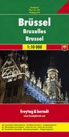
Stadsplattegrond Brussel | Freytag & Berndt
Stadsplattegrond met register. Helder kaartbeeld waarbij de naamgeving goed leesbaar is weergegeven. Met de toeristische bezienswaardigheden in symbolen weergeven: monumenten, musea, stadions e.a. Daarnaast handige zaken als postkantoren, parkeergarages en stations. Veelal ook met een openbaar vervoer of metro kaart als inzet. Explore Brussels with this Freytag & Berndt street map. The best way to plan your trip, prepare your itinerary, and to travel independently in the capital of Belgium.   The map includes an inset map of Central Belgium and Brussels subway lines and a detailed street index. Tourist information and places of interest are clearly marked by a range of icons, including pedestrian streets, parks and gardens, museums, monuments, live theatres, parkings, post offices, police stations, hospitals, subway stations, churches, synagogues.   The legend is in English, French, German, Dutch, Spanish, Italian, Czech, Polish, Slovak, and Hungarian.
13,95

Klanten-reviews van Stadsplattegrond Moskou | Freytag & Berndt

Er zijn nog geen beoordelingen voor dit productBen jij de eerste die een review plaatst?

Meer over Stadsplattegrond Moskou | Freytag & Berndt

Productomschrijving

Stadsplattegrond met register. Helder kaartbeeld waarbij de naamgeving goed leesbaar is weergegeven. Met de toeristische bezienswaardigheden in symbolen weergeven: monumenten, musea, stadions e.a. Daarnaast handige zaken als postkantoren, parkeergarages en stations. Veelal ook met een openbaar vervoer of metro kaart als inzet Street plan of Moscow showing hotels, theatres, metro stations, bus route numbers and much besides. Minor streets are named in the Russian alphabet (so you can read the street signs) with major streets in Russian and Roman script. The main landmarks are named in Russian and English. An enlargement of the city centre is included, and also a further enlargement of the Kremlin and its immediate environs.

Productspecificaties

Artikelnummer(s)
Brand
Freytag & Berndt

Verken gerelateerde categorieën

Shopblog.nl maakt gebruik van cookies. Ga je verder op onze website, ga dan akkoord met het plaatsen van cookies en de verwerking van deze data door ons en vermelde partners.