shopblog.nl
Categorieën
  Sluiten

Meer Nelles Verlag
Meer Nelles Verlag in Literatuur boeken

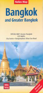
Stadsplattegrond Bangkok en omgeving | Nelles Verlag

Goede stadskaart van Bangkok en omgeving. Aan beide kanten bedrukt. Met veel toeristische aanduidingen als culturele bezienswaardigheden en aanduidingen van bijvoorbeeld de grotere hotels. Prima leesbare kaart. Bangkok on a double-sided map from Nelles combining an indexed street plan of the city’s central districts at 1:15,000 with a more general ...
11,95

Webshops met dit product

Webshop
Bezorging
Prijs

Anderen bekeken ook

Stadsplattegrond Bangkok en omgeving | Nelles Verlag
Goede stadskaart van Bangkok en omgeving. Aan beide kanten bedrukt. Met veel toeristische aanduidingen als culturele bezienswaardigheden en aanduidingen van bijvoorbeeld de grotere hotels. Prima leesbare kaart. Bangkok on a double-sided map from Nelles combining an indexed street plan of the city’s central districts at 1:15,000 with a more general plan of the capital with its outer suburbs presented at 1:75,000. Both plans highlight numerous places of interest.   On one side the main, indexed plan covers the city’s inner districts showing public transport routes: metro and skytrain lines with stations, bus routes with line numbers, and express boat service along the river. Public buildings, including selected hotels, are clearly marked and named, and shopping centres or market streets are indicated. The main centre of tourist accommodation, Banglamphoo - Khao San Road area, is also shown in greater detail on a small enlargement.   On the reverse a more general plan at 1:75,000 covers t…
11,95
Stadsplattegrond München | Freytag & Berndt
Stadsplattegrond met register. Helder kaartbeeld waarbij de naamgeving goed leesbaar is weergegeven. Met de toeristische bezienswaardigheden in symbolen weergeven: monumenten, musea, stadions e.a. Daarnaast handige zaken als postkantoren, parkeergarages en stations. Veelal ook met een openbaar vervoer of metro kaart als inzet   Large street plan of Munich within its administrative boundaries, with an enlargement of the city centre, a plan of its airport, a diagram of the U and S-Bahn networks and a map of the outer suburbs all conveniently placed in a separate booklet.    The main plan covers Munich at 1:22,500, showing the city’s public transport network: tram and bus routes with stops and line numbers, plus U- and S-Bahn stations. Campsites and youth hostels are marked, as well as the usual range of facilities shown on street plans; public buildings, religious establishments, police, etc.   Map legend which includes English is in a separate booklet attached to the map cover. The book…
13,95
Stadsplattegrond Praag | Freytag & Berndt
Stadsplattegrond van Praag: duidelijk leesbaar, klein register. Stadsplattegrond met register. Helder kaartbeeld waarbij de naamgeving goed leesbaar is weergegeven. Met de toeristische bezienswaardigheden in symbolen weergeven. Veelal ook met een openbaar vervoer of metro kaart als inzet. Large indexed street plan of Prague including its outer suburbs, with a clear enlargement of the central tourist districts of the city, the Old Town and Mala Strana.    The main plan extends west, south and east to show access to the city’s inner districts from the E48/E50/E55 motorway ring and includes the international airport. Tram and bus lines are shown with numbers and stops. Metro stations are marked and suburban railway lines are shown with names of local stations. Map legend includes English.
13,95
Stadsplattegrond Hanoi & North Vietnam - Noord Vietnam | ITMB
Overzichtelijke stadsplattegrond met register, schaal 1:15700 en een kaart van  Noord Vietnam op schaal 1:920.000. Double-sided map with north Vietnam on one side and a street plan of Hanoi on the reverse. The road map at 1:920,000 shows the area’s road and rail networks and local airports. National parks, nature reserves, beaches and numerous places of interest are highlighted. Provincial boundaries are marked and names of administrative regions prominently shown. Topography is indicated by altitude colouring. Latitude and longitude lines are drawn at 30’ intervals. On the reverse is a street plan of Hanoi at 1:15,700 annotated with numerous places of interest, accommodation, and various facilities. An enlargement shows the Old Town at 1:10,000, and a further inset covers the city’s suburbs area at 1:920,000. Both the road map and the street plan are indexed. All place names are shown in the Roman alphabet but with scrupulous transliteration, since the map was prepared by a company wi…
13,95
Stadsplattegrond München | Freytag & Berndt
Stadsplattegrond met register. Helder kaartbeeld waarbij de naamgeving goed leesbaar is weergegeven. Met de toeristische bezienswaardigheden in symbolen weergeven: monumenten, musea, stadions e.a. Daarnaast handige zaken als postkantoren, parkeergarages en stations. Veelal ook met een openbaar vervoer of metro kaart als inzet   Large street plan of Munich within its administrative boundaries, with an enlargement of the city centre, a plan of its airport, a diagram of the U and S-Bahn networks and a map of the outer suburbs all conveniently placed in a separate booklet.    The main plan covers Munich at 1:22,500, showing the city’s public transport network: tram and bus routes with stops and line numbers, plus U- and S-Bahn stations. Campsites and youth hostels are marked, as well as the usual range of facilities shown on street plans; public buildings, religious establishments, police, etc.   Map legend which includes English is in a separate booklet attached to the map cover. The book…
13,95
Stadsplattegrond Hanoi & North Vietnam - Noord Vietnam | ITMB
Overzichtelijke stadsplattegrond met register, schaal 1:15700 en een kaart van  Noord Vietnam op schaal 1:920.000. Double-sided map with north Vietnam on one side and a street plan of Hanoi on the reverse. The road map at 1:920,000 shows the area’s road and rail networks and local airports. National parks, nature reserves, beaches and numerous places of interest are highlighted. Provincial boundaries are marked and names of administrative regions prominently shown. Topography is indicated by altitude colouring. Latitude and longitude lines are drawn at 30’ intervals. On the reverse is a street plan of Hanoi at 1:15,700 annotated with numerous places of interest, accommodation, and various facilities. An enlargement shows the Old Town at 1:10,000, and a further inset covers the city’s suburbs area at 1:920,000. Both the road map and the street plan are indexed. All place names are shown in the Roman alphabet but with scrupulous transliteration, since the map was prepared by a company wi…
13,95
Wegenkaart - landkaart 751 Thailand | Michelin
De Michelin kaart van Thailand is een overzichtelijke landkaart waarop de toeristische sites staan aangeduid. De kaart heeft een plaatsnamenregister en een stadsplattegrond van Bangkok. De plaatsnamen staan op de kaart en in de index in het Nederlands en in het Thais. Thailand at 1:370,000 on an indexed road map from Michelin with street plans of central Bangkok and an enlargement for the capital’s environs. All place names on the map are shown in both Thai and Latin alphabet and the index is in both scripts. Road network emphasizes main routes but also clearly presents local roads, all with road numbers easy to read. Driving distances are shown on primary routes and main connecting roads; steep gradients, viewpoints, toll barriers and border crossings are marked; scenic routes are highlighted. Railway lines are included and domestic airports are marked. Symbols indicate various places of interest.  Topography is shown by relief shading with colouring for forested areas. National parks…
12,95
Stadsplattegrond Athene | Anavasi
Handzame kleine plattegrond van Athene, op de achterkant een overizcht van de omgeving van de stad en een korte beschrijving van de belangrijkste bezienswaardigheden. Locations of the city’s 102 important archaeological sites, museums, and other important buildings, plus on the reverse a road map of the environs including the port at Piraeus and the international airport.   Coverage extends from south of the Acropolis and the Mousson Hill to beyond the central railway station and the National Archaeological Museum, and east well beyond the Lycabettus Hill. 102 locations – archaeological remains, museums, theatres, churches – are highlighted and listed with their addresses and contact details. The plan shows metro stations, and tram routes with line numbers.    On the reverse is a map of the city’s environs showing the road network with the metro and railway lines. Coverage includes the port Piraeus, the city’s international airport and Marathon. English language notes about important p…
5,75

Klanten-reviews van Stadsplattegrond Bangkok en omgeving | Nelles Verlag

Er zijn nog geen beoordelingen voor dit productBen jij de eerste die een review plaatst?

Meer over Stadsplattegrond Bangkok en omgeving | Nelles Verlag

Productomschrijving

Goede stadskaart van Bangkok en omgeving. Aan beide kanten bedrukt. Met veel toeristische aanduidingen als culturele bezienswaardigheden en aanduidingen van bijvoorbeeld de grotere hotels. Prima leesbare kaart. Bangkok on a double-sided map from Nelles combining an indexed street plan of the city’s central districts at 1:15,000 with a more general plan of the capital with its outer suburbs presented at 1:75,000. Both plans highlight numerous places of interest.   On one side the main, indexed plan covers the city’s inner districts showing public transport routes: metro and skytrain lines with stations, bus routes with line numbers, and express boat service along the river. Public buildings, including selected hotels, are clearly marked and named, and shopping centres or market streets are indicated. The main centre of tourist accommodation, Banglamphoo - Khao San Road area, is also shown in greater detail on a small enlargement.   On the reverse a more general plan at 1:75,000 covers the city with its outer suburbs, highlighting main traffic arteries, including access to the international airport. Metro, skytrain and express boat lines are marked, plus the suburban railway lines with station names. In addition to information described above, the plan also gives names of numerous industrial and educational establishments, etc. Greater Bangkok 1 : 75.000 Banglamphoo / Khao San Road 1 : 7.900 City Centre 1 : 15.000

Productspecificaties

Artikelnummer(s)
Brand
Nelles Verlag

Verken gerelateerde categorieën

Shopblog.nl maakt gebruik van cookies. Ga je verder op onze website, ga dan akkoord met het plaatsen van cookies en de verwerking van deze data door ons en vermelde partners.